Table of Contents:

A Guide to Everest Three Passes Trek
Everything You Need to Know to Prepare for Your ETP Trek
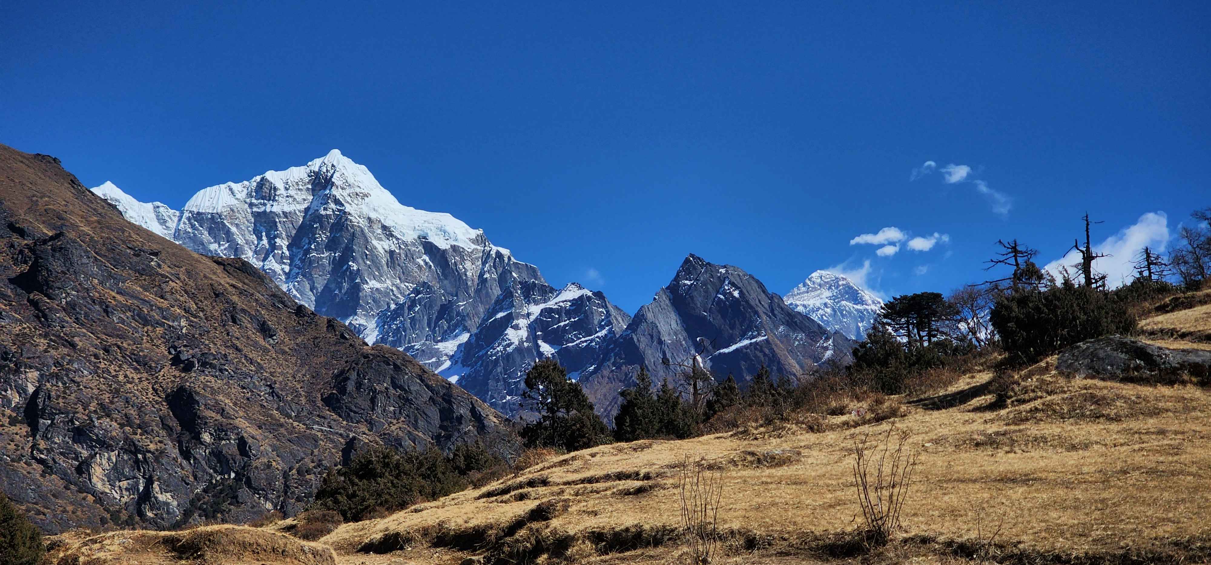
The Everest Three Passes Trek is the ultimate trekking challenge in the Everest region. It takes everything the standard Everest Base Camp trek offers, and adds three high mountain passes above 5,300 metres, two more valley systems, and some of the most remote and spectacular terrain in all of Nepal.
The route begins at Lukla (2,860m) and follows the Dudh Koshi valley up through Sherpa countryside, crossing suspension bridges, passing mani walls and old gompas, sharing the trail with yaks and local families for whom this path is simply the road between villages. From Namche Bazaar, the Sherpa capital of the Khumbu, the route splits away from the busy EBC corridor and heads into quieter country: the Bhote Koshi valley, the ancient village of Thame, the turquoise Gokyo Lakes, the glaciers. By the time you return to Lukla, you will have circled the entire Khumbu massif on foot.
This guide covers every day of the Freedom Adventures clockwise itinerary. The trail conditions, the hard days, the quiet ones, and everything in between.
What is the Everest Three Passes Trek?
The Everest Three Passes trek is a high-altitude trekking circuit through the Solukhumbu district of northeastern Nepal, within Sagarmatha National Park. It starts and finishes at Lukla (2,860m), and its defining feature is the crossing of three mountain passes, each above 5,300 metres, that connect the separate valley systems of the Khumbu region.
The route sits in the shadow of the world's highest peaks. Everest (8,848.86m), Lhotse (8,516m), Makalu (8,485m), Cho Oyu (8,188m), and dozens of peaks above 6,000m are visible at various points on the trek. Sagarmatha National Park, a UNESCO World Heritage Site, encompasses the entire route.
This is one of the most complete high-altitude trekking experiences available anywhere in Nepal without technical climbing equipment. It is not a beginner route. Prior experience at altitude, ideally on the Everest Base Camp trek or a similar multi-day route above 4,000m, is strongly recommended before attempting this circuit.
Everest Three Passes Trek at a Glance
Total duration | 22 days including Kathmandu arrival and departure |
Trekking days | 16 days Lukla to Lukla |
Total distance | Approximately 160 to 170km including acclimatization hikes |
Highest point | Kala Patthar, 5,545m |
Highest sleep point | Gorak Shep, 5,164m |
Three passes | Renjo La 5,360m / Cho La 5,420m / Kongma La 5,535m |
Direction | Clockwise: Renjo La, Cho La, Kongma La |
Difficulty | Strenuous to very strenuous |
Technical gear | Micro spikes required for Cho La. Recommended for Kongma La descent. |
Longest unsupported day | Kongma La crossing: 10 to 12 hours, no teahouses en route |
Prior experience | High-altitude trekking above 4,000m strongly recommended |
Elevation Profile: Everest Three Passes Trek Day by Day
Day | Stage | Start | End | High Point | Net Change |
Day 3 | Lukla to Phakding | 2,860m | 2,610m | 2,860m | -250m |
Day 4 | Phakding to Namche | 2,610m | 3,440m | 3,440m | +830m |
Day 5 | Acclimatization hike, Namche | 3,440m | 3,440m | 3,880m | 0m (sleep) |
Day 6 | Namche to Thame | 3,440m | 3,800m | 3,800m | +360m |
Day 7 | Acclimatization, Thame | 3,800m | 3,800m | ~4,000m | 0m (sleep) |
Day 8 | Thame to Lungden | 3,800m | 4,380m | 4,380m | +580m |
Day 9 | Lungden to Gokyo via Renjo La | 4,380m | 4,790m | 5,360m | +410m |
Day 10 | Acclimatization hike, Gokyo Ri | 4,790m | 4,790m | 5,357m | 0m (sleep) |
Day 11 | Gokyo to Thangnak | 4,790m | 4,700m | 4,790m | -90m |
Day 12 | Thangnak to Dzongla via Cho La | 4,700m | 4,830m | 5,420m | +130m |
Day 13 | Dzongla to Lobuche | 4,830m | 4,940m | 4,940m | +110m |
Day 14 | Lobuche to Gorak Shep and EBC | 4,940m | 5,164m | 5,364m | +224m |
Day 15 | Kala Patthar, return to Lobuche | 5,164m | 4,940m | 5,545m | -224m |
Day 16 | Lobuche to Chukhung via Kongma La | 4,940m | 4,730m | 5,535m | -210m |
Day 17 | Chukhung to Tengboche | 4,730m | 3,867m | 4,730m | -863m |
Day 18 | Tengboche to Namche | 3,867m | 3,440m | 3,867m | -427m |
Day 19 | Namche to Lukla | 3,440m | 2,860m | 3,440m | -580m |
The Three Passes on the Everest Circuit Compared
| Renjo La | Cho La | Kongma La |
Elevation | 5,360m | 5,420m | 5,535m |
Connects | Lungden valley to Gokyo | Gokyo valley to Dzongla | Lobuche to Chukhung |
Terrain | Rocky approach with multiple false summits, loose scree on final push, scree descent to Gokyo | Rocky approach, 680m glaciated crossing marked by metal poles, steep rocky descent east | Steep scree ascent (in this direction), open moraine, Khumbu Glacier crossing, boulder trail to Chukhung |
What makes it distinct | The finest panorama on the route. Four 8,000m peaks visible simultaneously. Gokyo Lakes appearing below on descent. | Only glaciated section of the trek. Fixed rope at summit. Earliest start is non-negotiable. Weather-sensitive. | Highest of three. Reversed direction on this itinerary means the steep face is the ascent. Comes after Kala Patthar. No support for the full day. |
Technical gear | None | Micro spikes required in normal conditions | Micro spikes recommended |
Crossing time | 7 to 8 hours | 7 to 9 hours | 10 to 12 hours |
When it falls | Day 9 | Day 12 | Day 16 |
Why Does the Everest Three Passes Trek Go Clockwise?
The clockwise direction is built around how the body acclimatizes. Going clockwise, Renjo La at 5,360m arrives after a full rest at Namche plus a second acclimatization stop at Thame (3,800m). That Thame stop is where most competing itineraries skip. It sets you 360 metres higher than Namche before you push toward Lungden and the first pass. By the time you stand on Renjo La, the body has moved through Namche, Thame, and Lungden in progressive stages.
Kongma La, the hardest and highest at 5,535m, comes last, when the body is most fully acclimatized. That is a deliberate trade for accumulated fatigue, and it is the better trade.
Day-by-Day: Complete Everest Three Passes Trek
Day 1: Arrival in Kathmandu (1,310m)
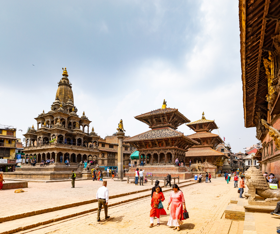
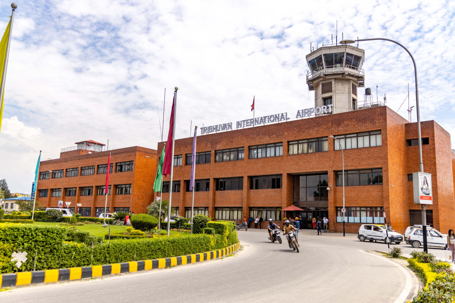
You land at Tribhuvan International Airport. Our representative is in the arrivals hall with a sign. From here, it is straightforward.
Kathmandu sits at 1,310 m. Acclimatization starts the moment you arrive, which is one of the reasons the itinerary begins this way. The city is doing useful work before the trek even begins.
In the evening there is a pre-departure meeting with your guide. This is where the route gets explained in detail, any last gear questions get answered, and you find out exactly what the first days on trail look like.
After the meeting, a welcome dinner. Then rest. Tomorrow is a long drive to Ramechhap.
Note
If you need to rent or buy any gear, Thamel has everything. Trekking poles, sleeping bag, liners, base layers, gaiters, micro spikes. Do it today before you are pressed for time. Prices in Kathmandu are cheaper than anything you will find on trail. Plus, your lead guide will be at hand to assist you with everything you need to rent or buy for the trek.
Day 2: Drive to Ramechhap (472m)
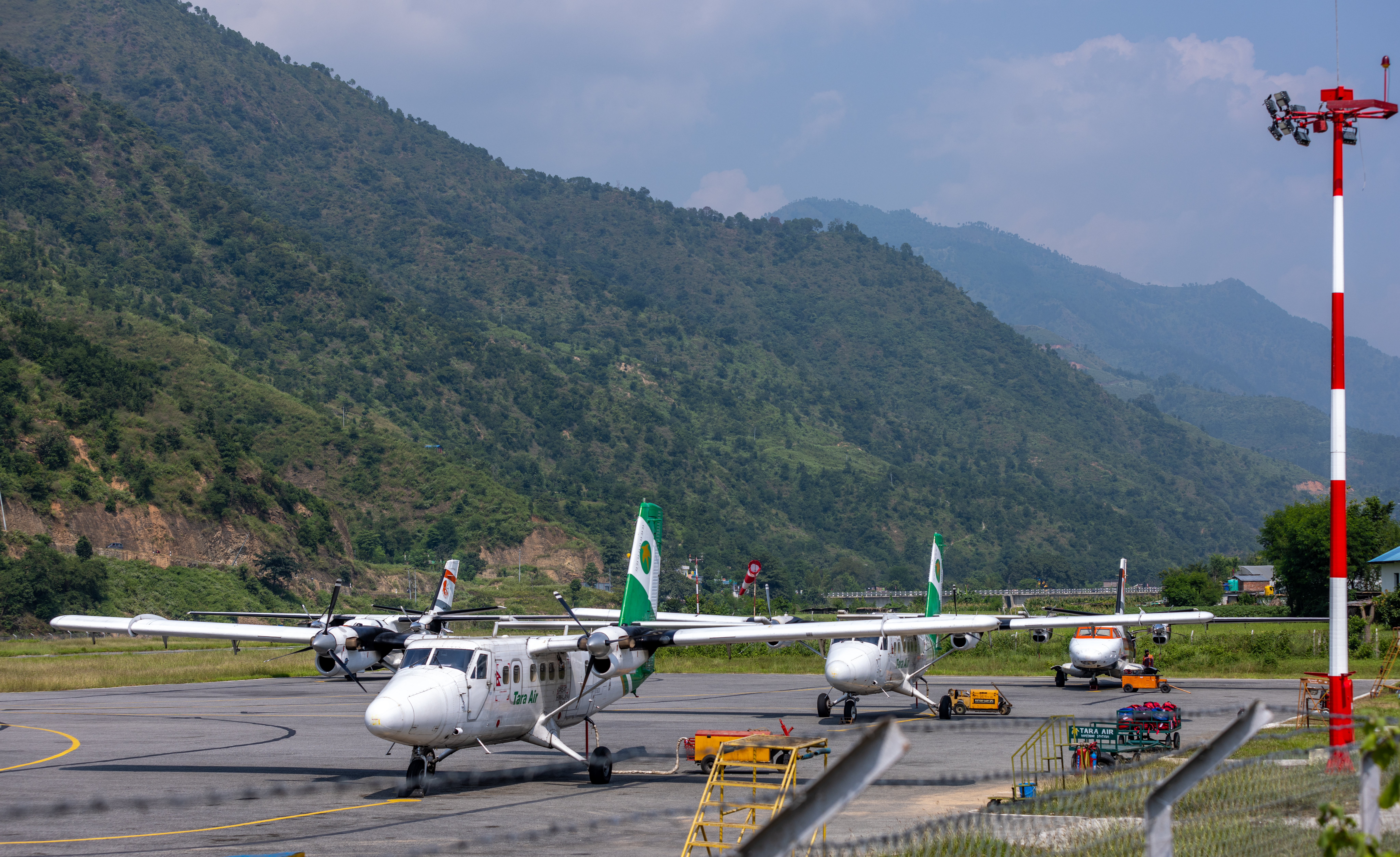
The vehicle leaves Kathmandu at 7 a.m. - 8 a.m. The drive to Manthali Airport in Ramechhap District covers roughly 130 km east of Kathmandu along the Araniko Highway and mountain roads, taking 6 to 7 hours depending on road and traffic conditions. Since 2023, the majority of Lukla flights operate from Manthali rather than Tribhuvan International, a change introduced to ease air traffic congestion at TIA. The road passes through Dhulikhel and drops into the Sunkoshi valley before climbing again toward Ramechhap.
You arrive in Ramechhap in the late afternoon and spend the night there ahead of an early morning flight to Lukla the following day.
On Lukla flights
Tenzing-Hillary Airport at Lukla (2,840m) is one of the most operationally demanding airstrips in the world: a 527-metre runway, cut into a hillside, with mountains on the final approach. Flights operate only in the early morning window when visibility and wind allow. Cancellations are common, particularly in the shoulder seasons, after rain, and in unstable weather.
Day 03: Fly to Lukla and Trek to Phakding (2,610m)
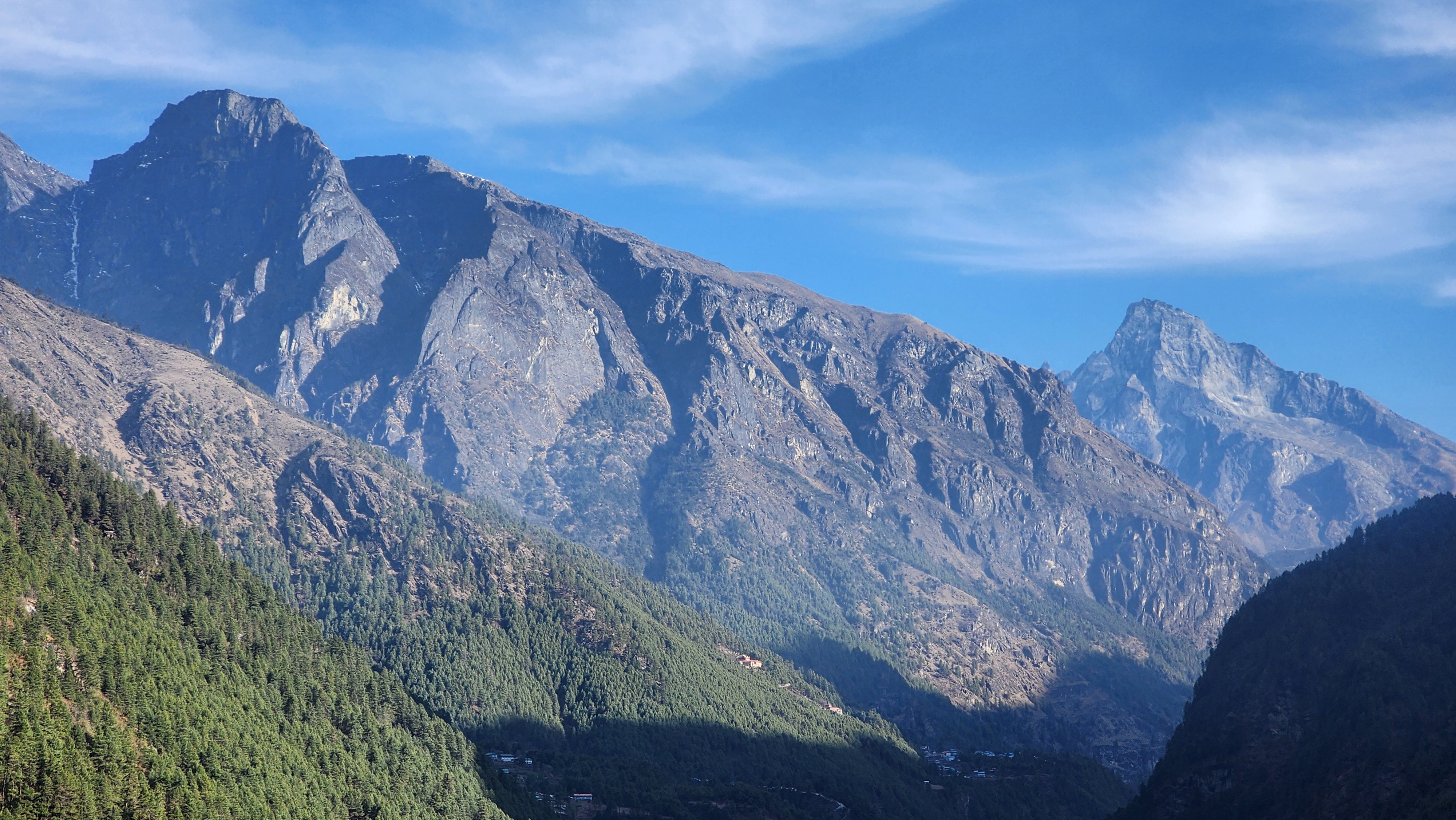
The Lukla landing is its own introduction. A steep, tilted runway cut into the hillside at 2,860m, a rapid deceleration, and then you are standing on the mountain with your bag and the smell of juniper incense from the small shrine near the terminal.
From Lukla, the trail drops immediately through Chheplung, where you catch your first view of Khumbila at 5,761m, the sacred guardian peak of the Khumbu that Sherpa custom has never permitted to be summited. It is a detail that stops most trekkers briefly, and it should. From Chheplung, the trail continues through Ghat on wide stone path through old rhododendron and fir forest. The Dudh Koshi appears below, milky glacial blue, running fast between steep forested banks. Prayer flags string above the path. Mani walls line the village edges. This is the beginning of a specific visual language that runs the entire route.
The trail rolls constantly even while trending downhill, a short rise out of one village, a drop into the next, repeated for three hours. This is what your guide will call Nepali flat. Nothing about today is hard. Nothing about today prepares you for tomorrow.
Day 4: Phakding to Namche Bazaar (3,440m)
The morning follows the Dudh Koshi north through pine and rhododendron forest on wide stone path. The river runs alongside the trail in the gorge below, loud and cold. The first suspension bridge sways gently over the current. By the fourth bridge, each one longer and higher than the last, you are paying attention to your footing in a way you were not on the first. The gorge section between Monjo and Jorsale is the narrowest and most dramatic, the trail cut into the cliff face above the water.
At Monjo, the Sagarmatha National Park checkpoint marks the boundary of one of the world's highest protected areas. Permits are checked here. Through Jorsale and then the Dudh Koshi gorge, the trail continues to the Hillary Suspension Bridge. The bridge crosses at roughly 90 metres above the river, swaying over the gorge. Once across, the trail does not level off again until Namche.
The climb from the bridge is approximately 600 vertical metres through dense, scented pine forest on switchbacks and stone steps. Steep, consistent, and unrelenting for roughly 90 minutes. It comes at the end of the day, when five or six hours have already drawn down your energy. At around 3,300m on the climb, the forest breaks briefly and, on a clear morning, Everest appears for the first time through a gap in the ridgeline, framed between Lhotse and Nuptse. Thirty seconds, then the trail turns back into trees.
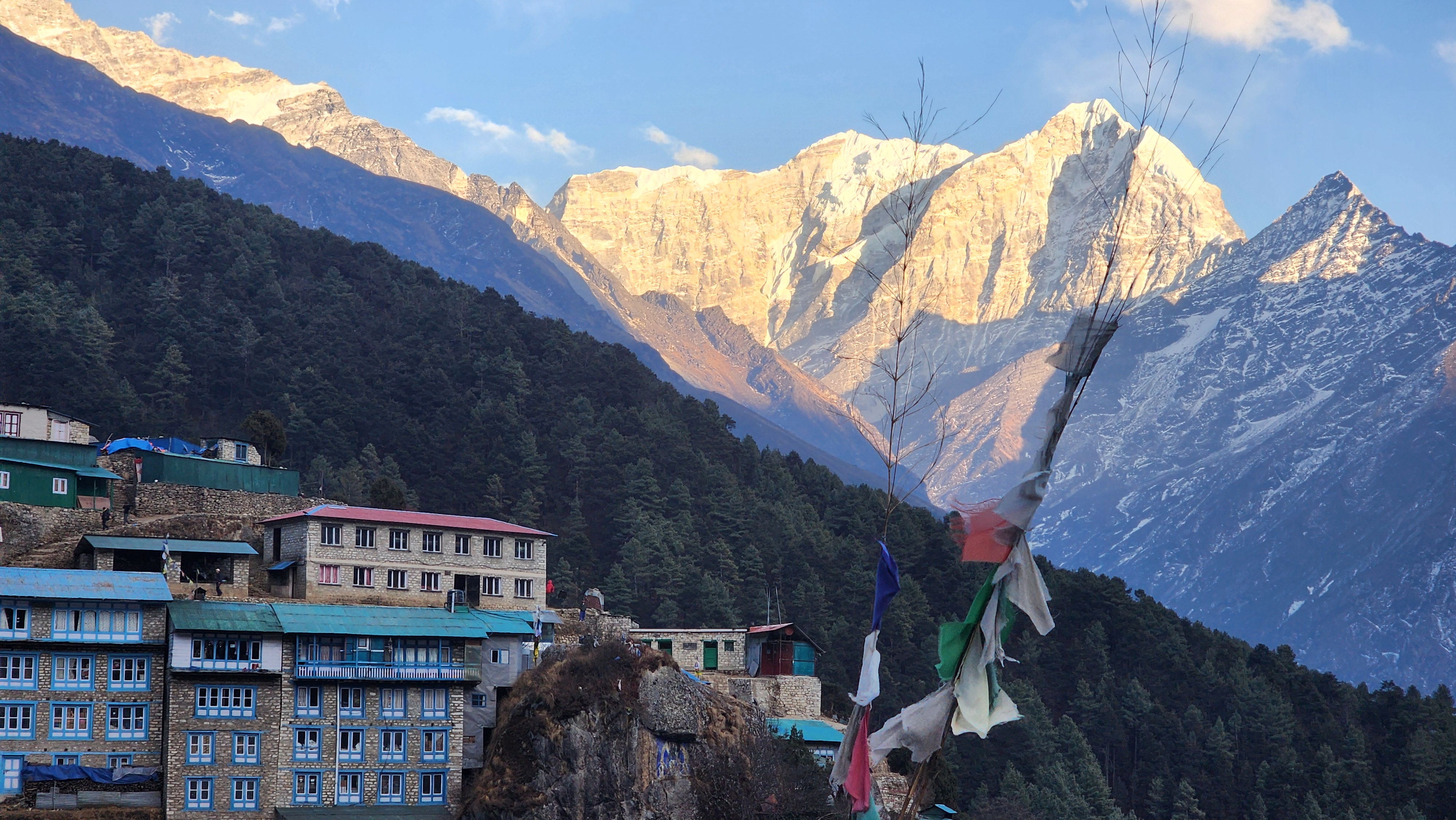
Namche Bazaar at 3,440m sits in a natural amphitheatre on the hillside, rows of teahouses and lodges stepping up the slope. Bakeries, gear shops, ATM, mobile signal, the Saturday market. Two nights here.
Your knees will not feel this one yet. They will on the way back.
Namche is where every EBC trekker and every Three Passes trekker overlaps for the last time. The two routes separate tomorrow. Enjoy the bakeries and the hot showers. Above Thame, teahouse quality drops and does not return to this level until Lobuche.
For a detailed look at what teahouse food and accommodation actually looks like at each stop on this trek, including where facilities thin sharply above Lungden and Thangnak, read our Everest Three Passes food and accommodation guide.
Day 5: Acclimatization at Namche Bazaar (3,440m, hike to 3,880m)
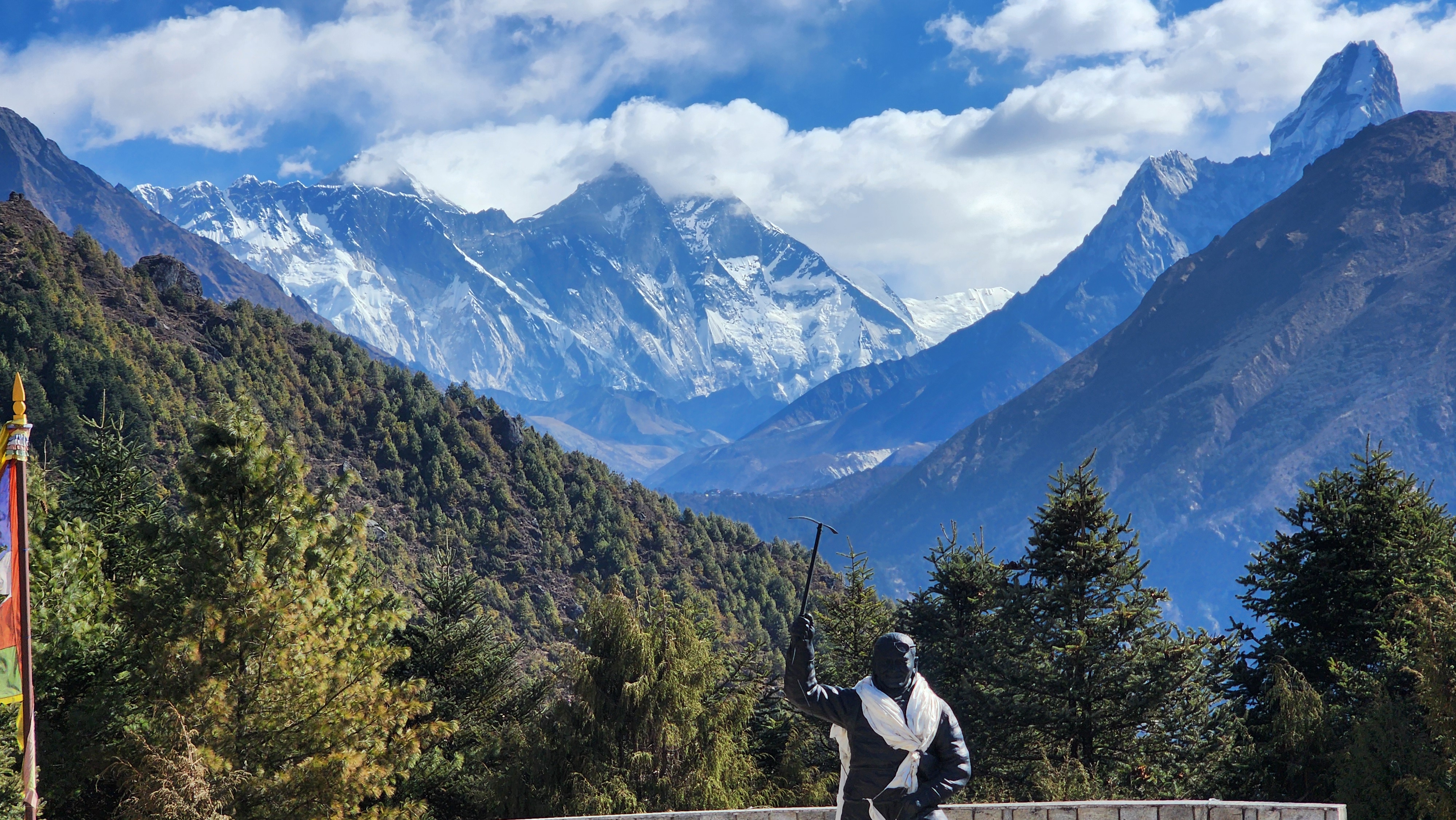
Today you earn tomorrow's rest by walking uphill. The acclimatization hike climbs above Namche through open yak pastures to the Everest View Hotel at 3,880m, gaining roughly 440m before you return to sleep at Namche's lower elevation. The principle is simple: go up during the day, sleep lower at night, and give the body time to adjust before the trail pushes higher. You will not feel the benefit today. You will feel it on Renjo La in four days.
From the hotel ridge, the first unobstructed view of Everest, Lhotse, Nuptse, Ama Dablam, and Thamserku all at once. It is worth the climb on its own. This is the same acclimatization hike that EBC trekkers do. After today, those routes go their separate ways.
Khumjung village, a short walk beyond the hotel, is worth the addition. Edmund Hillary funded the school here in 1961. The monastery holds what is displayed as a yeti scalp, which the resident monk will show you. The village has the quieter, more residential character that Thame will have tomorrow, and it is good preparation for what that feels like.
On AMS
Acute Mountain Sickness begins affecting some trekkers above 3,000 meters. Headache, nausea, dizziness, and disrupted sleep are normal early responses. If symptoms worsen rather than ease after 24 hours of rest, that is the signal to descend, not to push. No medication replaces descent. Diamox can assist with acclimatization but must be discussed with a doctor before the trek.
Day 6: Namche Bazaar to Thame (3,800m)
At Namche's upper edge, the trail splits. Left toward Tengboche and the standard EBC route. Right, northwest, up the Bhote Koshi valley toward Thame. This is where the Everest Three Passes trek becomes its own journey.
The trail exits Namche through dense old-growth rhododendron and pine forest, natural grazing ground for yak and home to musk deer and Himalayan thar if you move quietly. The forest is cool and dim and smells strongly of pine resin. Within 30 minutes of leaving Namche, the crowd has gone completely. This shift in atmosphere is immediate and physical.
The path drops to cross the Bhote Koshi, then climbs gradually along the west bank through small Sherpa settlements, mani walls, and scattered stone farmhouses. The valley is drier and more open than the southern Khumbu. High ridgelines above on both sides. The river runs grey-blue below. Grazing yak appear on the hillside above the trail. The pace of the landscape slows.
Thame at 3,800m is a working Sherpa village rather than a trekking hub. Stone houses, old walls, the gompa above on the hillside. This village is the childhood home of Tenzing Norgay, who stood on the summit of Everest with Edmund Hillary in 1953. It is home to Kami Rita Sherpa, who holds the world summit record with 29 ascents of Everest. Apa Sherpa, with 21 summits, grew up here. Ang Rita Sherpa, who summited 10 times without supplemental oxygen, was from this valley. The Sherpa mountaineering story is largely written by people who grew up in the houses you are walking past.
Looking up the valley from Thame on a clear afternoon, the Nangpa La at 5,716m is visible at the head of the valley, the ancient trading route to Tibet. Standing in Thame, that history feels close rather than historical.
Thame sits 360 metres above Namche. Two acclimatization nights at this higher baseline give the body altitude work that a Namche-only stop simply cannot replicate. The difference is felt on the Renjo La approach and it is not subtle.
Day 7: Acclimatization at Thame (3,800m)
Walk above the village if you feel well, return to sleep low. The Thame Monastery is one of the oldest in the Khumbu and hosts the Mani Rimdu festival in May. If your timing overlaps, what you see is not a tourist display. If it does not, the monastery is worth an hour regardless.
Afternoons in Thame are cold and often windy. The Bhote Koshi valley funnels wind south from the Nangpa La. Eat a full dinner. Think about Lungden tomorrow. What comes after it is not simple.
Day 8: Thame to Lungden (4,380m)
The trail continues northwest from Thame, passing through Thamo, a tiny hamlet clustered around a 350-year-old gompa that appears suddenly on the left above the trail. The painted facade and prayer flags against the dry valley rock is a quiet moment worth a minute.
Beyond Thamo, vegetation thins to low scrub and sparse alpine grass. The valley walls narrow and rise steeply. Stone walls and yak enclosures become the only structures. The Bhote Koshi runs grey and fast below. The raging river and the grazing yaks are the only things moving in this upper valley. If you have trekked the Manaslu Circuit to the west, where the upper Marsyangdi valley has this same arid remoteness with its own Tibetan-influenced quiet, you will recognize the feeling. The Khumbu version has its own character but the isolation is comparable.
Lungden is four to five stone teahouses at 4,380m. There is no settlement beyond it until Gokyo on the far side of Renjo La. The evening silence here, when the wind drops and the valley goes completely dark, is the specific silence of the high mountains. Eat everything on the plate tonight.
Lungden is the last settlement before Renjo La. Tomorrow runs for seven to eight hours in one push. If you feel unwell in Lungden tonight, resting an extra day here costs far less than struggling through a 5,360m pass in deteriorating condition. For the full altitude sickness guide specific to this route, including the Lake Louise scoring system and what to do with the result, read our Everest Three Passes altitude sickness guide.
Day 9: Lungden to Gokyo via Renjo La Pass (5,360m)
Up before dawn. Headtorch on. The stars above the Bhote Koshi from 4,380m in the dark are extraordinary, if you have a moment to stop and look.
The trail climbs from Lungden on a clear path that quickly becomes steeper and rockier as it gains the upper basin. The terrain is open moraine and boulder field, grey and silent, the pass invisible above. The gradient is demanding but consistent: steep walking on loose stone in thin air. Find a pace you can hold and hold it.
The false summits begin around 4,900m. The first ridgeline you crest looks exactly like the pass: prayer flags on the skyline, a clear horizon above. You reach it and find more trail angling upward into the next basin. Then another. Most accounts of this pass confirm this pattern and most trekkers still report being caught by it. The only preparation is knowing it is coming. When you see what looks like the top and find more trail above, drink water, breathe, and keep walking. It does end.
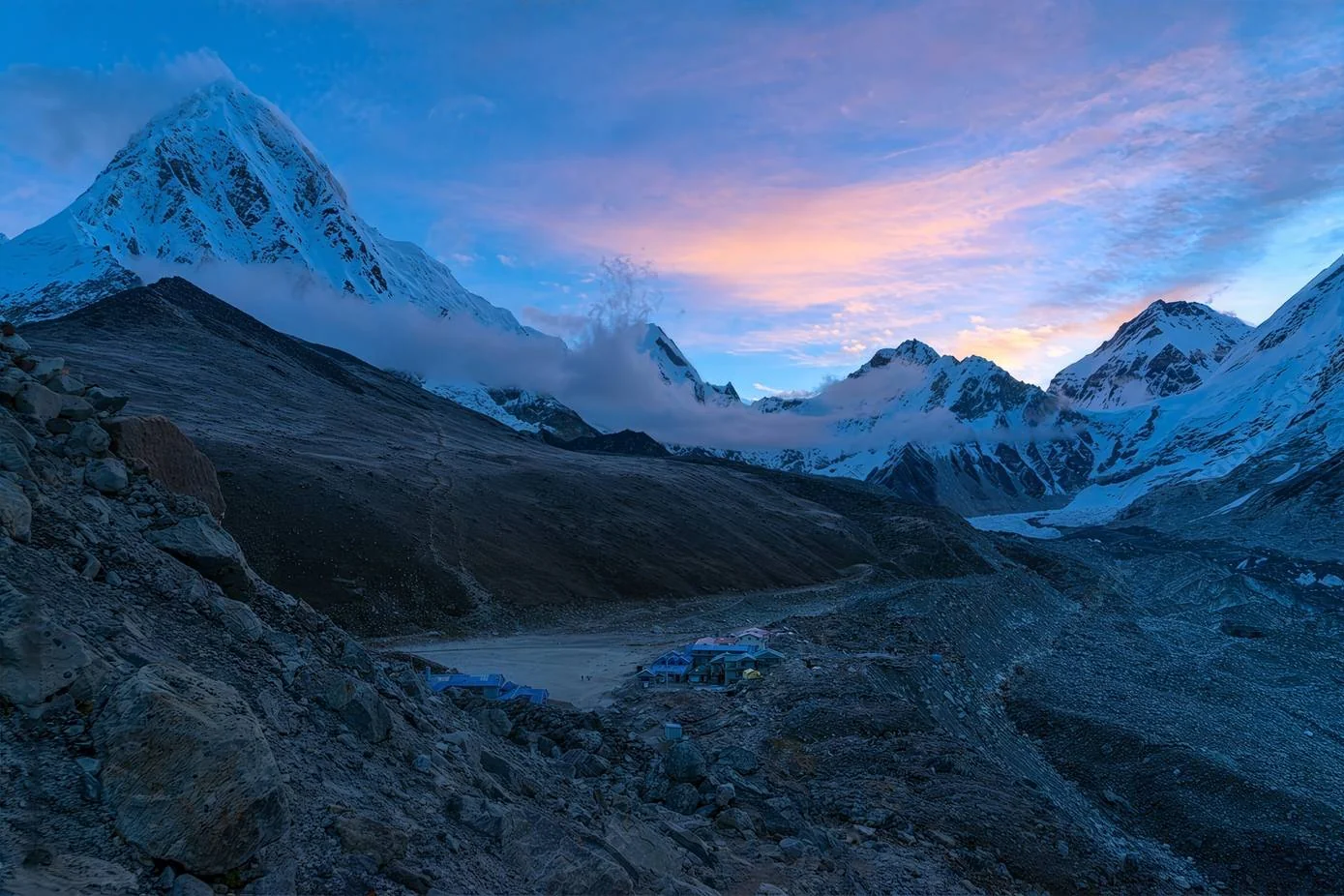
The real summit at 5,360m arrives with a cairn wrapped in prayer flags, wind, and a view that stops you mid-step. Cho Oyu at 8,188m fills the northern horizon, the sixth-highest mountain on earth. Everest appears to the southeast with Lhotse directly beside it. Below and ahead, the Third Gokyo Lake fills the valley in a colour somewhere between turquoise and deep green that does not look real from this height. To the east, the Fourth and Fifth Lakes visible further north. The Ngozumpa Glacier, the longest in the Himalayas at approximately 36km, spreads across the western valley floor.
Most trekkers who complete this circuit describe Renjo La as the finest single viewpoint of the entire trek. Kala Patthar looks at Everest from close proximity. Renjo La gives you the entire Khumbu system simultaneously, from above and whole. Take the time.
The descent loses roughly 570m to Gokyo over two to three hours on loose scree that steepens in sections. The lakes deepen in colour as you descend. The glacier grows from a surface detail into a presence beside you. Take the scree slowly. Tired legs on loose footing above 5,000m is where ankle injuries on this route concentrate.
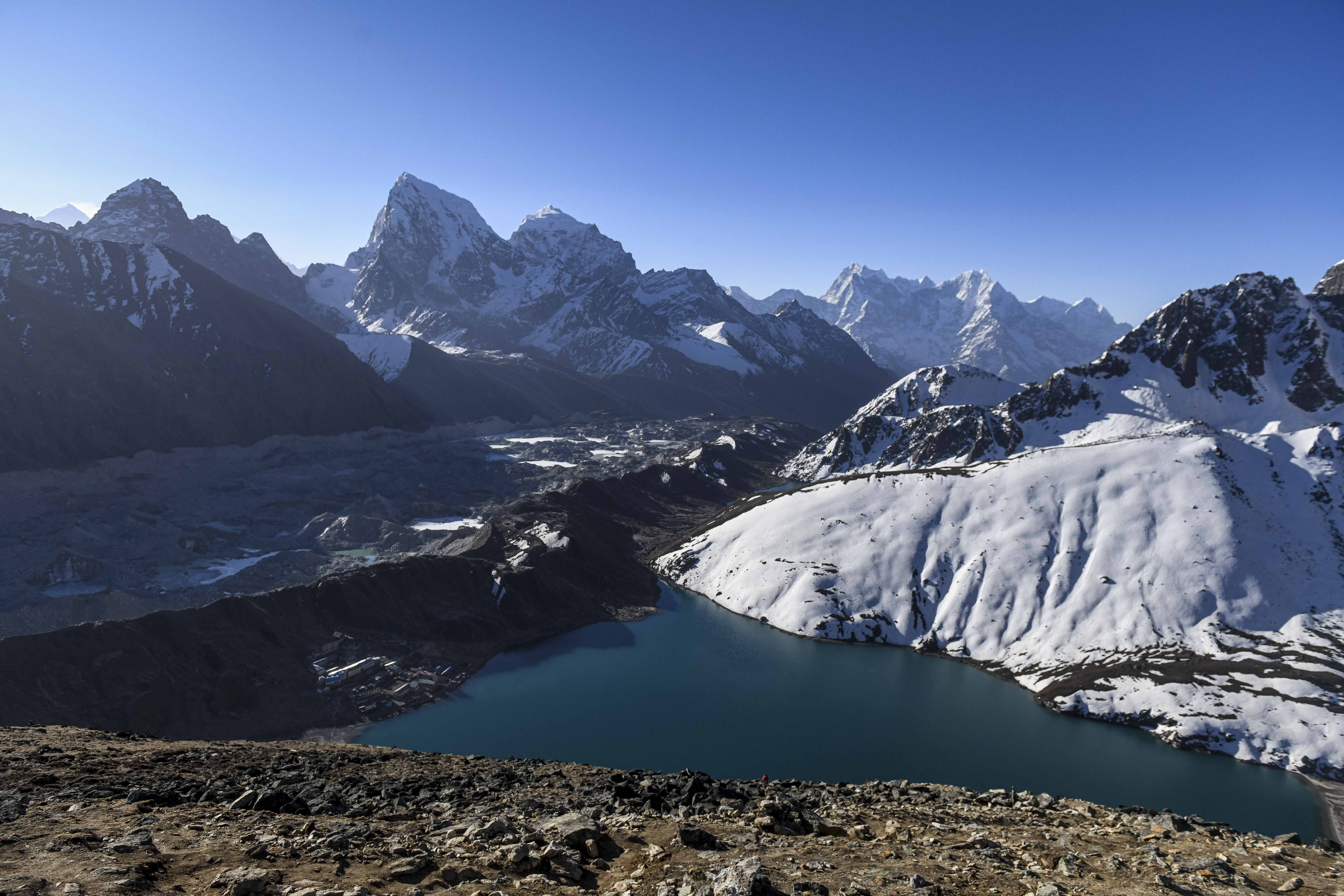
Gokyo village at 4,790m sits on the shore of the Third Gokyo Lake. The teahouses here are among the best quality on the route. The lake is sacred and swimming is not permitted. In the evening light, the water moves from turquoise to deep blue-green against the moraine.
The Ngozumpa Glacier is approximately 36km long, the longest in the entire Himalayan range. It has been retreating measurably for decades. The lateral moraine you will cross tomorrow to reach Thangnak is material the glacier deposited over centuries and left behind as it pulled back. You are walking on geological evidence of climate change.
Day 10: Acclimatization Trek to Gokyo Ri (5,357m)
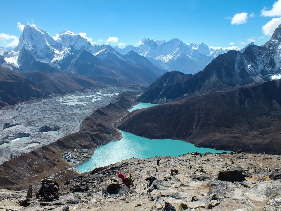
The trail to Gokyo Ri starts directly behind the teahouses on a steep switchback path up the ridge. Non-technical, but consistently steep: 567m of gain in 90 minutes to two hours. No scrambling, just open hillside climbing with the lakes and the glacier expanding below you as you gain height.
From the summit at 5,357m, four of the world's fourteen 8,000m peaks are visible simultaneously: Everest, Lhotse, Makalu, and Cho Oyu. The Ngozumpa Glacier below is vast in a way photographs consistently fail to convey. The numbered Gokyo Lakes appear in sequence to the north, each a different shade of blue depending on depth and light angle.
The acclimatization logic: you reach 5,357m, within 63 metres of Cho La's elevation, and return to sleep at 4,790m. By tomorrow's walk to Thangnak, the body has been at pass altitude in a recoverable setting. This is deliberate preparation for what follows.
Start before 6am. Cloud builds in the Gokyo valley by late morning and the summit view closes fast. The window is early and it is real.
Day 11: Gokyo to Thangnak (4,700m)
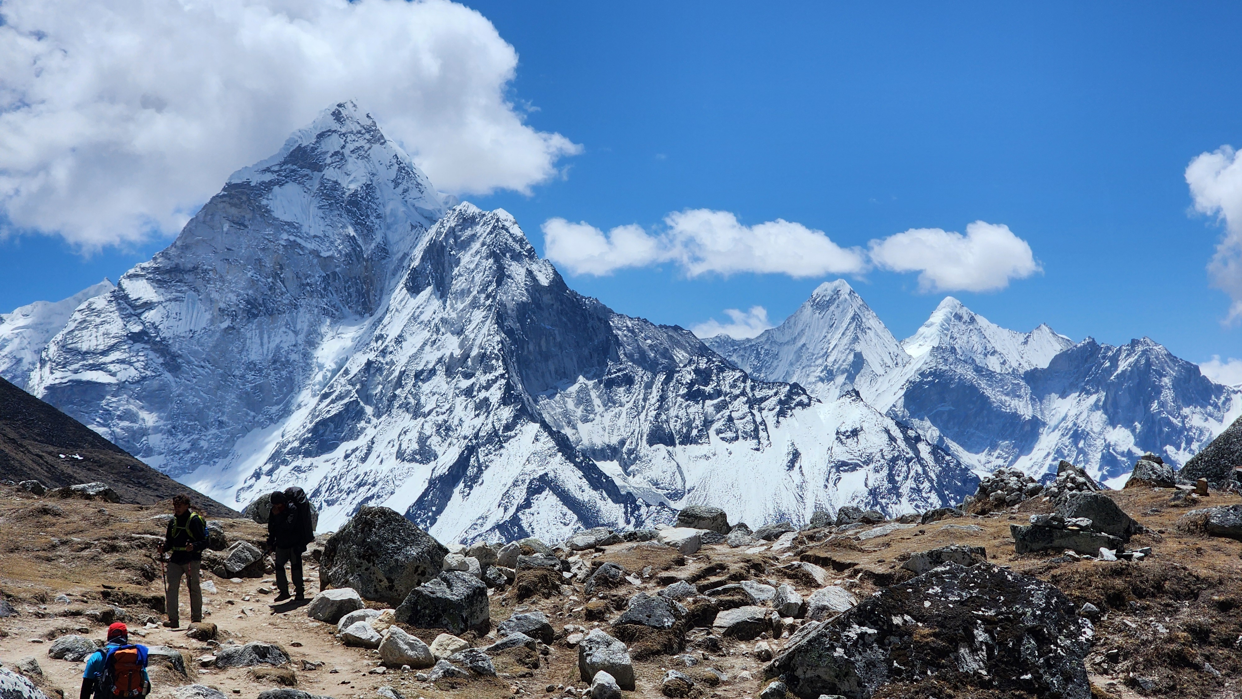
The trail south from Gokyo crosses the lateral moraine of the Ngozumpa Glacier. The terrain changes completely from the clear trail of the past several days: boulder fields, loose angular rock, sections where the path is unclear and requires reading the landscape rather than following a groove. The glacier runs alongside to the right, grey ice striped with dark moraine lines, visibly compressed and folding under its own weight. Walking pace drops to something deliberate and careful. This is the right response.
Thangnak, also written Dragnag, is a small settlement at 4,700m with basic teahouse accommodation. Facilities here are a step down from Gokyo. Looking east from Thangnak in the late afternoon toward the Cho La approach, you can see the line the trail takes up the rock and ice to the pass. Get an early dinner. Tomorrow starts before dawn.
Day 12: Thangnak to Dzongla via Cho La Pass (5,420m)
This is the day microspikes go from optional to essential.
The early start is not a preference: glacier snow is safe when it is cold and firm. By midday on the glacier, sun-warmed ice becomes slushy and the safety margin shrinks. Weather in the Khumbu deteriorates by early afternoon. The pass needs to be behind you well before 1pm.
The approach from Thangnak climbs on clear trail that becomes rockier as it gains the upper basin. Then the glacier comes into view. The crossing is 680 metres across, marked with metal stakes. In normal autumn and spring conditions the surface is crunchy and firm, which is exactly what microspikes are designed for. The crossing gains 80m of elevation over 30 to 45 minutes. Follow the stakes, walk steadily, do not rush.
At the far edge of the glacier, steep loose rock leads to the pass. A fixed metal rope anchors into the rock for the final exposed section. The pass at 5,420m is a narrow rocky gap with a stone cairn and prayer flags. The view back across the glacier toward Cho Oyu is wide and cold. Take a minute.
The east side drops steeply and rockily for roughly 250m, with a second fixed rope on the most exposed section. Below the rope the gradient eases through a boulder field and gradually onto clearer trail toward Dzongla. Slow, deliberate footing on the descent.
For non-mountaineers, Cho La is probably the first time you have been on glacier ice. Mera Peak climbers in the group will recognize the sensation. Everyone else will find it more straightforward than they expected if they have microspikes and follow the stakes.
Dzongla at 4,830m is a small, cold cluster of teahouses at the base of Cholatse (6,440m), which rises sharply directly above the village. Minimal, quiet, and exposed. After the Cho La crossing, exactly what you need.
Do not start the Cho La glacier crossing if cloud has built over the pass by the time you reach it. Visibility loss on ice and on the rocky eastern descent in fog is a genuine safety risk. The early start is the protection, not a guideline. Your guide makes the final call on conditions that morning.
Day 13: Dzongla to Lobuche (4,940m)
After Renjo La and Cho La, today feels almost gentle. The trail from Dzongla contours gradually around the base of Cholatse, the sharp 6,440m peak that loomed above your teahouse last night, on a wide path with long open views across the moraine. Cholatse stays with you for most of the walk, its rock faces changing colour as the morning light moves across them. The gradient is the easiest it has been in days and your legs will notice that immediately.
After four days on the quieter western circuit, the junction with the busy EBC corridor at Lobuche comes as a noticeable change. More trekkers, louder teahouses. If you have trekked EBC before, this stretch feels like returning to familiar ground. If you have not, this is your first taste of the Khumbu's main highway, which is home for the next three days.
Rest the afternoon without negotiation. The next two days are the highest of the entire trek, and Kongma La follows both of them.
Day 14: Lobuche to Gorak Shep, then Everest Base Camp (5,364m)
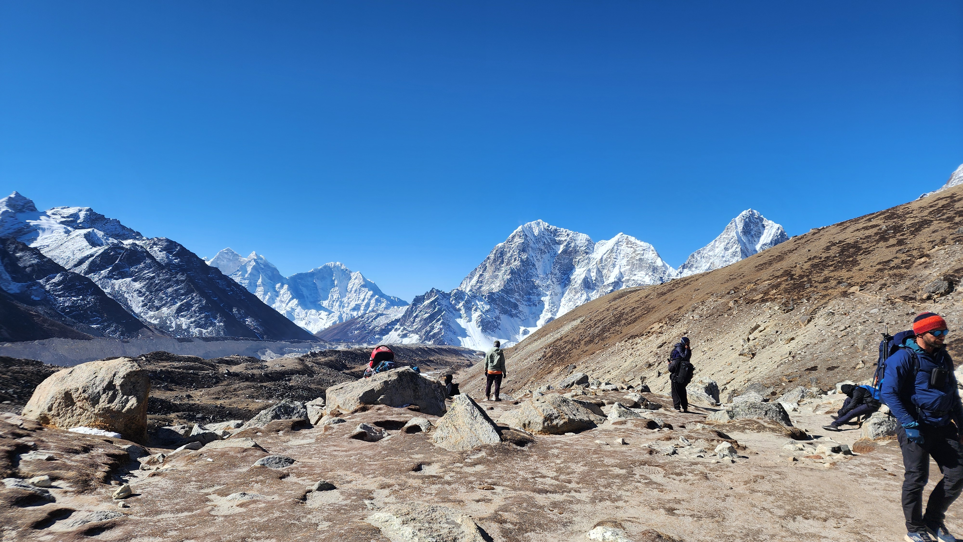
The trail from Lobuche follows the lateral moraine of the Khumbu Glacier north for 8 to 9km on narrow, rocky path. The footing is uneven the entire way: loose rock, ice-polished stone, occasional snow patches. The Khumbu Icefall grows slowly on the horizon ahead as you walk, a fractured mass of house-sized ice blocks suspended mid-collapse. You can hear it from Gorak Shep on quiet mornings.
At Gorak Shep at 5,164m, breathlessness on flat ground is normal. Not a fitness problem. The correct response to being at 5,164m. Every trekker slows here regardless of their condition on the lower trail.
After lunch, the afternoon push to Base Camp at 5,364m follows the glacier edge on loose, ice-polished stone that demands careful footing for the entire 2 to 3 hour walk. At EBC itself, what strikes most people is not the sign or the tents of the expedition teams. It is the sound: the Icefall is audible from here, cracking and shifting, a living sound from somewhere in the mountain above.
The return to Gorak Shep for the night adds another hour. Eat what you can manage and drink as much water as the altitude allows. For a more detailed account of the Lobuche to EBC corridor, our Everest Base Camp day-by-day guide covers this section specifically.
Day 15: Sunrise from Kala Patthar (5,545m), Return to Lobuche
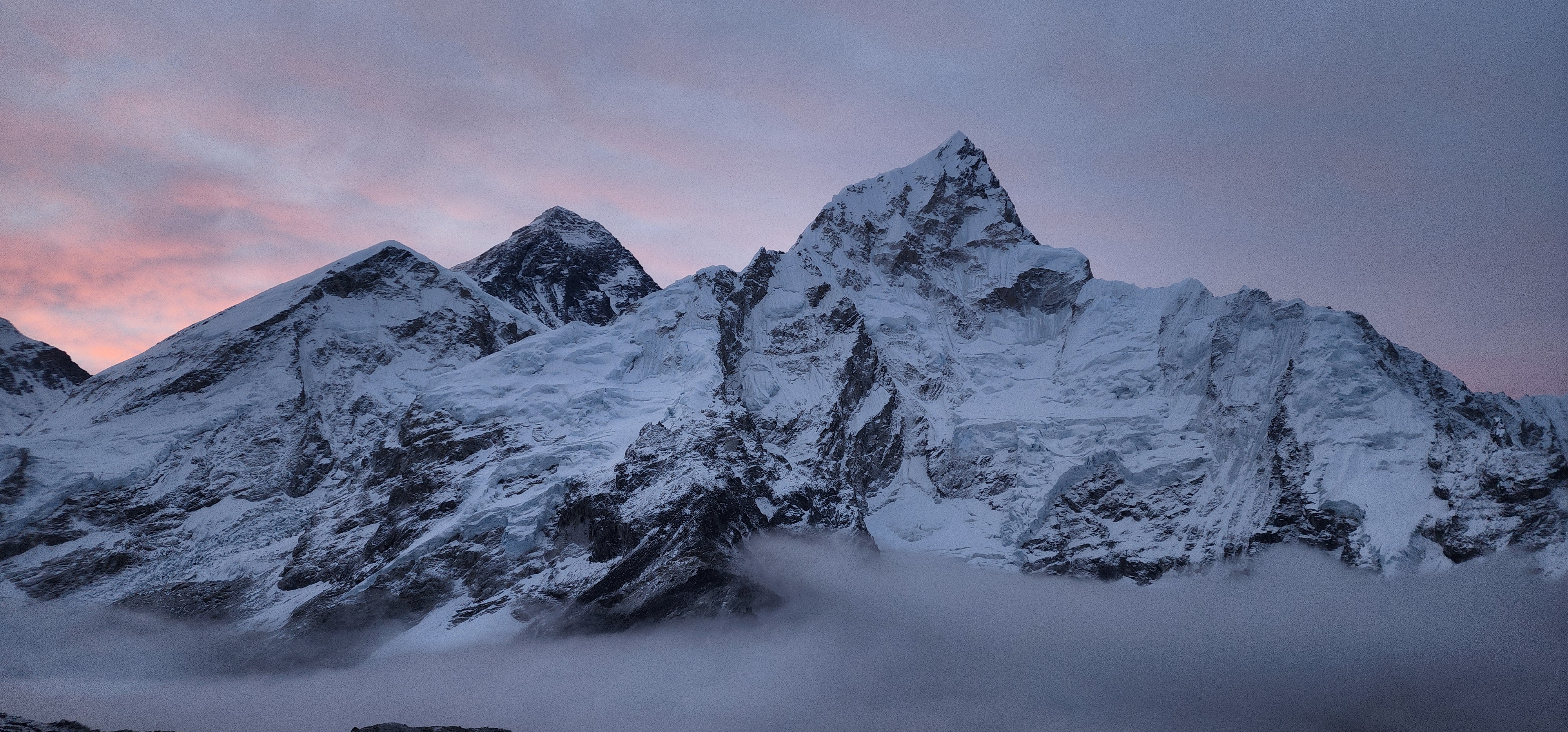
Out of Gorak Shep before dawn. The trail climbs south on steep, loose scree in the dark, gaining 381m in roughly 90 minutes. The headtorch picks up the path in a narrow circle of light. Above you, stars and the dark mass of the ridge.
At 5,545m, the highest point of the trek, Everest's summit pyramid is directly in front of you. As the sky lightens the Khumbu Icefall below catches the first colour, pink then orange, while the valley is still in shadow. The summit of Everest catches the sun last of all. The sequence takes about 20 minutes. This is the moment most trekkers describe as the justification for everything the route has asked.
The descent back to Lobuche takes two to three hours on the same scree, visible now in daylight. Take it slowly. Tired legs misjudging loose rock on the Kala Patthar descent is where descending accidents concentrate on this section.
Back at Lobuche by midday. Rest the afternoon. Kongma La is tomorrow and it is the hardest day of the entire trek. Sleep early tonight. Without exception.
If you feel genuinely symptomatic the morning of Kala Patthar beyond normal tiredness, score your Lake Louise criteria before leaving Gorak Shep. After two consecutive days above 5,000m, real AMS can sit underneath accumulated fatigue and be difficult to separate from it. The Everest Three Passes altitude sickness guide covers the full scoring system.
Day 16: Lobuche to Chukhung via Kongma La Pass (5,535m)
This is the hardest day of the trek. No equivalent caveat. It comes on day 14 of trekking. It follows Kala Patthar and EBC. It has no teahouses, no water sources, no shelter, and no retreat option. Carry food and water for a full 12-hour day before leaving Lobuche. Three litres of water minimum. A full meal's worth of food. This is a logistical requirement of the day, not a precaution.
One detail most guides do not address: this itinerary crosses Kongma La in the reverse of the standard counterclockwise direction. Most accounts describe ascending the gentler eastern face from Chukhung and descending the steep western scree to Lobuche. Going clockwise means the steep western scree face is the ascent. This is harder. If you have crossed Thorong La on the Annapurna Circuit or Larkya La on the Manaslu Circuit, you have some reference point for what a high pass day asks. Kongma La at 5,535m, in this direction, on day 16, sits at the top of that scale.
You leave Lobuche before first light. The trail climbs northwest on rocky path that becomes progressively rougher through boulder field and loose scree. The pass stays hidden until you are nearly on top of it. The rule from Renjo La still applies: drink water, breathe, keep going.
At 5,535m, the pass carries a cairn and prayer flags and a full 360-degree panorama: Everest, Lhotse, Nuptse, Makalu, Ama Dablam, Cho Oyu. The entire Khumbu massif at once from its highest point.
The descent east is gentler than the ascent, dropping from the pass through open boulder terrain toward the Khumbu Glacier, marked by cairns that shift slightly each season as the ice moves. Follow your guide. Do not navigate the glacier independently. The trail from the glacier to Chukhung follows the Imja valley south, with Ama Dablam ahead and the turquoise Imja Lake visible to the east.
Chukhung at 4,730m at the end of this day is the most welcome teahouse of the entire trek. Sit down, eat everything on the menu, and acknowledge what today was.
There is no shelter on the Kongma La crossing between Lobuche and Chukhung. No teahouses. No water sources. No retreat point once you are committed to the pass. The 12-hour food and water supply is not optional. A trekker who runs out of both on the far side of the glacier has no recourse.
Day 17: Chukhung to Tengboche (3,867m)
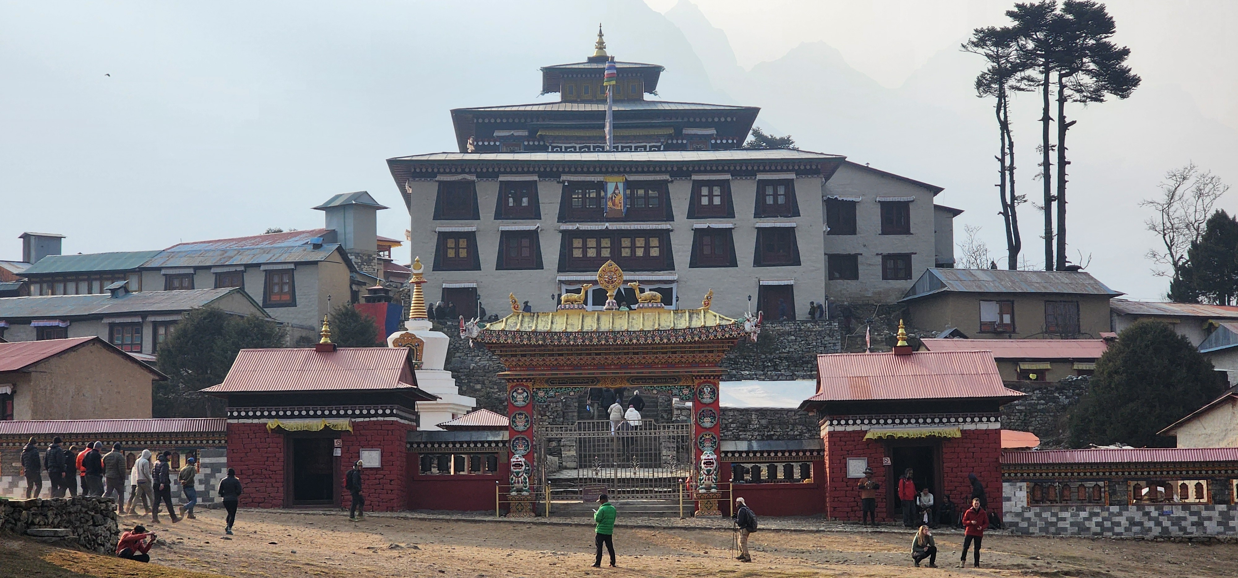
You made it through Kongma La. Today the trail turns downhill and starts giving back some of what the past two weeks have asked. The legs are tired but the air gets thicker with every hour, and by the time Tengboche comes into view on its ridge, you will feel the difference.
The trail drops west through the Imja valley from Chukhung through open yak pastures with wide valley views. Ama Dablam at 6,812m stays ahead and right for most of the morning, at a proximity and angle that the EBC corridor never provides. It is regularly described by mountaineers as the most beautiful peak in the Khumbu. From the Imja valley floor below Chukhung, it earns that description. Mera Peak at 6,476m is visible on clear days to the southeast, the objective for those who want to continue from where the Three Passes circuit ends into genuine mountaineering.
Through Dingboche and continuing south through Pangboche, the trail drops through the highest permanent settlements in the Khumbu. Below Pangboche, trees begin. First sparse juniper, then pine, then the forest thickens below 3,500m and the air changes. After five days above 4,500m, the return of trees and denser air is physical rather than atmospheric.
Tengboche Monastery at 3,867m sits on a ridge with Ama Dablam framed directly east. The largest monastery in the Khumbu. Butter lamps inside the main hall, carved murals, the smell of incense and juniper. Worth an hour before sleep. After sixteen days of hard trekking, this place has a quality that is hard to name.
Day 18: Tengboche to Namche Bazaar (3,440m)
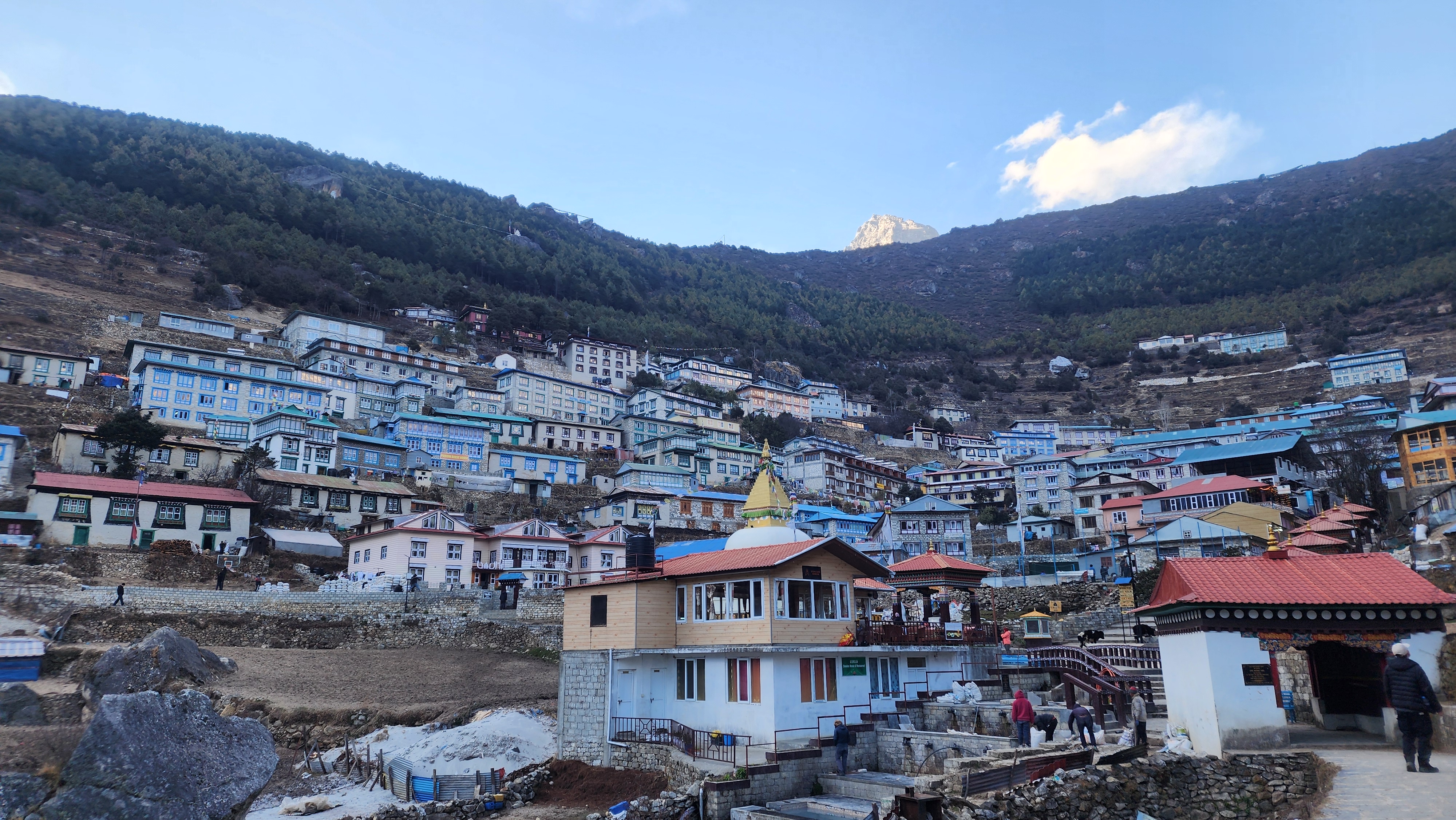
The trail descends steeply from Tengboche through rhododendron and pine forest, loud with birds in the morning, warm and green after the high moraine. The path drops to Phunki Tenga at the river, where water-driven prayer wheels spin in the current. A suspension bridge crosses the Dudh Koshi here. Then the trail climbs back through pine and juniper forest to Namche, 400m of ascent that you earn in the right direction for once.
Namche on the return is different from Namche on the way out. The bakeries and the internet that were staging amenities three weeks ago now feel like re-entering something familiar. One more walking day before Lukla.
Day 19: Namche to Lukla, Last Night in the Mountains
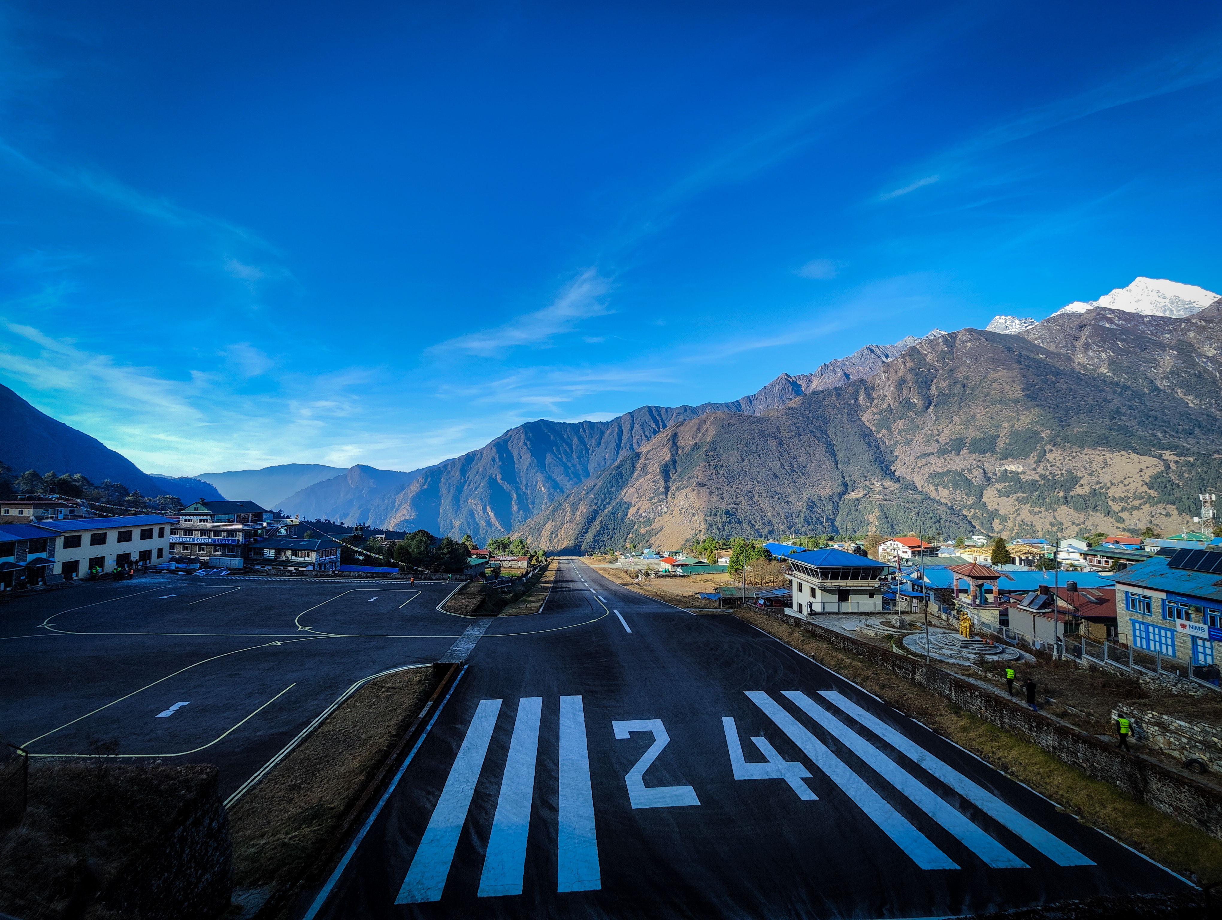
The final trekking day and the longest: 18 to 19km, descending from Namche to Lukla. It comes on day 17 of trekking and on legs carrying everything that has come before. Brace yourself on the knees, this is where they earn their keep.
The trail from Namche drops steeply at first through old rhododendron forest. The small settlements of Zapute, Toktok, and Benkar appear in sequence, each with its mani walls and stone houses and the sound of children that reminds you that people live here year-round. At Larja Dobhan, the Bhote Koshi joins the Dudh Koshi at the valley floor. The 500-year-old Pemacholing Monastery appears on the hillside above the trail near Monjo. The stone steps descending to the river level are where the knees give their clearest signal about what the past three weeks have asked of them. Go slowly. Trekking poles earn their keep on this final section.
Below Phakding the gradient eases and the valley opens. Lukla appears on the hillside above. The final 45-minute climb to the village from Phakding is gentle and welcome. Lukla at the end of the day is the kind of place that means nothing before a journey and everything at the end of one.
The Namche to Lukla descent is where under-prepared knees pay for everything the route has asked over the previous weeks. Trekking poles, a measured pace, and deliberate foot placement on the stone steps are the tools. For the specific training that protects the knee joint on this kind of sustained descent, our Everest Three Passes fitness and training guide covers single-leg step-downs and loaded descent training, the exercises that matter most for this day.
Day 20: Fly Manthali, Drive to Kathmandu
The flight from Lukla to Manthali is 25 to 30 minutes. The Himalayan range appears in the window briefly, smaller from the air than it felt from below, and then the green foothills open out and you are back in the lowlands. The six to seven hour drive to Kathmandu passes quickly. By the time you reach the city, the air at 1,310m feels almost thick after three weeks above 2,800m. Kathmandu, which felt like a transit point when you left, now feels very much like an arrival.
Day 21: Kathmandu Sightseeing and Contingency Day
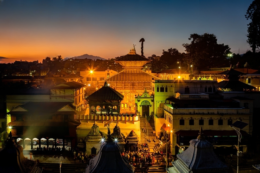
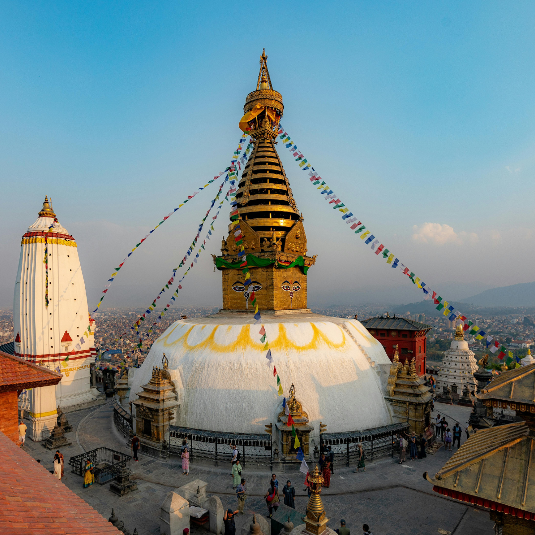
A well-earned day to explore Kathmandu before your flight home. The city is home to seven UNESCO World Heritage Sites within the valley, and the most visited are all within easy reach. Boudhanath Stupa is one of the largest in the world and carries a different weight after three weeks in Buddhist mountain culture. Swayambhunath on the western hill has panoramic views across the valley. The Durbar Squares of Kathmandu, Patan, and Bhaktapur are extraordinary examples of Newari architecture that have stood for centuries.
Thamel's lanes are also good for picking up souvenirs, handmade crafts, pashmina, and thankas if you want to take a piece of Nepal home. Your guide can point you in the right direction.
This day also serves as a contingency buffer for any Lukla flight delays on the return. If everything ran smoothly, it is yours entirely.
Day 22: Departure
Freedom Adventures team will transfer you to the airport for your onward flight . You leave having walked a complete circuit of the highest mountain on earth. Three passes above 5,300 metres. Valleys and glaciers and ancient villages that most visitors to this region never see. That is not a small thing. Safe travels.
Who is the Everest Three Passes Trek For?
This is not the right first trek in Nepal. It is not the right first high-altitude trek. It is the right trek for someone who has spent consecutive days above 4,000m, knows how their body responds to altitude, and wants to see the Khumbu in full rather than through one valley.
If you have completed the Everest Base Camp trek and want the natural next step in the same region, this is it. The Everest Base Camp day-by-day guide covers what EBC demands if you need to build to this point first.
If you are drawn to high-altitude circuit trekking but want a different landscape and culture, the Manaslu Circuit Trek crosses Larkya La at 5,160m in a restricted-permit zone where trekker numbers are a fraction of the Khumbu and the landscape shifts north toward Tibetan Buddhist culture. The Manaslu Circuit Trek guide covers it fully. The Annapurna Circuit at Thorong La (5,416m) is another comparable circuit challenge, covering a completely different range with lower pass-day commitment. Our Annapurna Circuit trek guide sets out the differences.
For those ready to move from trekking into mountaineering after Three Passes, Mera Peak at 6,476m is the step forward: crampons, rope, and a summit day above 6,000m. Our Mera Peak climbing guide covers the preparation and what it demands above high camp.
Related Treks
Everest Base Camp Trek — The foundation of the Khumbu region and the recommended route before attempting Three Passes.
Manaslu Circuit Trek — Nepal's most complete restricted-permit circuit, Larkya La at 5,160m, far fewer trekkers.
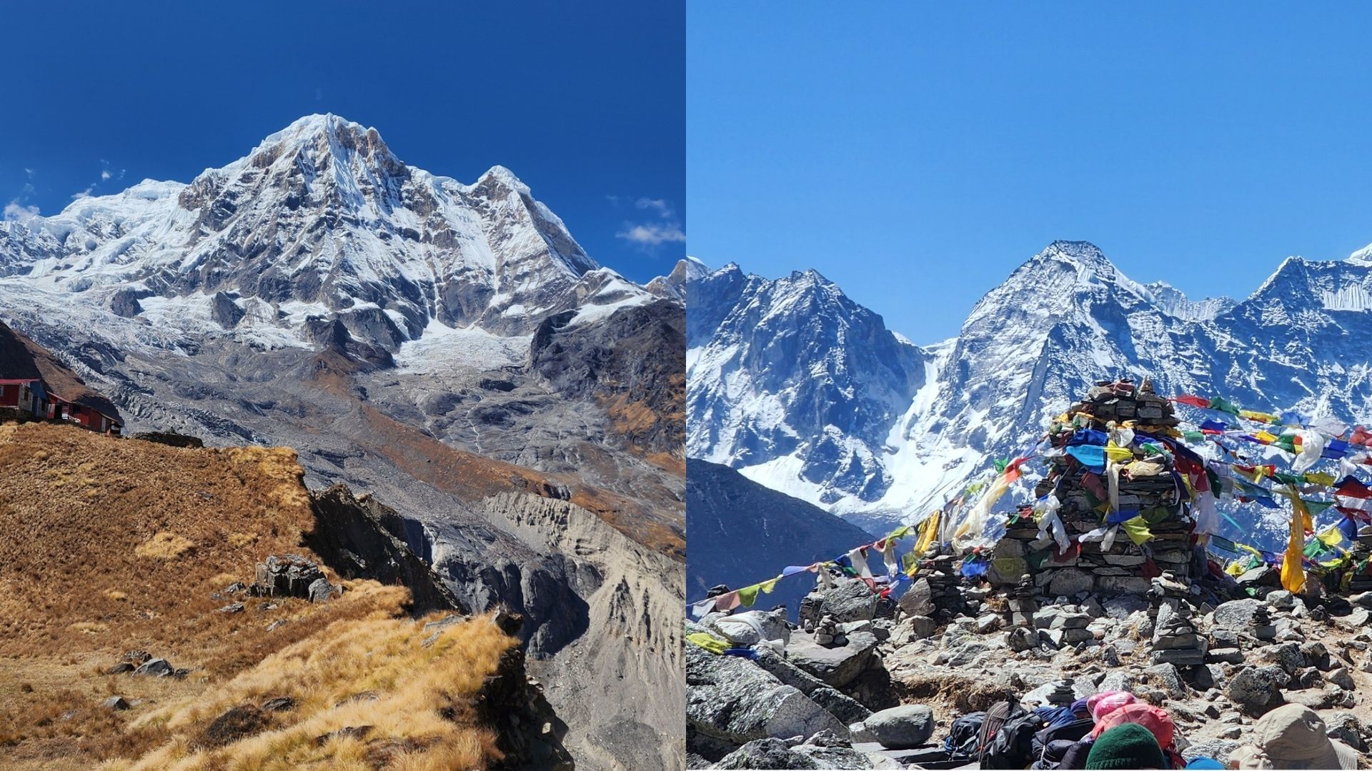
Annapurna Base Camp Trek — 2 Base Camp at: Annapurna (4130m) and Machhapuchhre (3700m) through a completely different Himalayan range and culture.
Mera Peak Climbing — The natural next step for trekkers ready to move from trekking into mountaineering after Three Passes.
Most trekkers who complete this circuit describe arriving in Chukhung after Kongma La as the moment the trek revealed what it was. Not Kala Patthar. Not Renjo La. The specific feeling of walking into a teahouse at 4,730m at the end of the hardest day, on legs that have crossed three passes above 5,300m across three weeks in the Khumbu.
The mountains look different from Chukhung than they did from Namche in week one. Ama Dablam above the valley. The pass you just crossed somewhere in the ridgeline behind you. The distance between where you stood three weeks ago and where you are standing now.
You have read the whole route. Which day on this breakdown gives you the most pause, and why?
Trek Everest Three Pass with Freedom Adventures.
KEEP EXPLORING
Uncover similar insights
Day-by-Day Demands, Training Plan, and Mental Grit