Table of Contents:

The Ultimate Guide to the Everest Base Camp Trek
Complete 16-Day EBC Trek Itinerary
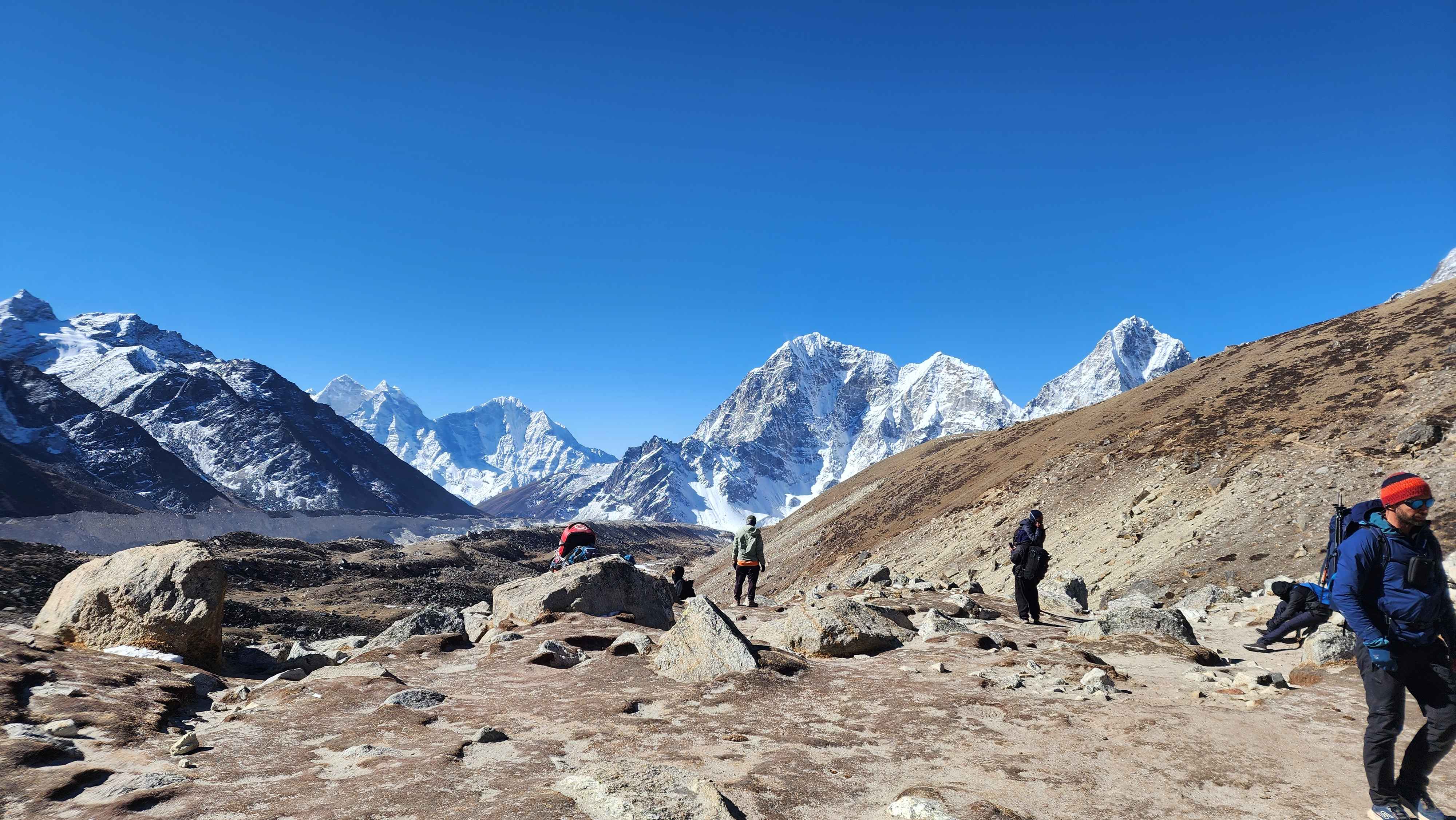
Every mountain has a base camp. Only one of them has become a destination in its own right. What you are signing up for is 14 days inside the Khumbu, the most storied mountain valley on earth, walking deeper into it each day until the air is half as thick as what you breathe at home and the highest peak on the planet is standing directly in front of you. This trek does not ask you to climb anything. It asks you to keep going, through pine forest and glacial moraine, through Sherpa villages that predate mountaineering by centuries, past the memorial cairns at Dughla where the mountain's cost is written in stone, all the way to the foot of the Khumbu Icefall where expedition teams prepare to go where you will not. You will stand at 5,364 meters at base camp and then, on the morning after, you will climb to 5,545 meters on Kala Patthar and watch the sunrise move down the face of Everest while the valley below is still dark. That moment is why people put this on their list and leave it there for years.
The trek itself is 130 kilometers from Lukla to base camp and back, spread across eleven walking days through the Khumbu Valley in the Solukhumbu District of northeastern Nepal. The valley is the heartland of the Sherpa community, one of the world's most remarkable mountain peoples, whose names appear on every significant Himalayan climbing record of the past seventy years.
Where is Everest Base Camp?
Everest Base Camp sits at 5,364 meters inside Sagarmatha National Park, Solukhumbu District, northeastern Nepal, at the foot of the Khumbu Glacier.
You reach it by flying into Lukla at 2,860 meters and walking north through the Khumbu Valley for nine days. The valley follows the Dudh Koshi River before the terrain opens into high glacial moraine, where the Khumbu Glacier feeds the icefall that rises directly above the camp. The camp itself is flat moraine with no fixed structure, no gate, no marker. What you arrive at is the same ground expedition teams have used as their staging point , with the Khumbu Icefall, Everest's first real obstacle, beginning immediately above.
Sagarmatha National Park, a UNESCO World Heritage Site since 1979, covers 1,148 sq km almost entirely above 3,000 meters. Everest (8,848.86m), Lhotse (8,516m), Cho Oyu (8,188m), and Makalu (8,485m) all sit within or bordering it. There is no other place on earth where four mountains above 8,000 meters stand this close together, and the trail passes the base of all of them.
How Hard is the Everest Base Camp Trek?
Moderately strenuous to hard, depending on how your body handles altitude. There is no technical climbing, no glacier crossing, nothing that requires prior mountaineering experience. What makes it hard is the combination of sustained daily effort, cumulative fatigue over 14 days, and an oxygen supply that drops to roughly half of sea level by the time you reach base camp. Most days you will walk 5 to 7 hours. Most days you will feel fine. It is the days you do not that define the trek.
Where It Gets Specifically Hard?
Phakding to Namche: Day 04
The first honest test. After a gentle morning through river gorge and suspension bridges, the Hillary Bridge marks the end of the easy section. From there, 600 vertical meters of steep switchbacks through pine forest with no flat section and no shortcut. It comes late in the day when legs are already tired. This is where most trekkers get their first read on how the trail is going to treat them.
Dingboche to Lobuche: Day 09
The altitude crosses 4,900 meters and the landscape empties completely. Open moraine, no shelter, wind off the glacier in the afternoons. The climb to Thukla Pass at 4,830 meters is short but steep, and by this point the body is no longer fully recovering overnight. What felt manageable lower down now costs noticeably more. Cold is also a constant from here, not just at night.
Lobuche to EBC: Day 10
The longest and most draining day on the trek. You walk from Lobuche to Gorakshep across loose moraine, continue to base camp at 5,364m, and return to Gorakshep to sleep, all in one push. At this altitude even flat ground demands real effort. The path from Gorakshep to base camp is uneven glacial debris. By the time you return, most trekkers have been on their feet for 6 to 7 hours at over 5,000 meters.
Kala Patthar: Day 11
The hardest single push of the trek, and it comes the morning after the hardest day. You leave Gorakshep before dawn, in the dark, in the cold, on tired legs, and climb vertical steep loose scree to 5,545 meters. The altitude, the early hour, and the accumulated fatigue from the days above 5,000 meters all land at once. Most trekkers describe it as the most demanding 90 minutes of the entire route. The view from the top is also the best of the entire route.
Who This Trek Is Right For
Adults who can walk six hours a day on hilly terrain with a 5 to 7 kg pack without stopping frequently. Train on actual hills over consecutive days, at minimum three months out. Altitude sickness does not care about fitness levels, but a strong base makes everything above 4,000 meters more manageable.
For the full picture on physical preparation, training timelines, and what the descent does to your knees, read our complete EBC Trek Difficulty Guide.
Day -by- Day Breakdown
Day 01: Arrival in Kathmandu
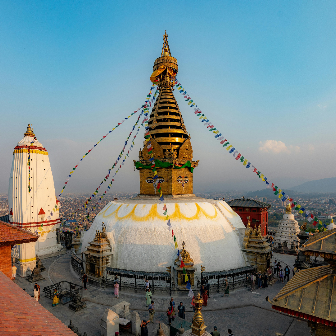
You land at Tribhuvan International Airport. Our representative is in the arrivals hall with a sign. From here, it is straightforward.
Kathmandu sits at 1,310 m. Acclimatization starts the moment you arrive, which is one of the reasons the itinerary begins this way. The city is doing useful work before the trek even begins.
In the evening there is a pre-departure meeting with your guide. This is where the route gets explained in detail, any last gear questions get answered, and you find out exactly what the first days on trail look like.
After the meeting, a welcome dinner. Then rest. Tomorrow is a long drive.
Note
If you need to rent or buy any gear, Thamel has everything. Trekking poles, sleeping bag, liners, base layers, gaiters, micro spikes. Do it today before you are pressed for time. Prices in Kathmandu are cheaper than anything you will find on trail. Plus, your lead guide will be at hand to assist you with everything you need to rent or buy for the trek.
Day 02: Drive to Manthali
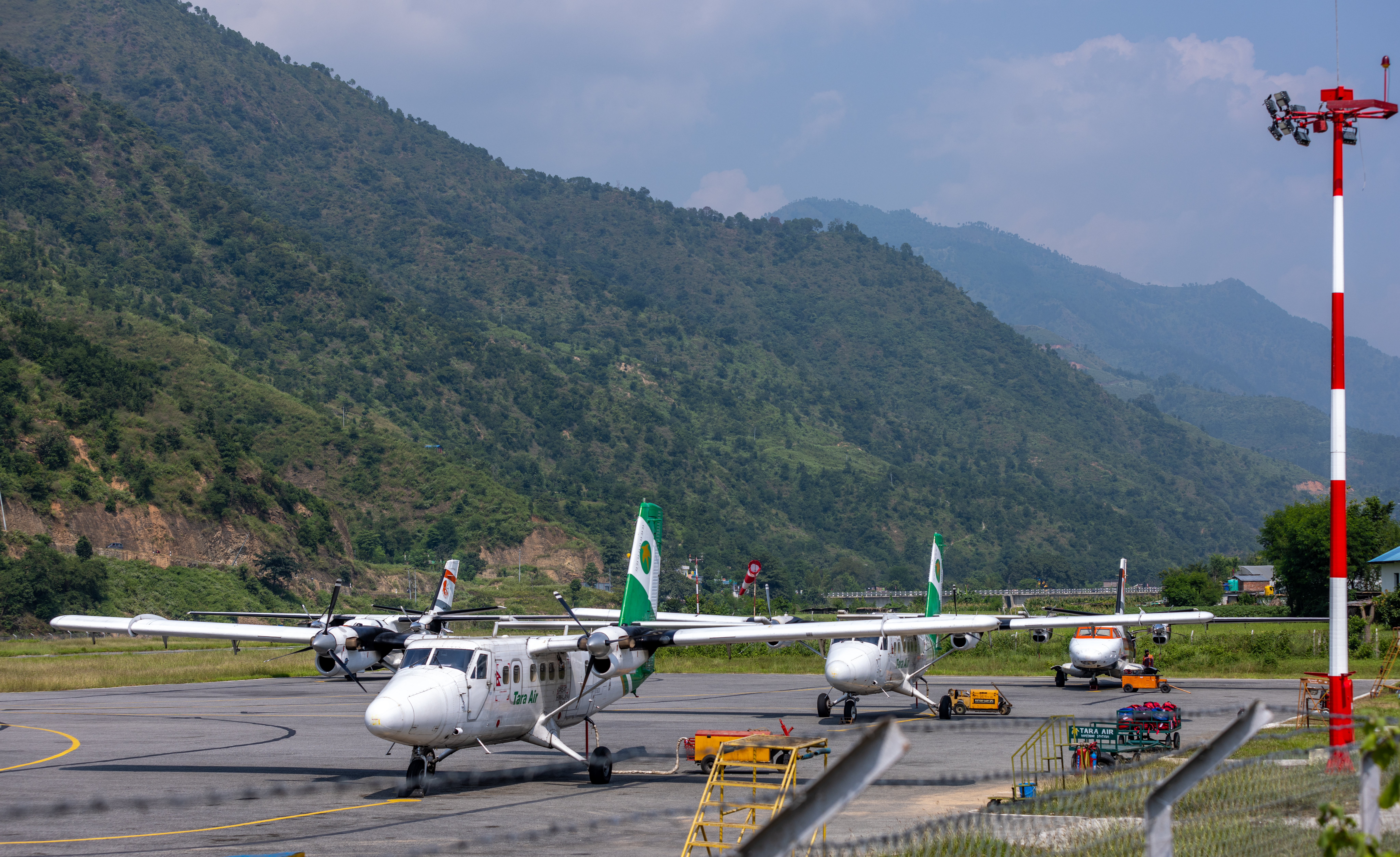
The vehicle leaves Kathmandu at 7 a.m. - 8 a.m. The drive to Manthali Airport in Ramechhap District covers roughly 130 km east of Kathmandu along the Araniko Highway and mountain roads, taking 6 to 7 hours depending on road and traffic conditions. Since 2023, the majority of Lukla flights operate from Manthali rather than Tribhuvan International, a change introduced to ease air traffic congestion at TIA. The road passes through Dhulikhel and drops into the Sunkoshi valley before climbing again toward Ramechhap.
On Lukla flights
Tenzing-Hillary Airport at Lukla (2,840m) is one of the most operationally demanding airstrips in the world: a 527-metre runway, cut into a hillside, with mountains on the final approach. Flights operate only in the early morning window when visibility and wind allow. Cancellations are common, particularly in the shoulder seasons, after rain, and in unstable weather.
Day 03: Flight to Lukla and Trek to Phakding
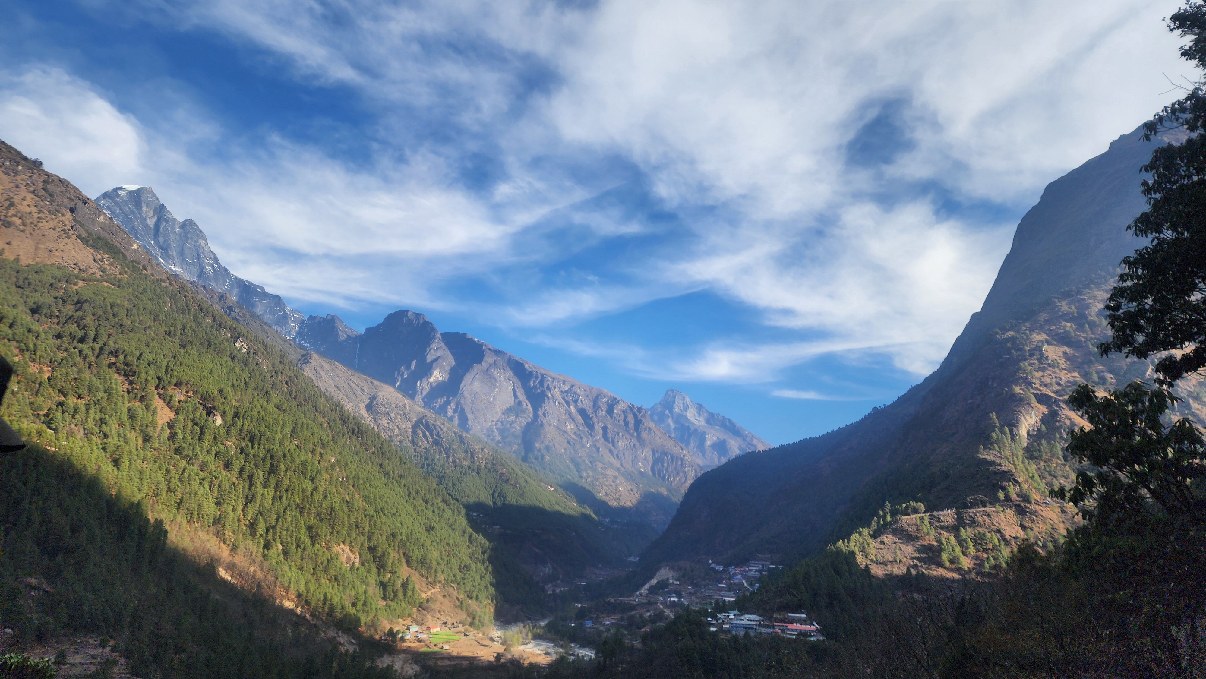
You will take a short flight from Manthali to Lukla, roughly 20 minutes over increasingly dramatic terrain.
At Lukla you will meet the full team, load up, and head out. The trail drops immediately into a gentle descent through pine and fir forest, the path wide and well-worn underfoot. You pass through Chheplung, the first proper Sherpa village, its stone houses sitting above terraced fields. The Dudh Koshi River appears below you on the left, glacially grey-green from the meltwater above, rushing and loud. You follow its course south, the forest thick and shaded on either side.
The trail rolls through Thado Koshi and down to Phakding in a series of small ups and downs, never steep, never taxing. Kusum Kanguru (6,367m) appears above the eastern tree line. Most people walk straight past their first 6,000 metre peak without looking up.
Phakding sits in a bowl beside the river at 2,610 meters. A quiet village with a school, a monastery, and enough teahouses to absorb the daily flow. Short day by design. The legs are getting their bearings.
Day 04: Phaking to Namche
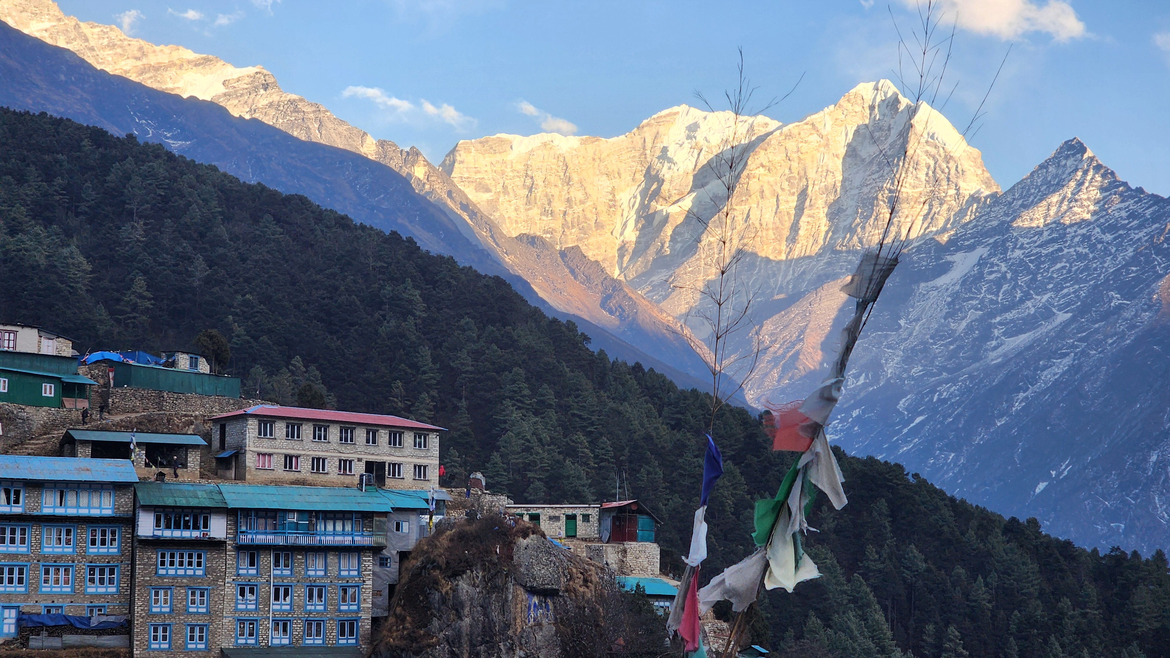
This is where the trek begins in earnest. You leave Phakding on a good trail through Toktok and Bengkar, the valley walls rising on both sides. The trail crosses the Dudh Koshi on suspension bridges multiple times through this section, each one draped in prayer flags, swaying lightly underweight, the river surging below. At Monjo you enter Sagarmatha National Park and present your permits at the checkpoint.
Beyond Jorsale the valley gorge tightens and the two rivers, the Dudh Koshi and Bhote Koshi, converge. Then you arrive at the Hillary Bridge. It is 140 meters of steel cable and timber plank, suspended 55 meters above the water, covered in prayer flags, moving gently under your feet. Cross it and the ascent to Namche begins immediately: 600 vertical meters of steep switchbacks through pine forest, relentless and unshaded for 90 minutes to two hours. There is no easier version of this climb. It is where the first day divides the trekkers who are ready from those who thought they were.
The Hillary Bridge is named after Sir Edmund Hillary and spans the Dudh Koshi at approximately 3,250 meters. It is the last suspension bridge before the long climb to Namche and the most significant logistical crossing on the entire route. Yaks always have right of way on the bridge. Step to the uphill side and let them pass.
Day 05: Acclimatization in Namche
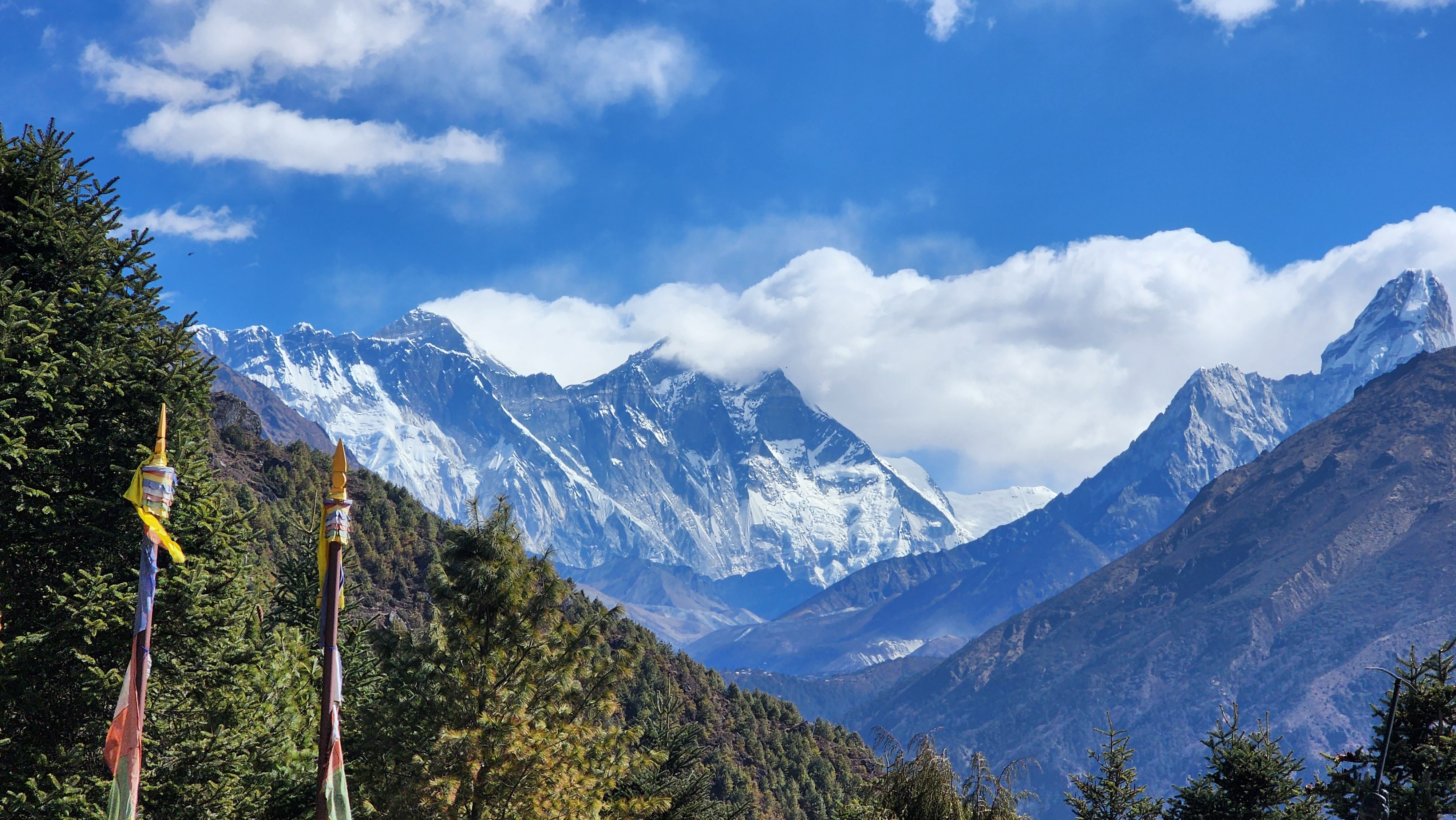
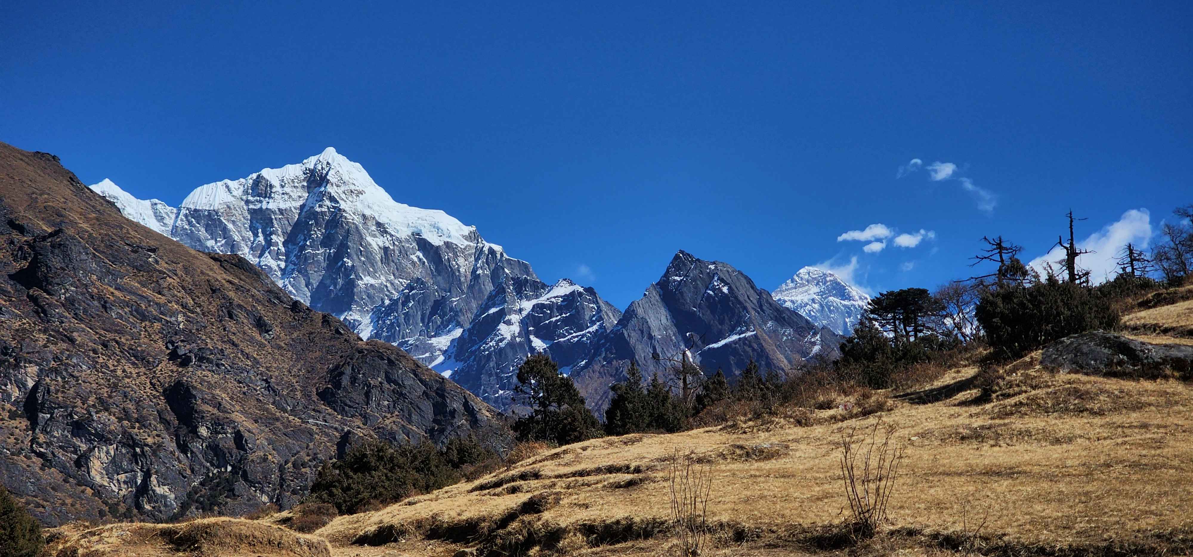
You will climb above Namche to Syangboche (3,748m) and continue to the ridge below the Everest View Hotel at around 3,900 meters. From here the full Khumbu panorama opens: Everest above the Nuptse-Lhotse wall to the north, Ama Dablam's hanging glacier to the southeast, Thamserku and Kangtega filling the valley behind you. It is the first time the full scale of what lies ahead becomes visible as one uninterrupted picture. Return to Namche to sleep.
The principle is simple: go higher during the day, sleep at your current altitude at night. This stimulates red blood cell production without the strain of sleeping at a new elevation. The acclimatization day at Namche is one of the two most important days on the entire route.
On AMS
Acute Mountain Sickness begins affecting some trekkers above 3,000 meters. Headache, nausea, dizziness, and disrupted sleep are normal early responses. If symptoms worsen rather than ease after 24 hours of rest, that is the signal to descend, not to push. No medication replaces descent. Diamox can assist with acclimatization but must be discussed with a doctor before the trek.
Day 06: Namche to Tengobche
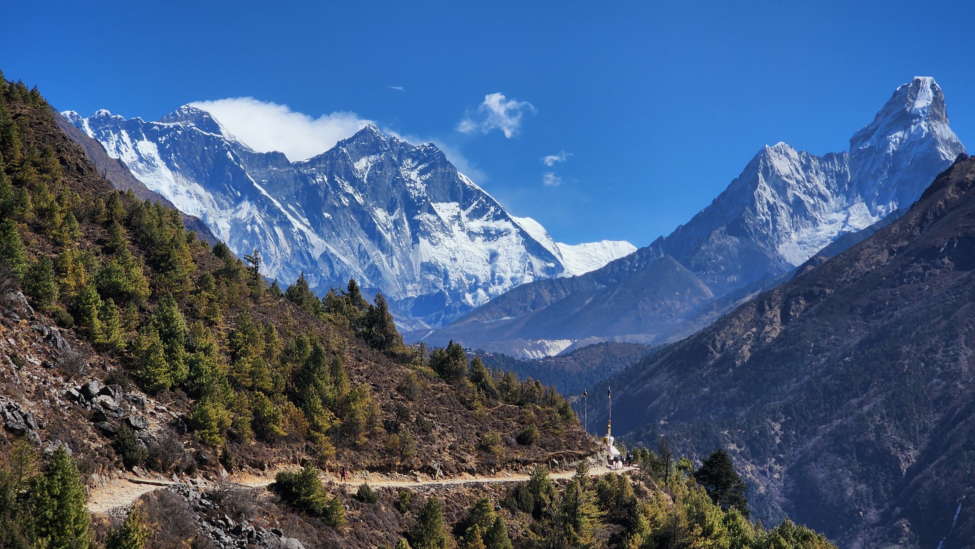
You leave Namche on a trail that traverses the eastern wall of the Khumbu Valley at a steady contour, neither gaining nor losing much elevation for the first hour. Ama Dablam (6,812m) sits directly ahead for most of the morning. Its ridgelines look designed rather than formed, a precise pyramidal summit with a hanging glacier on the southeast face that is visible from several kilometers away. This is why it is one of the most photographed mountains in the Himalaya. You will understand why before 9am.
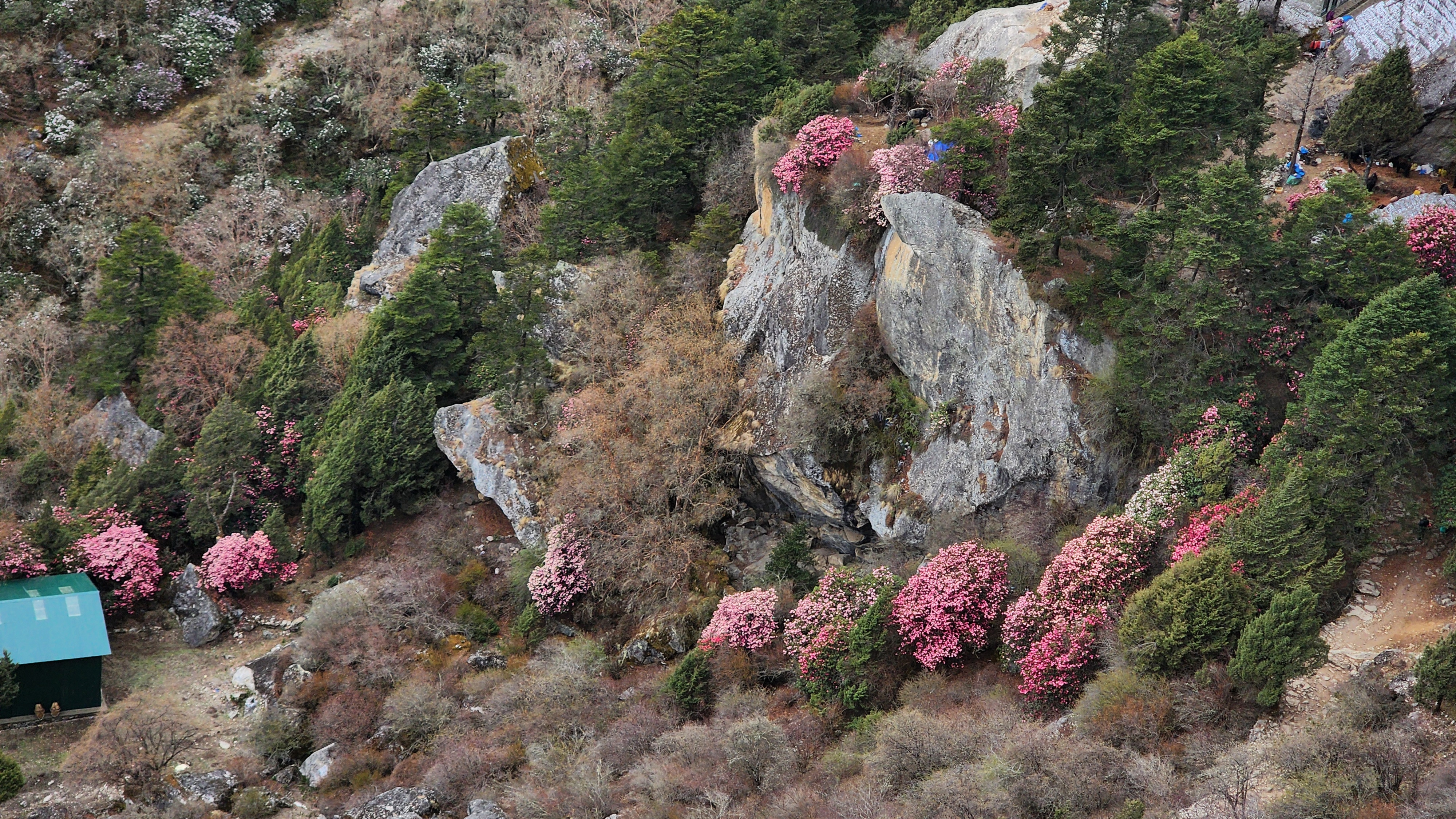
The path eventually drops to Phunke Tenga at 3,250 meters, crossing the Dudh Koshi on a suspension bridge surrounded by juniper and pine that fills the air with a forest scent. From there a steep climb of about two kilometers through dense rhododendron and birch brings you up to Tengboche. In spring this forest blooms red and pink through the canopy. In autumn it turns gold. In either season it is the section trekkers mention most when they come home, not for altitude or achievement, but simply for how it looks walking through it.
Sleep here is often disrupted. The altitude has caught up.
Heads Up
October brings Mani Rimdu to Tengboche, a three-day festival of masked dances and sacred ceremony held at the monastery. It draws Sherpa communities and monks from across the Khumbu and is one of the most genuine cultural events accessible on any trekking route in Nepal. Worth timing for if possible.
Tengboche Monastery was originally built in 1916, destroyed by earthquake in 1934, rebuilt, burned to the ground by fire in 1989, and rebuilt again. It is the largest gompa in the Khumbu region and follows the Nyingma tradition of Tibetan Buddhism. Expeditions seeking Everest still come here for blessings before heading up the valley.
Day 07: Tengboche to Dingboche
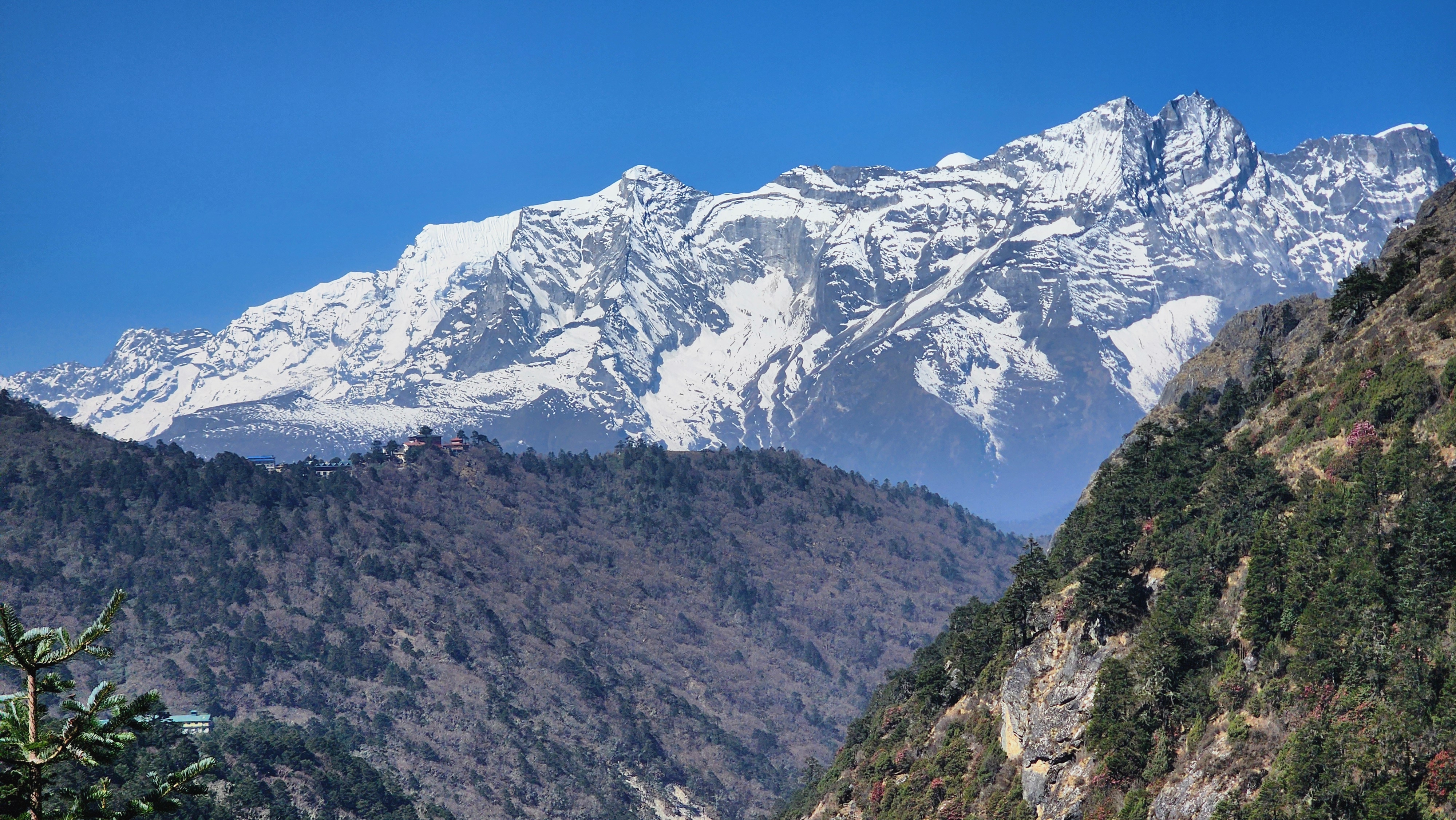
You descend from Tengboche through a rhododendron forest to Deboche, a small settlement. From Deboche you cross the Imja Khola on a suspension bridge, the river clear and fast below, and begin a gradual climb through the last of the forest. This is where the vegetation makes its final exit. Scrub juniper and dwarf rhododendron take over, then open alpine grass, then nothing but stone and sky. The peaks stop being a backdrop and start being a presence you are walking inside of.
Through Pangboche the valley widens into a broad glacially-formed basin. The stone walls dividing the land here are not decorative. They are yak boundaries and field dividers built over centuries by people who have farmed at 4,000 meters for hundred years. Ama Dablam dominates the south, Island Peak (6,189m) appears to the east. The trail climbs gradually through Shomare and Orsho before flattening into the open valley that leads to Dingboche.
Fact
Pangboche, at around 3,985 meters, is the highest permanent Sherpa village in the Khumbu. Its monastery is one of the oldest in the region and holds a purported Yeti hand. The village has been continuously inhabited for over three centuries.
Day 08: Acclimatization in Dingobche
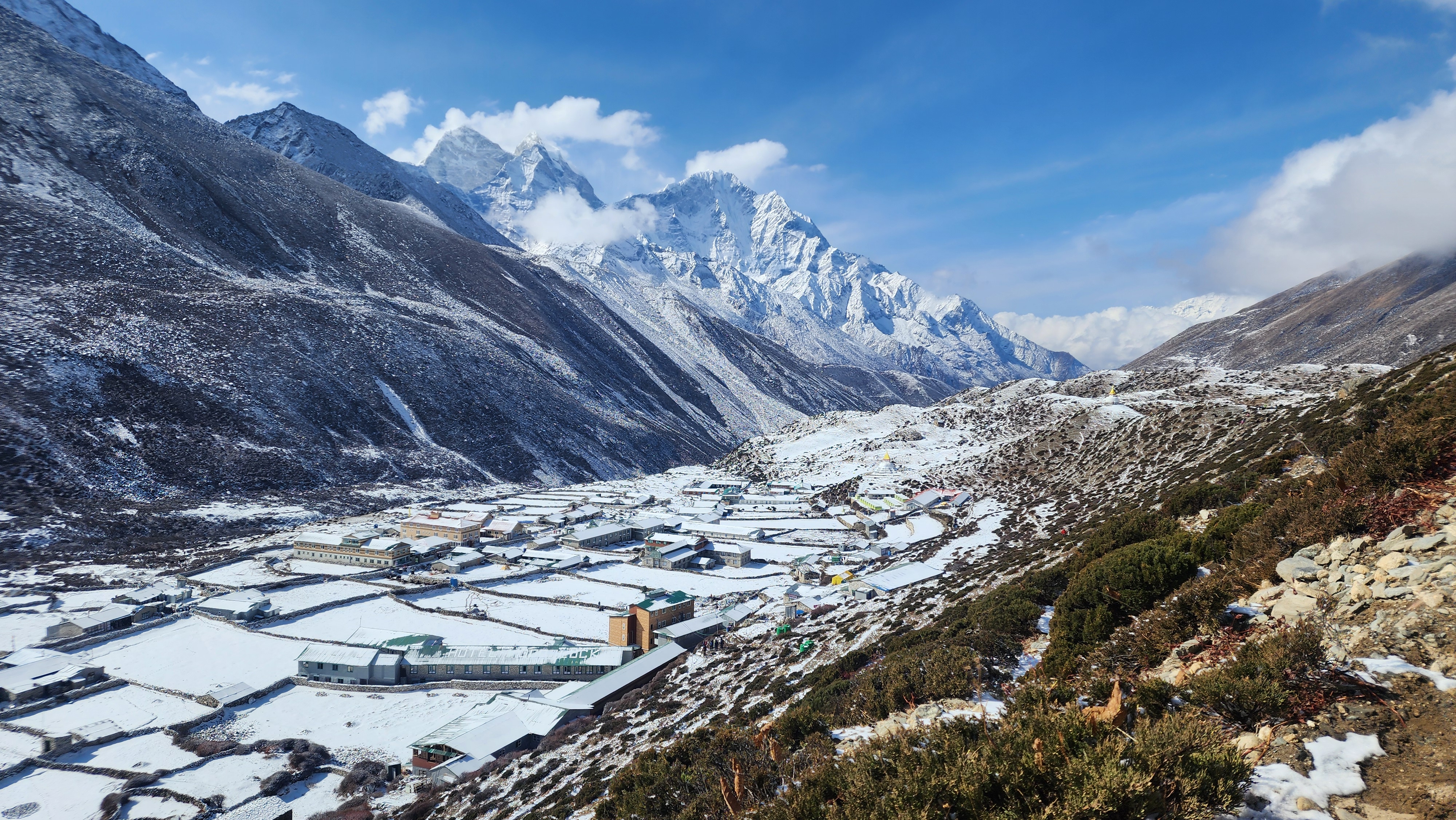
You will climb the ridge directly north of the village. The trail is steep and direct, just an ascent on open ground to around 5,100 meters before turning back. From there: Makalu (8,485m) and Cho Oyu (8,188m) visible to the east and west, the full Imja Valley below you, and Lobuche Peak at a completely different angle than you will see it from the trail. The Island Peak south face sits directly opposite.
This day tells you honestly where your acclimatization stands. If the climb goes steadily, the upper Khumbu is within reach. If the headache from the past nights has not resolved, this day tells you something more important than the schedule does. An alternative option is the walk to Chhukung (4,730m) at the head of the Imja Valley, below the sheer south face of Island Peak.
Important
Do not push through persistent symptoms on this day. The transition from Dingboche to Lobuche tomorrow is significant. Going up with unresolved AMS above 4,000 meters is one of the most common reasons trekkers are evacuated from the upper Khumbu. An extra day at Dingboche is not a setback. It is a decision that gets most people to base camp.
Day 09: Dingboche to Lobuche
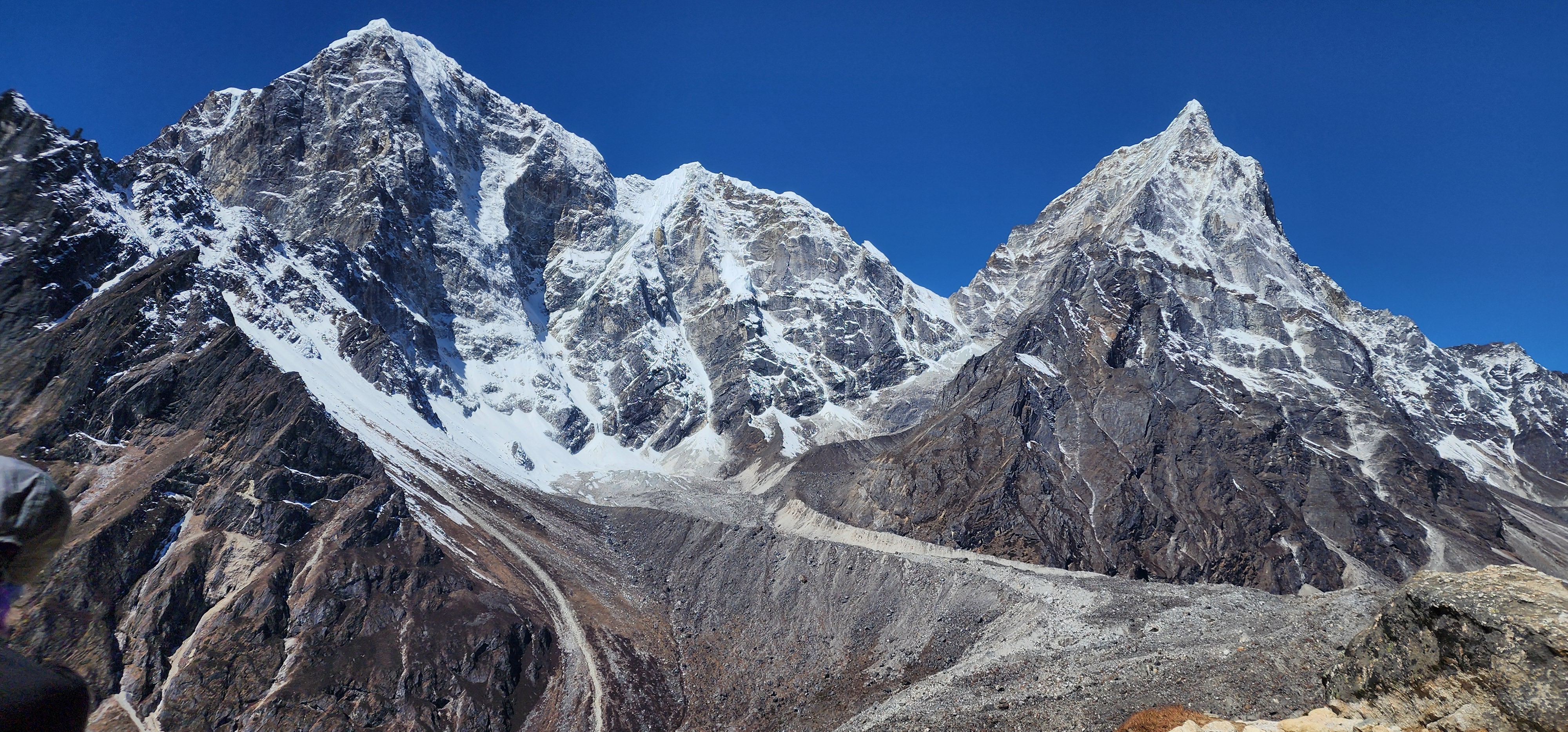
You leave Dingboche on a trail that climbs gradually northwest across open ground, the valley growing quieter with every hour. At Dughla (4,620m) you cross a stream and reach the base of the climb to Thukla Pass. Before the ascent there is the memorial site: stone cairns inscribed with names and draped in prayer flags on the ridge above. This is where the mountaineering community marks its dead. Memorials for Scott Fischer, Rob Hall, and decades of Sherpa and expedition climbers lost on Everest and the surrounding peaks stand here. Most people walk through without speaking. There is nothing to add.
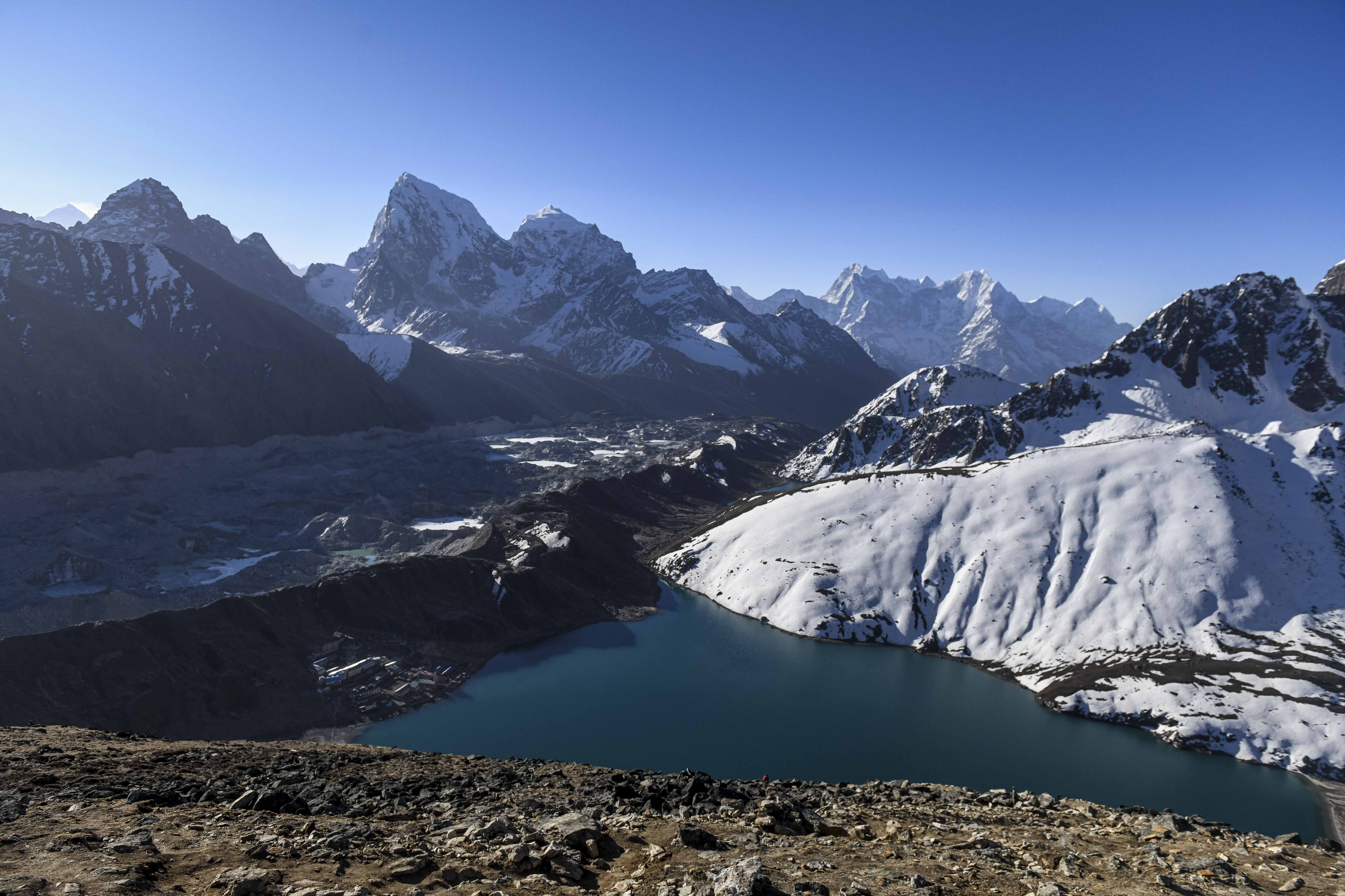
From Thukla Pass (4,830m) the landscape is completely transformed. The Khumbu Glacier opens to the right, massive and grey. Nuptse's enormous southwest face fills the western horizon. The trail follows the lateral moraine edge to Lobuche, a cluster of basic teahouses sitting at 4,940 meters with wind off the glacier in the afternoons and temperatures that fall well below zero after dark. From this altitude the body no longer fully recovers overnight. You will feel it in the morning.
Day 10: Lobuche to Everest Base Camp
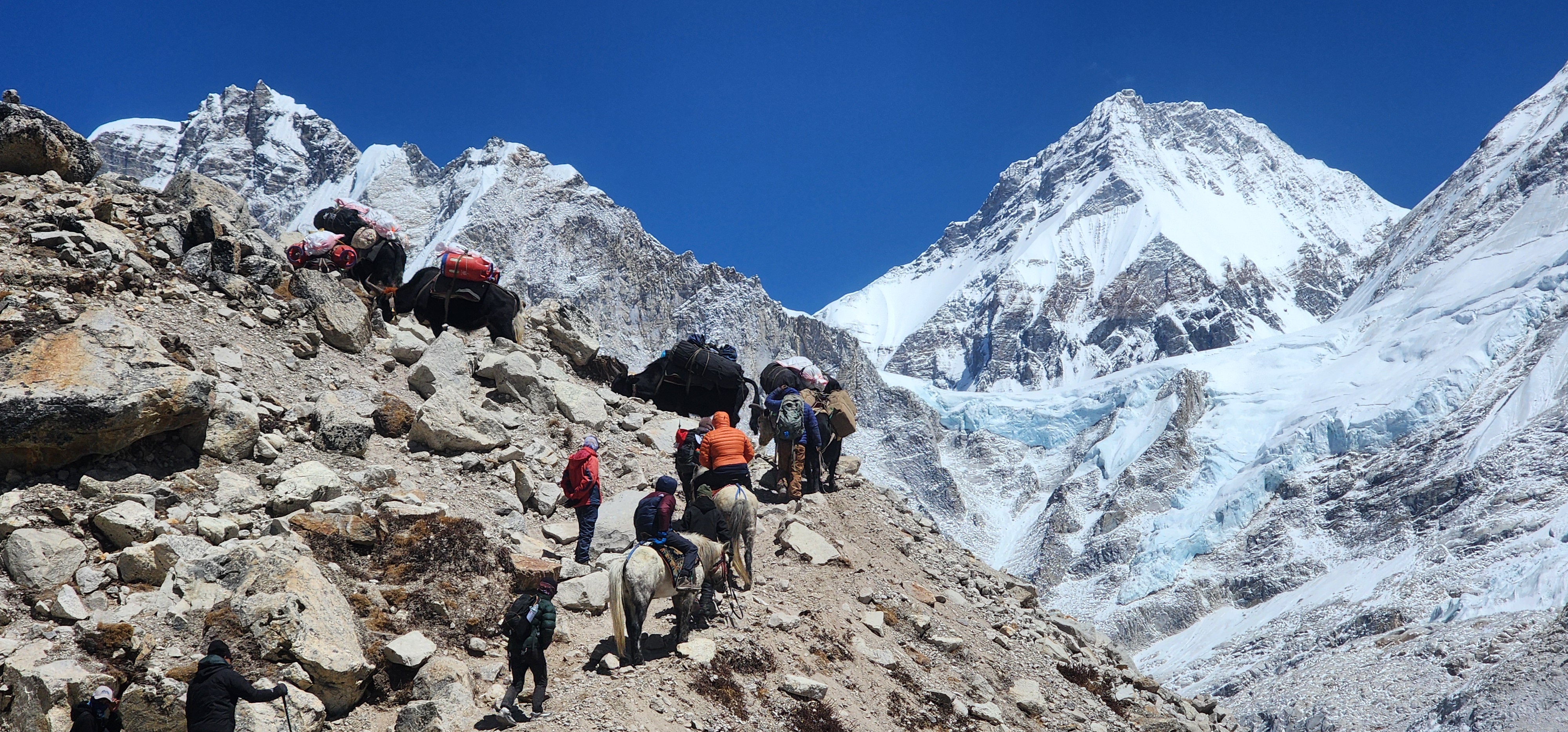
You leave Lobuche on the moraine trail with Pumori (7,161m) directly ahead and the Khumbu Glacier on your left. The ground is loose rock, boulders, and sandy glacial debris. Four kilometers of this brings you to Gorakshep (5,164m), which sits on the flat of a former glacial lake and was the original Everest base camp for the early expeditions of the 1950s. Stop, eat, and rest here before continuing.
From Gorakshep to Everest Base Camp is 3.5 kilometers across the moraine. The ground is uneven and demanding underfoot. The walk takes 90 minutes to two hours. Do not rush it. When you arrive at base camp (5,364m) the Khumbu Icefall rises immediately above: compressed glacial ice broken into seracs and crevasses 20 meters high. This is what expedition teams cross before dawn to reach Camp I. Looking at it from below and choosing to turn around here does not feel like failure. It feels correct. Return to Gorakshep for the night. Sleep is genuinely hard at 5,164m.
Warning
Base camp is at 5,364m and Gorakshep at 5,164m. These are the two most demanding consecutive nights on the trek in terms of altitude. Drink more water than you think necessary, eat even without appetite, and take any worsening symptoms seriously. The nearest medical facility is the HRA clinic at Pheriche, one long day's walk below.
Day 11: Kalapatthar to Pheriche
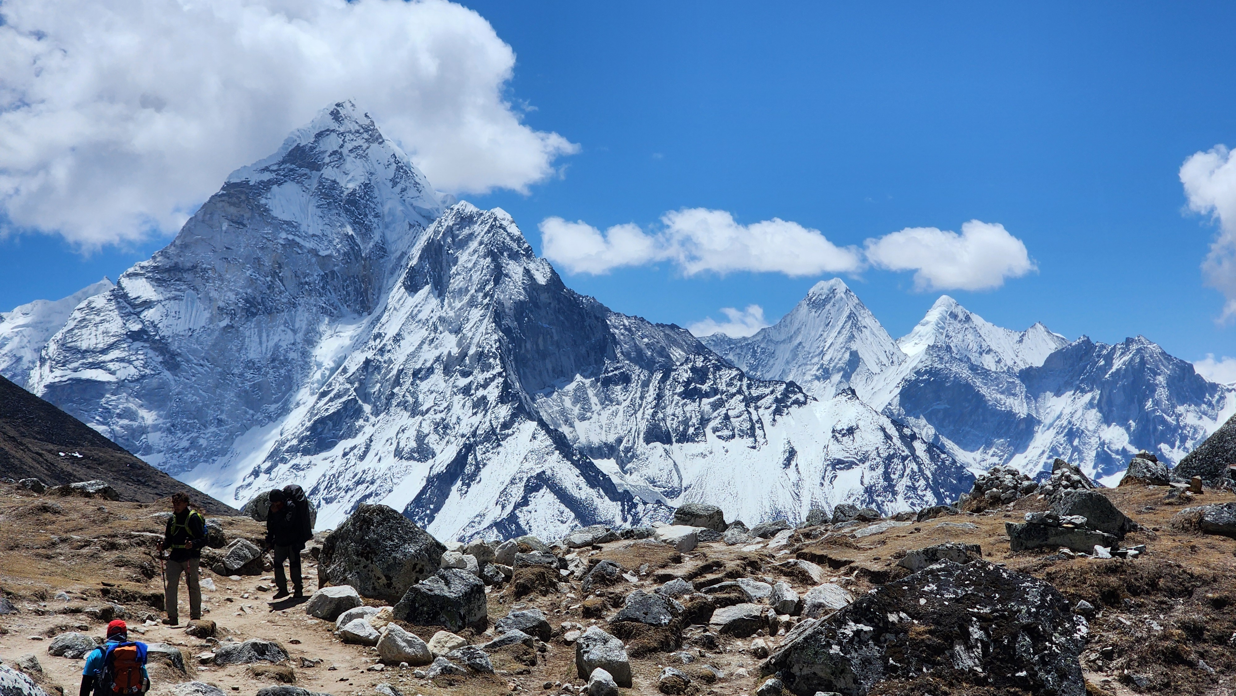
You will leave Gorakshep in darkness, headlamp on, before the valley moves. The trail climbs the south ridge of Pumori on steep loose scree. Most groups reach the viewpoint in 90 minutes. Kala Patthar at 5,545 meters gives you what base camp cannot: an open, unobstructed view of Everest's full summit pyramid. At base camp, Nuptse's west ridge partially blocks the upper mountain. Here it is completely clear. The Southeast Ridge, the exact route Hillary and Tenzing climbed on 29 May 1953, is directly in front of you.
At sunrise the first light catches the summit while the valley below is still dark. It moves down the face from gold to white. Lhotse, Nuptse, Changtse, and Pumori above you all shift in sequence. The sequence takes about twenty minutes. Go regardless of cloud. Being at 5,545 meters at that hour is its own thing.
Descend to Gorakshep for breakfast and then walk the full descent to Pheriche (4,371m). The descent removes more than 1,000 meters of altitude. Food tastes noticeably better. Sleep tonight is deep.
Day 12: Pheriche to Phortse
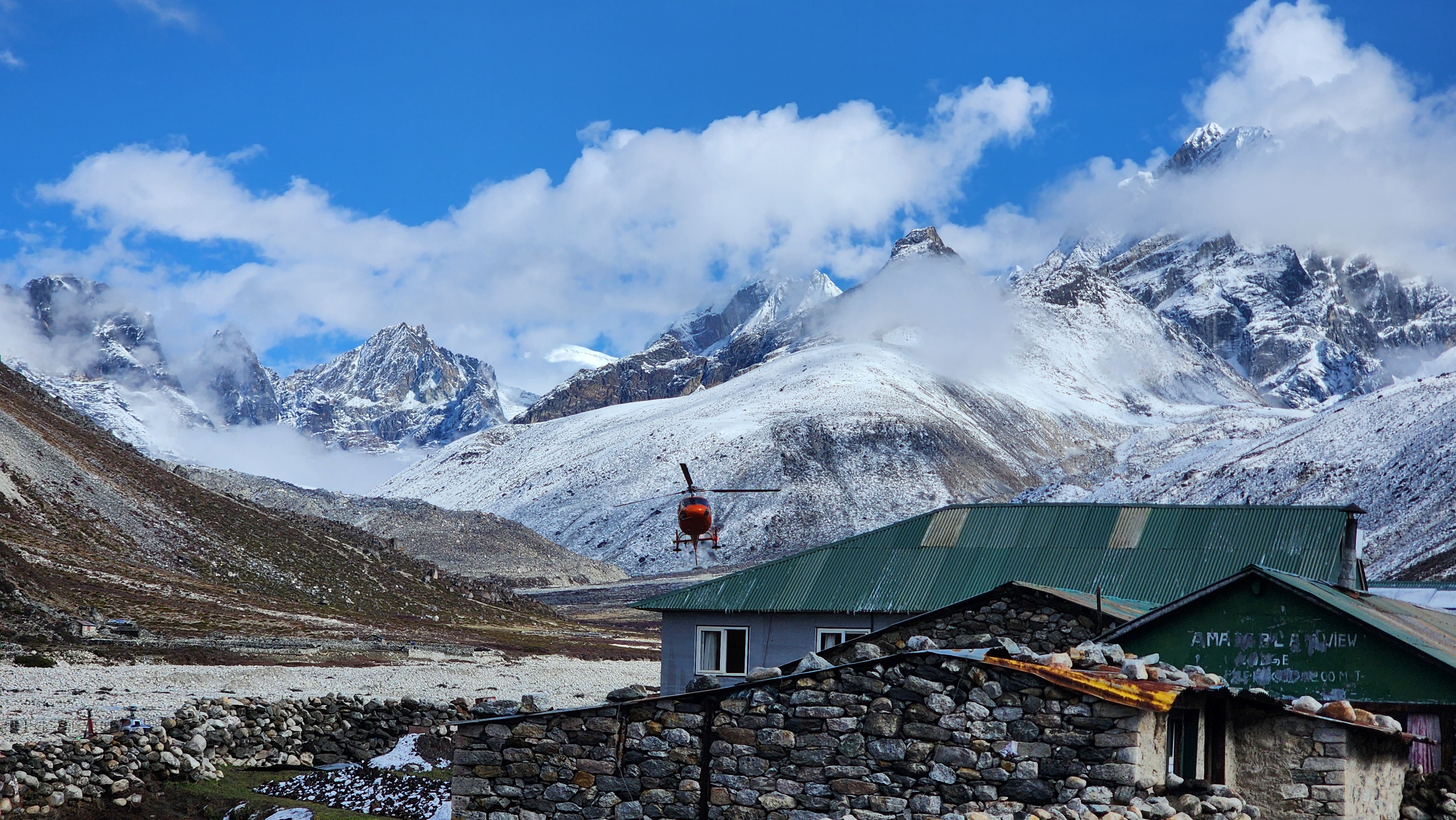
From Pheriche the trail crosses the valley floor and joins the main path at Pangboche, then takes the high traverse toward Phortse rather than dropping back toward Tengboche. The path runs along steep hillside on stone-cut steps well above the valley floor, Ama Dablam's full south face directly opposite across the gorge, Thamserku and Kangtega to the south, Everest and Lhotse still visible to the north. The views from this traverse are better than anything on the ascent route. It is quieter, less photographed, and feels like a different trail entirely.
Day 13: Phortse to Monjo
You descend from Phortse to Phortse Thanga on the valley floor, join the main trail at Sanasa, and drop through Namche. From Namche the path is the familiar trail in reverse: pine forest, the Hillary Bridge, Jorsale, and Monjo. Six hundred vertical meters of descent from Namche to the valley floor happen in under three hours of actual walking. Use trekking poles from the first step below Namche. This specific descent from Namche is responsible for most of the knee complaints trekkers carry home for weeks. Pace yourself on the downhills, no matter how strong your legs feel.
Day 14: Monjo to Lukla
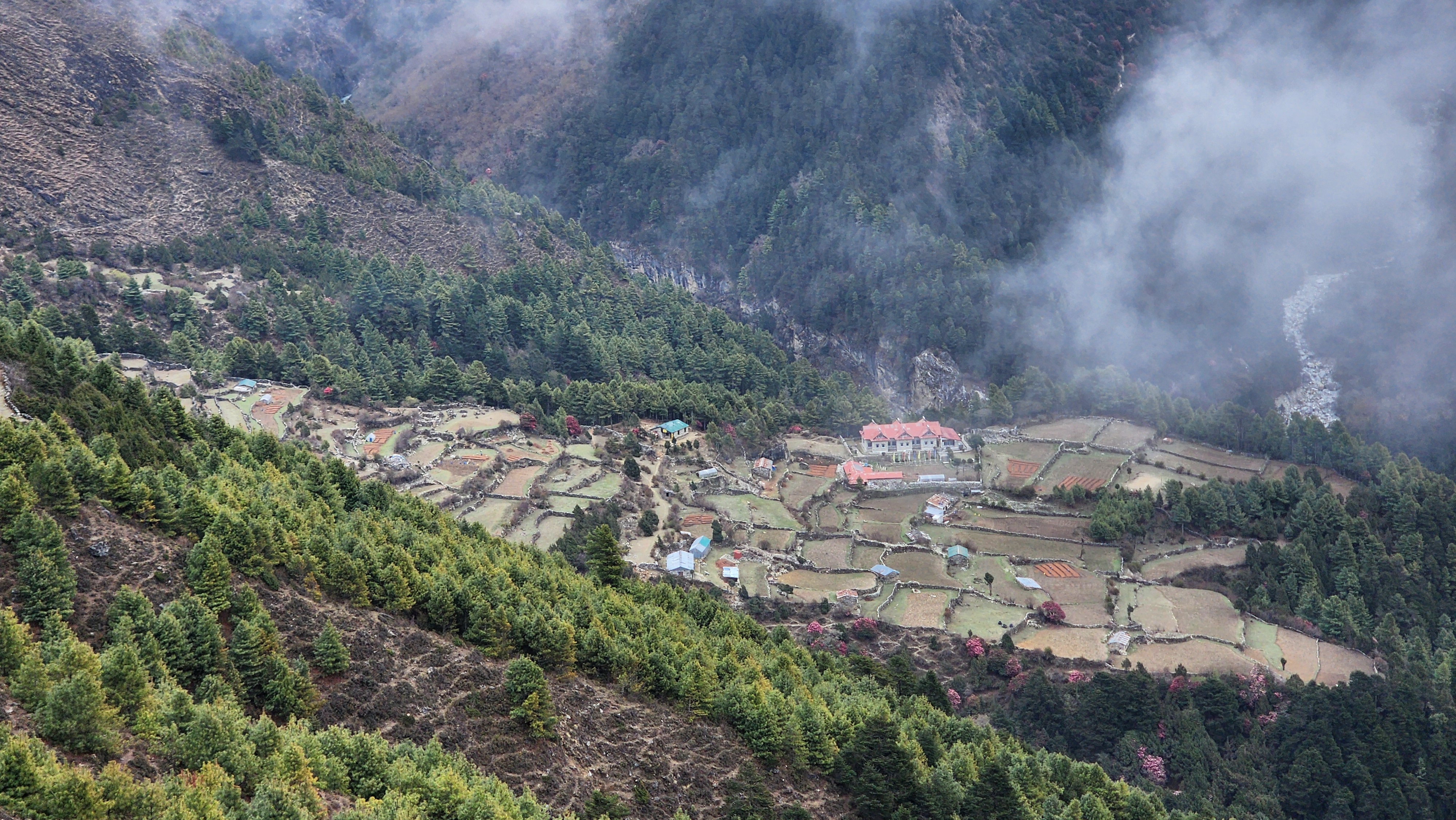
The last full day retraces Phakding, Chheplung, and the climb back up to Lukla. The trail is familiar. The body is tired. The climb back to Lukla, which felt like nothing on Day 1, is a proper ascent today. The forest is the same, the river is the same, the mani walls are the same. But you are not. The bakeries and teahouses on Lukla's main street have been the final evening for trekkers returning from the Khumbu for fifty years. The feeling at the end of it is real and it belongs to you.
Day 15: Flight to Manthali & Drive to Kathmandu
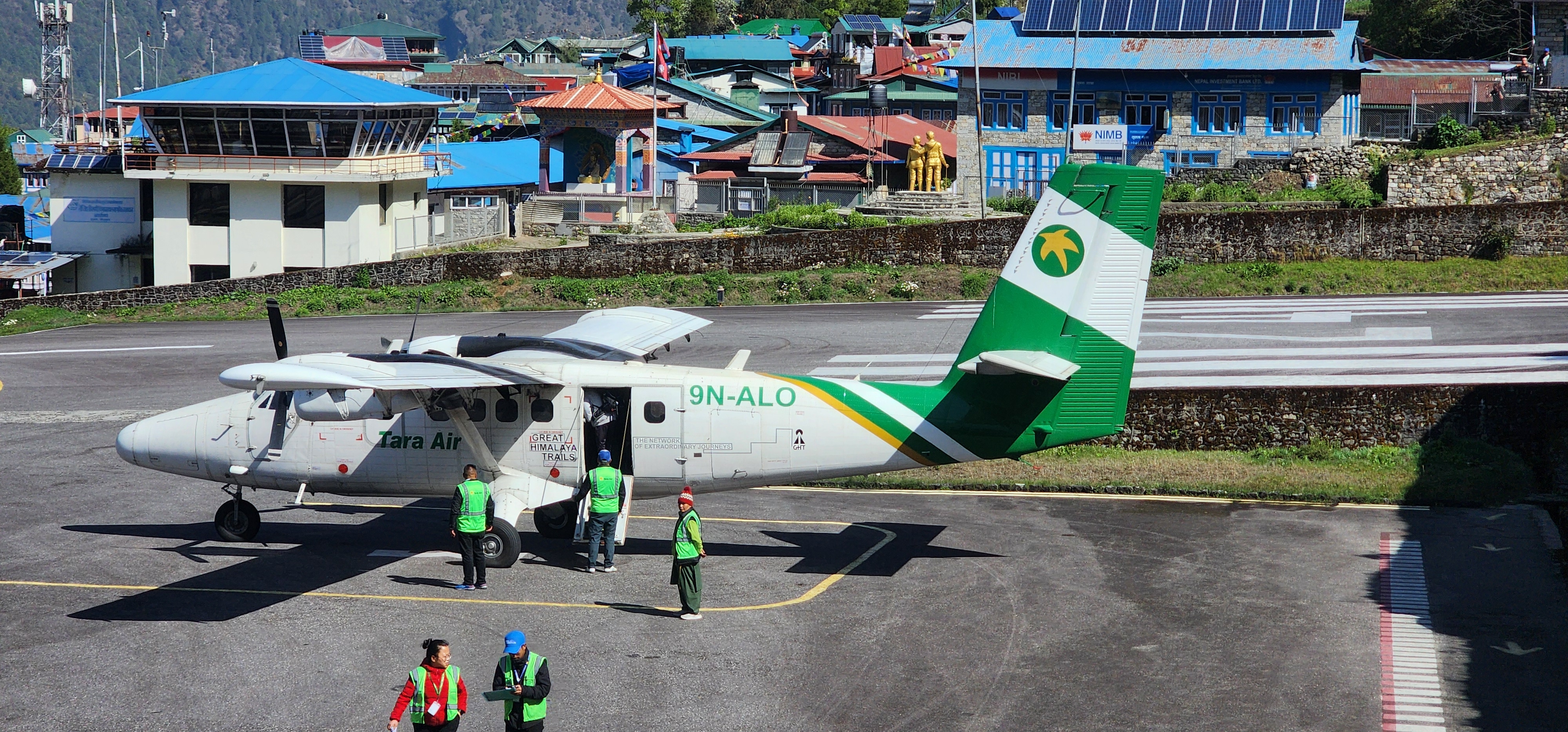
The flight from Lukla to Manthali is 25 to 30 minutes. The Himalayan range appears in the window briefly, smaller from the air than it felt from below, and then the green foothills open out and you are back in the lowlands. The six hour drive to Kathmandu passes quickly. By the time you reach the city, the air at 1,400m feels almost thick after three weeks above 2,800m. Kathmandu, which felt like a transit point when you left, now feels very much like an arrival
Day 16: Departure
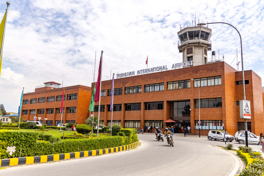
Our representative will transfer you to Tribhuvan International Airport as per your flight schedule. You leave Nepal after 15 days of adventure, with the footsteps of the world's highest mountains behind you and an achievement that stays with you long after the trail does.
Until the next adventure. Safe travels, and see you in the mountains.
Best Time to Visit
Autumn (Sep — Nov) | Clear skies after the monsoon, consistent mountain visibility, stable temperatures. October is the peak of the season: clearest above 4,000m, coldest overnight, most people on trail. Expect below -15°C at Lobuche and Gorakshep by late October. |
Spring (Mar — May) | Warmer on the lower trail, rhododendrons in bloom through the Tengboche forest, Everest expedition season active at base camp. Cloud builds more reliably in the afternoons than in autumn. Both windows work; autumn gives better odds at Kala Patthar. |
Monsoon (Jun — Aug) | Daily rain, leeches on the lower trail, limited mountain visibility, and elevated landslide risk in the gorges. Not recommended for most trekkers. |
Winter (Dec — Feb) | Most teahouses above Namche close. The upper Khumbu becomes a serious undertaking with deep snow and sustained extreme cold. For experienced mountaineers only. |
Accommodation
Teahouses at every overnight stop. Rooms till Namche are comfortable with reliable hot water. Above Namche: shared bathrooms, no room heating, hot showers that are frequently cold. At Lobuche and Gorakshep the rooms are simple and the wind through the walls at night is consistent.
Food on Trail
Dal bhat is the most reliable meal at every elevation: rice, lentil soup, vegetable curry, with unlimited refills, always cooked fresh. Above Lobuche the menu narrows sharply. Eat cooked food throughout. Avoid raw vegetables above 4,000m. Boil, filter, or purify all water without exception. Ginger lemon honey tea at every stop.
Kit List
Non-Negotiable
Sleeping bag rated to -20°C
Down jacket
Waterproof shell, jacket and trousers
Trekking boots, broken in before arrival
Trekking poles, both
Headlamp with spare batteries
Worth Noting
UV radiation increases 10 to 12 percent per 1,000m. Sunscreen above 3,500m is not optional
Portable power bank. Solar charging above Tengboche is unreliable
Water purification tablets or a filter
Ibuprofen, antihistamines, electrolyte tablets
Diamox if prescribed, discussed with a doctor before the trek
Moleskin for blisters before they become a problem
The Khumbu does something to people that is difficult to explain after the fact and impossible to prepare for in advance. The scale is not in any single view. It builds across the days, village by village, until by the time you are standing at 5,545 meters watching the sunrise move down the face of the highest mountain on earth, the person who landed in Kathmandu two weeks ago seems like a different arrangement of the same materials.
Ready to find that place? Trek Everest Base Camp with Freedom Adventures.
KEEP EXPLORING
Uncover similar insights
Day-by-Day Demands, Training Plan, and Mental Grit