

Table of Contents:

A Guide to Mera Peak Climbing
Day-by-Day Guide for 2026
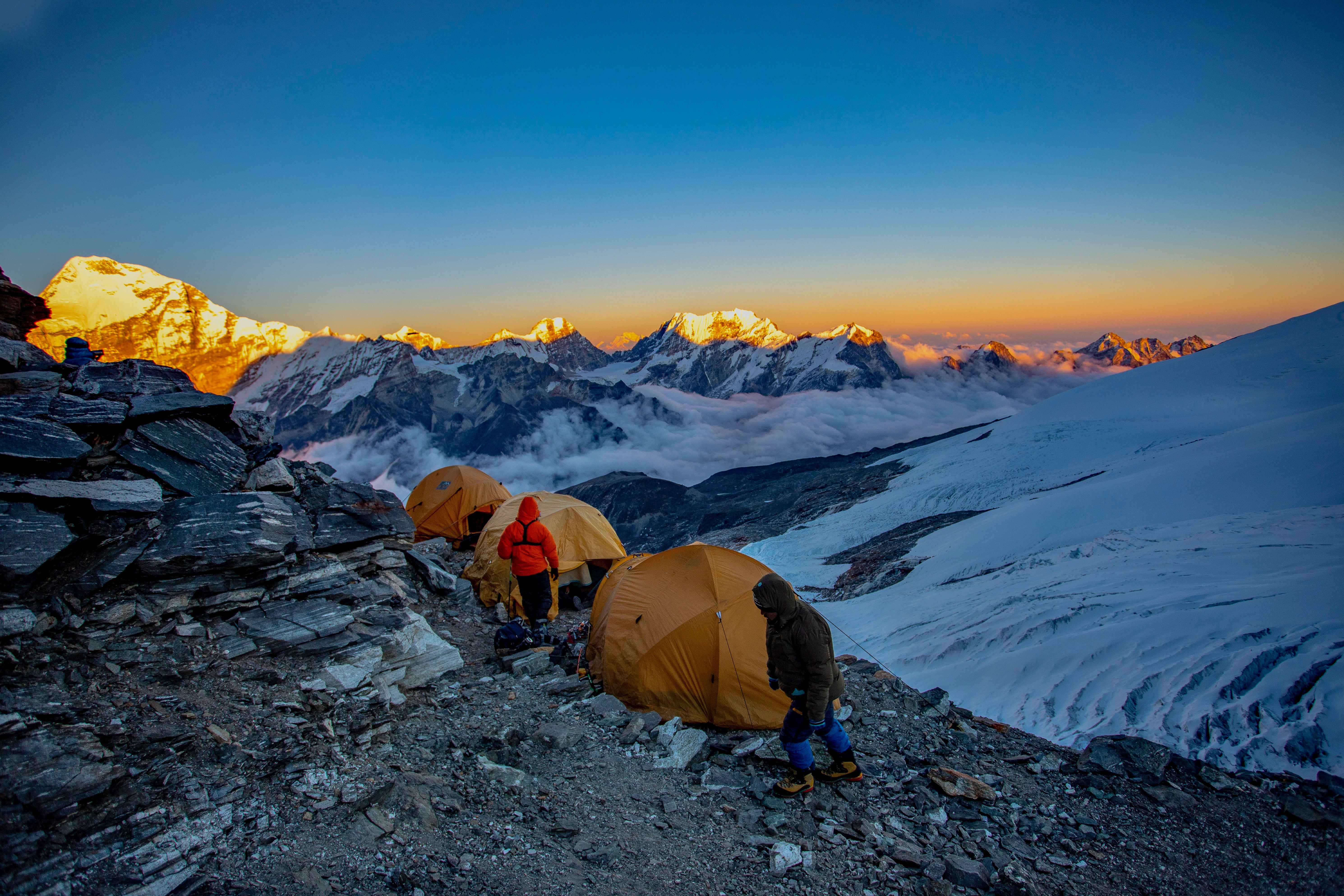
Mera Peak is classified as a trekking peak, and it is the highest one in Nepal open to climbers without a background in technical mountaineering. From the summit, on a clear day, you get five of the world's 8,000 metre giants in a single view: Everest, Lhotse, Makalu, Cho Oyu and Kangchenjunga, along with a wide sweep of smaller peaks across the Hongu and Hinku valleys. Spring, from March to May, and autumn, from September to November, are the two seasons the mountain is actually climbed in.
The first ascent was made on 20 May 1953 by Colonel J.O.M. Roberts and Sen Tenzing, climbing the peak now known as Mera Central. Roberts went on to be widely credited as the founder of Nepal's trekking industry, and the route he and Sen Tenzing pioneered from the north is still the one almost everyone climbs today.
Mera actually has several possible lines to the top, and they are not all the same difficulty. The northern route, the standard one, is graded moderate rather than technical, which is what makes Mera a trekking peak rather than an expedition one. The southern and western approaches are steeper, more heavily glaciated, and are really only suited to climbers with prior mountaineering experience. Most itineraries, ours included, also cross the Zatrwa La at 4,610 metres at some point on the trek, an old trading pass into the Hinku valley lined with Sherpa villages that still carry their traditional character.
Where is Mera Peak Located?
The mountain sits at the head of the Hinku valley in Solukhumbu district, in the Mahalangur range and inside Makalu Barun National Park, roughly 30 kilometres south of Everest. It is remote in a way Everest Base Camp is not. The approach runs through villages and forest that see a fraction of the Khumbu's traffic, and for most of the trek you are walking a valley with no road, no jeep track, and very few other trekkers around you.
The Three Summits of Mera Peak, and Which One You'll Climb
Mera is not a single summit. It has three, strung along one ridge:
Mera North – 6,476 m (21,247 ft)
Mera Central – 6,461 m (21,198 ft)
Mera South – 6,065 m (19,898 ft)
Guided climbers go up Mera Central. It has an established route that does not need extra rope work beyond the one fixed section near the top, and it is what almost everyone means when they say they have climbed Mera. Mera North, 15 metres higher, needs a longer, more crevassed line, and it is not something most operators, us included, run as a standard trip.
Mera Peak Trek at a Glance
Summit | Mera Central, 6,461 m |
Region | Hinku valley, Solukhumbu, Mahalangur range |
Trip duration | 18 days, Kathmandu to Kathmandu |
Starting point | Drive from Kathmandu to Phaplu |
Trek grade | Moderate trekking, alpine grade F to PD on the glacier and summit block |
Highest sleeping point | Mera High Camp, about 5,780 m |
Best seasons | Mid-March to May, and late September to November |
Accommodation | Teahouse lodges up to Khare, tented camps at Base Camp and High Camp |
Permits | NMA climbing permit, Makalu Barun National Park entry permit |
Guide | Required by law, and permits are issued in the guide's name |
Day by Day Guide
Here is the route broken down day by day, with distance, duration and elevation for each one, followed by what the ground actually looks like and where things tend to go wrong.
Day 01: Arrival in Kathmandu (1,310 m)
Distance: 7 km Duration: 45 min
You land at Tribhuvan International Airport and settle into your hotel. Today is for gear, not distance. Your guide checks everything against the packing list, and whatever is missing gets sorted in Thamel, where boots, down jackets and sleeping bags are all rentable. If you are bringing your own boots, keep them in your cabin bag on the flight, not checked in. Your crampons need them to fit properly, and a delayed bag is not a problem worth having.
Note
Agree the emergency plan with your guide before you leave Kathmandu: who calls the insurer, how a helicopter gets arranged, where the nearest pickup point sits on each day of the route. Helicopters do fly out of Khare when they are needed.
Day 02: Kathmandu to Phaplu (about 2,400 m)
Distance: 270 km Duration: 8 to 10 hours
The BP Highway through Dhulikhel, down to the Sunkoshi near Khurkot, then up through Okhaldhunga to Salleri and Phaplu. Some stretches are smooth, some are rough, and landslides during and after monsoon can add hours. Terraced hillsides replace the river valley as the road climbs, and on a clear afternoon Numbur Himal shows over the ridgelines. You arrive with daylight left, at an altitude that gives most people an easy first night.
Day 03: Phaplu to Panggom (about 2,850 m)
Distance: about 11 km on foot, plus a short drive to Khari Khola Duration: 5 to 6 hours
A short drive down to Khari Khola, around 2,000 metres, then the walking starts: about 800 metres of climbing, on stone steps and forest track through rhododendron, oak and bamboo, opening onto terraced farmland that local families work every day. Step to the uphill side when a mule train passes. In monsoon and the weeks after it, the lower forest can carry leeches, and trousers tucked into your socks are enough to keep them off.
Panggom is a small ridge village with a monastery above it and your first proper view of Numbur Himal. The lodge is basic, a shared squat toilet, a wood stove, solar power that may or may not work. This is the day you stop wondering how heavy your pack is and start knowing.
Day 04: Panggom to Ramailo Danda (about 3,280 m)
Distance: about 12 km Duration: 5 to 6 hours
This is the first day that really tests your legs. The trail climbs through forest to the Panggom La, a saddle at around 3,175 metres, and from there Mera shows up for the first time as a distant, jagged line on the horizon. The path drops to Sibuje, crosses farmland past old mani walls, then turns sharply upward from Ningsow into a steep, forested final climb, right at the point in the day when you are least in the mood for more climbing.
About 900 metres of ascent and 700 down over the day. The lodges here are the plainest of the trip, with limited water and solar power only.
Day 05: Ramailo Danda to Chhetra Khola (about 3,000 m)
Distance: about 11 km Duration: 4 to 6 hours
You drop through mossy forest into Makalu Barun National Park, cross a river, and climb back out of it on the other side, a climb that feels longer than it is. This stretch of forest holds red panda, Himalayan black bear and musk deer, though seeing any of them is genuinely rare. The park as a whole records around 88 mammal species and more than 400 bird species.
About 600 metres up and 600 down. Chhetra Khola is a small settlement by the river, and its elevation is quoted anywhere between 2,800 and 3,100 metres depending on who you ask.
Underfoot
Wet forest trails are where most twisted ankles happen on this route. Use poles on the descents and take short, deliberate steps over roots and wet stone.
Day 06: Chhetra Khola to Kothe (about 3,600 m)
Distance: about 14 km Duration: 6 to 7 hours
Bamboo and fir along the Majang Khola, a mix of climbs and stream crossings, lunch usually at Takto where your trail meets the one coming down from the Zatrwa La. From here on you start sharing the path with groups who flew straight into Lukla. Past Tashing Ongma, the forest opens into the wide, rocky Hinku valley proper.
About 1,000 metres up and 750 down. Kothe has real lodges, a proper dining room, and hot showers and Wi-Fi if you are willing to pay, easily the most comfortable stop so far.
Day 07: Kothe to Thangnak (4,358 m)
Distance: about 8 km Duration: 4 to 5 hours
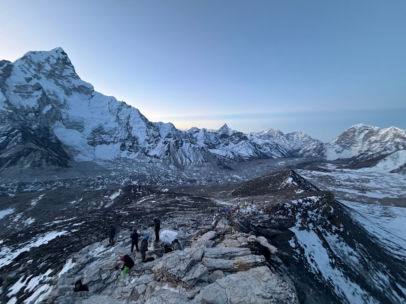
The forest ends above Kothe. The trail follows the Hinku Khola through birch and juniper into a wide bed of boulders and gravel, with tea stops at Saure and Gondishung. Above Gondishung stands Lungsumgba Gompa, a monastery around 200 years old, built into the shelter of a large boulder. What makes it worth the stop is the rock itself: carved into it is Mera Peak, along with its climbing route, an old piece of trailside stonework that predates any map of this mountain. Trekkers and climbers still stop to burn incense and offer a short prayer here for a safe summit before continuing over moraine to Thangnak.
About 750 metres of ascent, gentle by trail standards. What makes the day hard is the height, not the ground underfoot. This is your first night above 4,000 metres, and a mild headache and thin sleep here are common, which is exactly why tomorrow is built the way it is.
Day 08: Thangnak, acclimatization day (4,358 m)
Distance: up to about 6 km, round trip Duration: 3 to 5 hours
You sleep at Thangnak two nights running. The idea is simple: climb high during the day, come back down to the same bed at night. Guides usually offer a climb toward Shertemba Go at around 5,100 metres, about 3.5 hours up and 1.5 back, or a gentler loop toward Sabai Tsho and the Charpate Himal glacier. Turning around lower is completely normal if the height is making itself felt.
Acclimatization note
The usual guidance is to gain no more than about 500 metres of sleeping elevation a night above 3,000 metres, with a rest day every three to four days. Two stretches on this route go beyond that on paper, simply because lodges only sit at fixed points in the valley. This second night at Thangnak is what makes up the difference.
Day 09: Thangnak to Khare (about 5,050 m)
Distance: about 6 km Duration: 3 to 4 hours
The trail climbs onto the moraine above Sabai Tsho, a glacial lake with Kyashar rising behind it. On the third of September 1998, an earthquake shook the area and, according to local accounts, a section of glacier above the lake broke away and fell in. The moraine dam gave way, and a flood of water, ice and boulders came down the valley, damage that is still visible in the riverbed today.
Short by distance, but you gain roughly 700 metres, most of it above 4,500 metres, so the pace drops naturally. Khare is the last settlement on the route and the last real bed you will sleep in. Gear gets checked properly here, and your guides run a hands-on session on crampons, moving as a rope team, and using an ascender on the fixed line. Learn the rope commands and hold on to them. On the glacier, in wind, you will not always be able to see your guide.
Day 10: Khare to Mera Base Camp (about 5,300 m)
Distance: about 4 km Duration: 3 to 4 hours
The ground changes today, rocky slope onto loose moraine, then the glacier margin, where crampons go on and the rope often comes out. The lower Mera Glacier here is broad and fairly flat, though the rope stays on regardless. Roughly 300 metres of climbing.
Base camp is a tented platform of snow and rock near the Mera La, usually pitched somewhere between 5,300 and 5,350 metres. Sleeping here instead of pushing straight to High Camp is simple arithmetic: that jump would be around 730 metres in one day, more than the guideline allows. Splitting it turns one big step into two smaller ones. Headaches, vivid dreams, and periodic breathing, short cycles of fast breaths and pauses, are all common here and are not, by themselves, anything to worry about.
Day 11: Mera Base Camp to High Camp (about 5,780 m)
Distance: about 3.5 km Duration: 3 to 4 hours
The route climbs over the Mera La, a broad col at around 5,415 metres, then follows gentler glacier slopes upward, crampons and rope on throughout. About 430 to 480 metres of ascent, with crevasses along the way that are few and mostly visible in daylight.
High Camp sits on a rock outcrop at the glacier's edge, around 5,780 metres, in a spot that takes real wind. Water comes from melted snow, so hot tea and soup carry most of your fluid intake. Dinner is early, sleeping bags by dusk, wake-up around midnight. Few people sleep properly at this height, and that is normal, not a bad sign.
HACE / HAPE warning
High altitude cerebral and pulmonary oedema can kill within hours. Confusion, an inability to walk a straight line, a headache that will not respond to medicine, breathlessness at rest, or a wet cough all mean immediate descent, whatever time of night it is.
Day 12: High Camp to the summit and back to Khare (6,461 m)
Distance: about 3 km each way to the summit, roughly 11 km for the full round trip to Khare Duration: 10 to 14 hours
You leave between one and three in the morning, once the wind has usually dropped and the snow has firmed up. Temperatures run minus 20 to minus 30 with wind chill. Spare batteries stay inside your jacket, and bottles travel upside down in insulated sleeves so the lid does not freeze shut first.
From High Camp to the summit takes 6 to 8 hours climbing, mostly on a broad glacier at 30 to 40 degrees, crossing crevasse zones on the guide's chosen line. Near the top, two or three breaths per step is normal, and the pace will feel frustratingly slow. That slowness is the whole point, not something going wrong. Somewhere between 30 and 100 metres below the summit, a rope is fixed on a steeper pitch of up to about 50 degrees, the one section on Mera where technique genuinely matters.
The summit is a small snow dome. On a clear day you get Everest, Kangchenjunga, Lhotse, Makalu and Cho Oyu in one view, with Chamlang and Baruntse closer and the Hongu valley falling away below. Time on top is short, often just a few minutes, because both the cold and the clock demand it. The descent runs back through High Camp, the Mera La and base camp to Khare, on the same ground you climbed, and glacier glasses stay on the entire way.
Day 13: Back-up summit day
Distance: varies Duration: varies
Every Mera itinerary needs a spare day, and this is ours. Weather closes the summit window more often than people expect before they climb, and a one in the morning start into high wind or heavy snow is not a call any guide makes lightly. If the group did not summit on day 12, this day is used for a second attempt. If it went well, it becomes a rest day at Khare, or extra slack for the walk out. The Lukla flight is the least predictable part of this whole trip, and a spare day in hand here is worth more than it looks.
Day 14: Khare to Kothe (about 3,600 m)
Distance: about 14 km Duration: 5 to 7 hours
About 1,450 metres of descent, back past Sabai Tsho, Thangnak, Lungsumgba Gompa and Gondishung. Appetite and energy tend to come back somewhere around midday as the air thickens. Poles earn their keep on the moraine and the steeper sections. Kothe has the hot shower most people have been thinking about for days.
Day 15: Kothe to Chetwarwa (about 4,300 m)
Distance: about 13 km Duration: 4 to 6 hours
The way home goes over the Zatrwa La, and this gets you to its foot: a steep climb through forest along a ridge, opening into yak pasture, about 700 metres of climbing. Chetwarwa turns up under several spellings depending on the map, Chhetrabu, Chetarwa, Thuli Kharka. Basic lodges, a cold night, and from the pasture, all three summits of Mera lined up together for the first time.
Day 16: Chetwarwa to Lukla over the Zatrwa La (2,860 m)
Distance: about 15 km Duration: 6 to 8 hours
One of the longest days of the trip. A two-hour climb to the pass, around 4,610 metres over two saddles close together, then a long, steep descent, roughly 1,750 metres, through rock, loose gravel and rhododendron forest down to Lukla.
Ice warning
Trip reports mention slips on icy stretches of the Zatrwa La after fresh snow, and the drop beside some sections is long enough to matter. Keep your boots laced tight, carry microspikes, and stay switched on this close to the end of the trip.
Day 17: Lukla to Manthali by air, then Kathmandu (about 1,400 m)
Distance: short flight, then about 132 km by road Duration: 15-to-25-minute flight, 6 to 7 hour drive
During the main climbing seasons, flights from Lukla land at Manthali in Ramechhap rather than Kathmandu, with the drive from there on the BP Highway. Outside those months, flights go direct in about 35 minutes. Lukla flights run on visibility over a short, sloped runway, and morning delays are common.
Note
Do not book a tight connection for the same evening as your Lukla flight. Keep at least one spare night in Kathmandu before any international departure.
Day 18: Departure
Distance: 7 km Duration:45 min (airport transfer)
A final transfer to Tribhuvan International Airport. If your flight is late in the day, Boudhanath, Patan and Bhaktapur are all close, and Thamel covers any last-minute shopping. Most people coming straight off the mountain want a bath and a long sleep more than a sightseeing schedule, and that is a perfectly good way to spend the day too.
How Hard is Mera Peak?
Mera is a long climb rather than a technical one. There is no rock climbing and no vertical ice, just crampons, a rope team, and one stretch of fixed line near the summit that most people manage without much trouble once they have been shown how. What actually wears people down is the sequence: five nights at or above 4,350 metres before you even reach High Camp, and a summit day of 10 to 14 hours that starts in the middle of the night. Fitness matters, but it is not the whole story. People who were fine on an earlier trek can still struggle here, and the ones who summit are usually the ones who kept their pace slow rather than the ones who arrived fittest.
Best Time to Climb Mera Peak
Mera has two real windows: spring, from mid-March to May, and autumn, from late September to November. Spring brings longer days, warmer valleys lower down, and rhododendrons in bloom on the walk in, though March can still bring fresh snow to the upper mountain and cloud starts building by late May. Autumn tends to bring the most settled weather of the year, especially through October and November, with colder, quieter conditions the later you go. Monsoon and winter both bring real problems, soft, unreliable snow in one case and deep cold with short summit windows in the other, so neither suits a first attempt. Read more here about the best time to climb Mera Peak, month by month.
Food and Accommodation on the Route
The lodges get plainer as you climb and more expensive the higher you go. Days 3 to 5 have the roughest rooms of the trip, while Kothe, Thangnak and Khare have proper dining rooms, and Kothe even has hot showers and Wi-Fi if you want to pay for them. Above Khare, base camp and High Camp are tented camps run by the crew, with long-drop toilets and no showers. Dal bhat shows up at almost every meal and is usually the safest choice, with noodle soup, momos and Tibetan bread filling out the rest of the menu. Water needs to be boiled or treated the whole way, and very little is sold once you are past Kothe, so bring your own snacks for summit day. Read more here about food and accommodation on the Mera Peak route.
Permits and Things to Know Before You Book
You will need an NMA climbing permit, issued through a registered agency in your guide's name, along with a Makalu Barun National Park entry permit and local permits depending on your exact route, all arranged for you. A licensed guide is a legal requirement for foreign trekkers in Nepal's national parks and conservation areas, not just a Mera-specific rule. Your own travel insurance needs to cover climbing to 6,500 metres with helicopter evacuation included, and it is worth reading the fine print before you fly rather than after. Most of the technical gear, harness, ice axe, ascender, helmet, is usually supplied by the operator, so ask exactly what is included before you start packing. Read more here on permits, insurance and what to pack for Mera Peak.
All the Mera Peak Guides
This itinerary is one piece of preparing for Mera. The full chain covers everything else.
When to Go Best Time to Climb Mera Peak
Month-by-month conditions, how spring and autumn actually differ on the ground, and the seasonal verdict.
Physical Preparation Mera Peak Difficulty and Fitness Guide
What actually wears people down on this climb, the fitness benchmark to aim for, and the 12 to 16 week training plan.
Altitude Health Altitude Sickness on the Mera Peak Climb
AMS, HACE and HAPE explained, how altitude affects appetite and sleep, and what your guide is actually watching for.
Food and Stay Mera Peak Food and Accommodation Guide
What the lodges and tented camps are actually like at every stop, from Panggom down to High Camp.
What to Pack Mera Peak Packing List
The non-negotiable items for glacier travel and a night at 6,461 metres, and what your operator usually supplies.
Permits and Rules Mera Peak Permits and Regulations
The NMA climbing permit, national park fees, and the guide requirement, explained in full.
Explore More Treks and Climbs in Nepal
Other Peaks and Treks
Everest Base Camp Trek — The classic lodge trek to 5,364 metres, and a common first step before a climb like Mera.
Everest Three Passes Trek — Kongma La, Cho La and Renjo La, all above 5,300 metres, strong acclimatisation for anyone eyeing a Khumbu peak.
Yala Peak Climbing Guide — A shorter snow peak in Langtang, around 5,700 metres, for a first Himalayan summit.
Annapurna Base Camp Trek — A lower, gentler trek into the Annapurna Sanctuary at 4,130 metres.
Manaslu Circuit Trek with Tsum Valley — A quieter circuit crossing the Larkya La at 5,106 metres, in a different range entirely.
Mera rewards patience more than speed. The people who summit are rarely the fittest in the group. They are the ones who ate when they had no appetite, told their guide about the headache instead of sitting on it, and kept the pace slow when everything in them wanted to go faster. Whenever you are ready to talk it through, we are here.
KEEP EXPLORING
Uncover similar insights
Day-by-Day Demands, Training Plan, and Mental Grit
Month-by-Month Guide to do Everest Three Passes Challenge