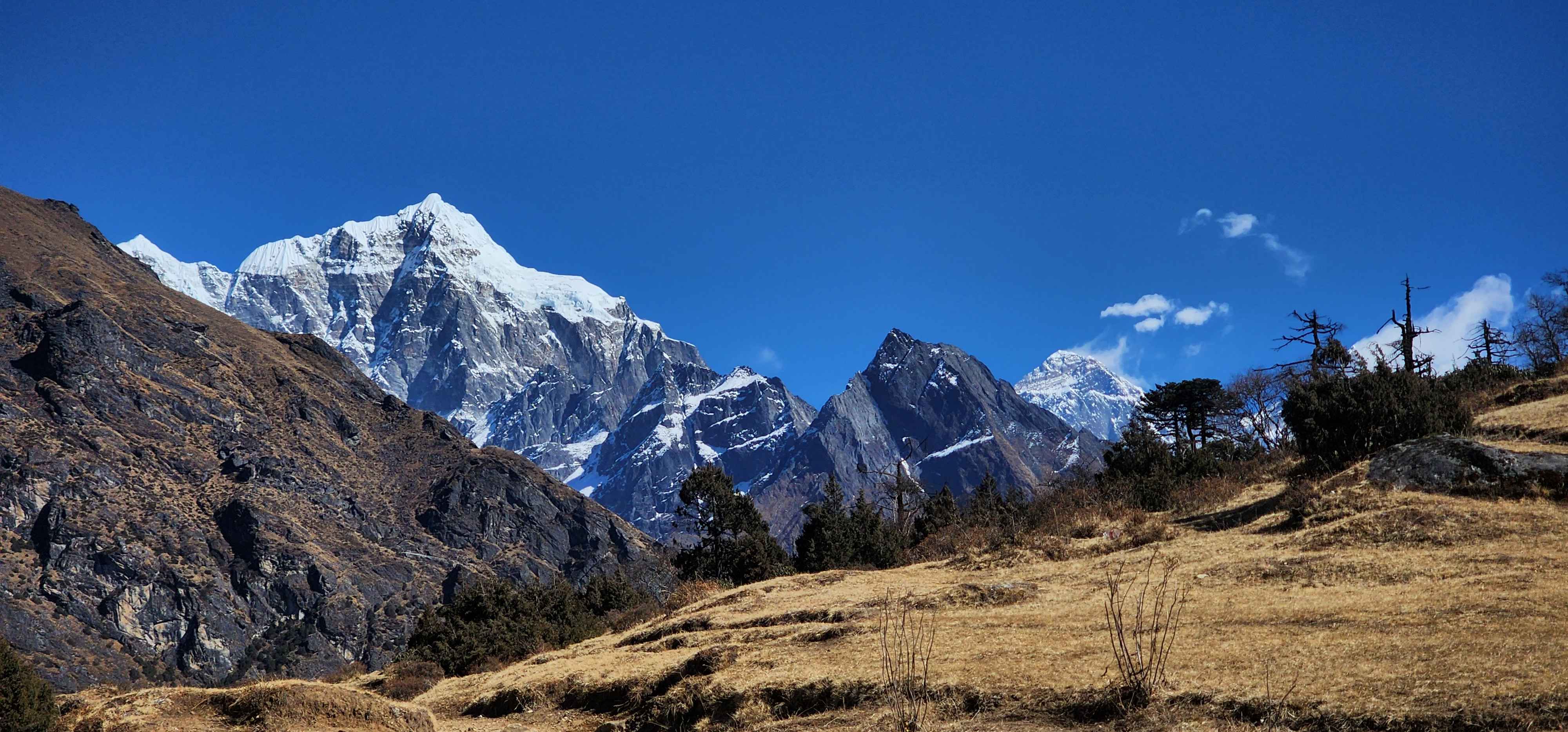

Rasuwa Flood, August 2026
What We Know So Far and Our Current Travel Advisory
Last updated August 30, 2026.
An alternate road from Kathmandu via Tokha, Chhahare, Gadkhar Bridge, Aapre, Narja, Lachyang, Saramthali, Patikharka, Bogatitar and Kalikasthan to Dhunche has reopened for light four-wheeled vehicles, reconnecting Rasuwa to the national road network. This is a separate, longer route, not the original Trishuli-Betrawati-Syabrubesi road, which remains closed.
The Kathmandu-Pokhara highway (Prithvi Highway) has reopened in full. Everest, Annapurna and Sauraha (Chitwan) are unaffected.
Avoid non-essential travel to Rasuwa district, including Langtang, Gosaikunda, the Tamang Heritage Trail, Syabrubesi, Timure and Rasuwagadhi, until authorities and your operator confirm safe access.
Last updated August 27, 2026. This is a developing situation and we will keep this page current as more is confirmed.
On the morning of Wednesday, August 26, a flash flood came down the Bhote Koshi river through Rasuwa district, in the mountains along Nepal's border with Tibet. It hit hardest in Timure and Syabrubesi, the two towns most people pass through on the way to Langtang. We have been watching this closely since it happened, and we wanted to put what we know in one place, along with where things stand for anyone with a trip planned through this region.
Before anything else: our guides, staff and porters are all safe. We know many of you have been asking, and we are grateful for that.
Where and when this happened
The Bhote Koshi rises across the border in Tibet and enters Nepal at Rasuwagadhi, the customs and border point that connects the two countries. Early reports pointed to an earthquake as a possible trigger, but preliminary findings from Nepal's Department of Hydrology and Meteorology, later supported by the US Geological Survey, point instead to a glacial collapse upstream, a large mass of ice breaking away and coming down into the valley, picking up loosened, waterlogged sediment on the way. It happened during the monsoon, when the ground in this region is already saturated, which is part of why the water carried as much as it did.
There was no storm to watch and no slow rise in the river to give anyone warning. That is one of the hardest things about a glacial event like this one. It can happen on a clear morning.
Who has been affected
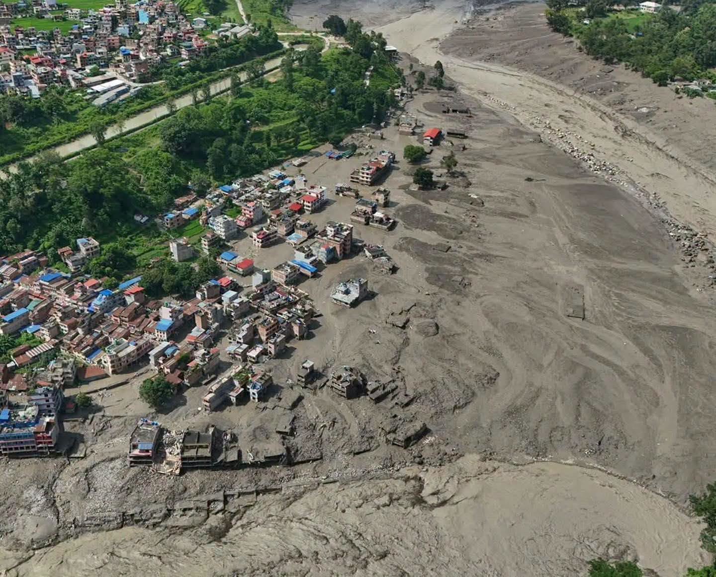
Timure and Syabrubesi took the worst of it. Timure is home to the Rasuwagadhi border crossing and a customs yard that handles a significant amount of Nepal-China trade, and it was hit directly, along with the market area around it. Syabrubesi is the town every Langtang Valley, Gosaikunda and Tamang Heritage trek starts from, and it was hit too. Among those affected are local residents and shopkeepers, hydropower workers at the projects along the river, customs staff, and security personnel from the Nepal Police, Armed Police Force and Nepali Army who were stationed in the area. There is significant loss of life, and search and rescue work is still ongoing for people who remain unaccounted for. We are not going to publish running casualty figures here. Those numbers are changing by the hour and are being tracked properly by Nepal Police, the Nepal Tourism Board and the district administration, and that is where they should come from.
Trekkers were also in the area when the flood hit, since this is the height of the trekking season in Langtang. Most have since made contact with their operators or families.
If you have a friend, family member or client whose status you are trying to confirm, the Nepal Tourism Board and Tourist Police are maintaining an active list and are the right first call.
The flood did not stay in Rasuwa. As the surge moved down the Trishuli river, alerts were issued further downstream in Nuwakot, Dhading, Gorkha and Chitwan, and communities along those riverbanks were asked to move to higher ground as a precaution.
What the damage looks like right now
The Pasang Lhamu Highway, the main road connecting Kathmandu to Rasuwa and on to the Langtang region, has been cut in multiple places. At least two bridges are gone, including infrastructure at the border crossing itself. The Rasuwagadhi customs yard and dry port took heavy damage. Several hydropower projects along the river, some operational and some under construction, have been affected, and telecom towers in the district went down, which cut phone and internet access in parts of Rasuwa right when clear communication mattered most for rescue coordination.
The border crossing at Rasuwagadhi is closed. Rescue helicopters have had trouble landing in the worst-hit areas, partly due to weather and partly because the helipad at Timure itself was damaged. The Nepali Army, Armed Police Force and Nepal Police have all been mobilized, and the Prime Minister's office has directed a full-scale search, rescue and relief response, with a Cabinet meeting convened the same day to coordinate it.
A full damage assessment is still underway. Local officials have said it is difficult to even begin a formal count while parts of the district remain cut off. What is confirmed for now is road and bridge damage, disruption to the border crossing and customs operations, and hydropower and telecom infrastructure losses, with the fuller picture expected to come into focus over the next several days as rescue teams reach the more remote areas.
Which regions are affected, and which are not
We know most of you reading this are not planning a trip anywhere near Rasuwa, so here is the region-by-region picture as it stands today.
Kathmandu and Pokhara are unaffected. Both cities are operating normally.
The Everest region is unaffected. It sits in a completely separate river and valley system from Rasuwa, and nothing about this event changes conditions there.
The Annapurna region itself is unaffected. There is a temporary road closure around Mugling, on the Kathmandu to Pokhara highway, caused by the same spell of heavy rain, and we expect this to clear within days.
The Langtang region is where the real damage is. The lower Langtang Valley, including the road to Syabrubesi, Syabrubesi itself, and sections of trail toward Lama Hotel, has been badly affected, with reported damage to bridges in the area. Rasuwa remains a high-alert district and search and rescue work is ongoing. It is too early to give a full assessment of the trail beyond what is already known to be damaged, and we will share more as our team gets a clearer picture on the ground over the coming days.
What this means for trekking in the region
It helps to separate two things that are getting mixed together in a lot of the coverage: the high mountain trail inside Langtang National Park, and the road and gateway towns you pass through to reach it. The damage so far is concentrated on the access road and at Timure and Syabrubesi themselves, not confirmed to extend into the upper valley trail. But right now, reaching the trailhead safely from Kathmandu is the real constraint, regardless of trail conditions further up.
The overland route to Kailash and Manasarovar through Rasuwagadhi is closed for the rest of this season. That crossing runs through the same infrastructure that was damaged, and rebuilding a border point like this one takes months, not days.
Our current advisory
Freedom Adventures advisory, updated August 27, 2026
We are not sending any groups into Rasuwa district at this time. This includes Langtang Valley, Gosaikunda and Tamang Heritage departures.
We would advise against independent travel to Timure, Syabrubesi, Betrawati or Trishuli until local authorities lift the current restrictions.
If you have a trip booked with us through this region this season, please contact us directly and we will talk through your options honestly, whether that is rescheduling, an alternate route, or simply waiting for more clarity.
Contact: info@freedomadventuretreks@gmail.com / +977 9823900916
Please be patient with us until we have a clearer picture. We would rather give you an honest "we don't know yet" than a guess, and we will update this page as soon as there is something solid to share.
Where to go for official updates
For real-time figures on casualties, missing persons and road status, the right sources are the Nepal Tourism Board, Nepal Police, the district administration in Rasuwa, and your own embassy's travel advisory page if you are a foreign national. The Tourism Board and Tourist Police are also the right first contact if you are trying to confirm the safety of someone who was travelling in the area.
Our thoughts stay with everyone affected by this, the families waiting for news, the workers and security personnel still unaccounted for, and the communities in Timure and Syabrubesi who are now rebuilding. We will keep this page updated as things become clearer.
KEEP EXPLORING
Uncover similar insights
Day-by-Day Demands, Training Plan, and Mental Grit