
A Guide to Annapurna Sanctuary Trek in Nepal
Everything You Need to Know to Prepare for Your ABC Trek
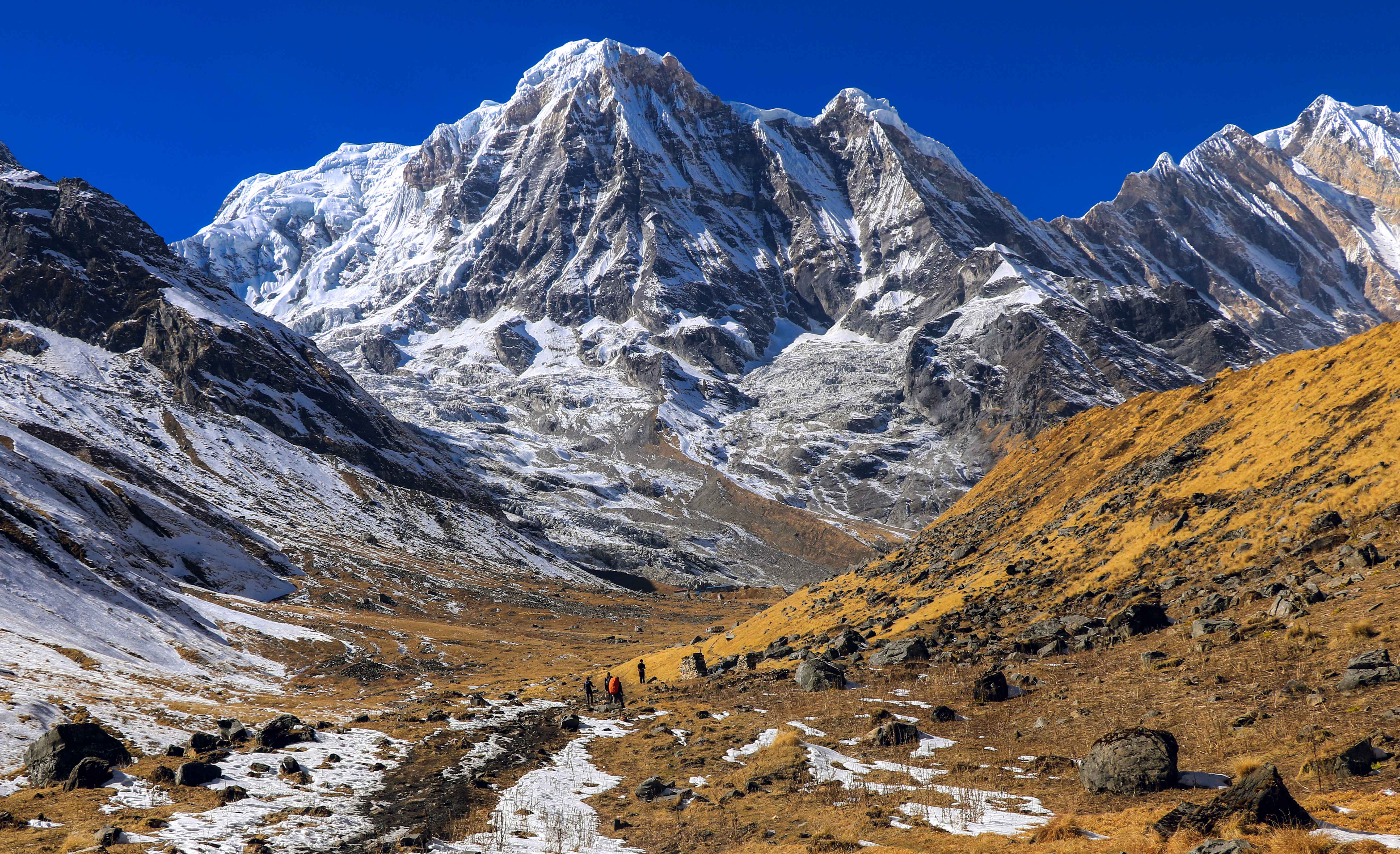
The Annapurna Base Camp Trek is a journey from Kathmandu into the heart of the Annapurna massif and back. You walk into a glacial amphitheater at 4,130 meters, surrounded on all sides by peaks above 7,000 meters, and you do it entirely on your own legs with nothing more than a pair of boots and a guide. No ropes. No crampons.
What it is, is complete. The approach changes character four times. The altitude is real but manageable. The base camp delivers everything the photographs suggest and nothing they can adequately prepare you for. There is a reason this is one of the most walked high-altitude routes in the world. It earns the distance.
Where is Annapurna Base Camp
Annapurna Base Camp sits in the Kaski District of Gandaki Province, in the central Himalayas of Nepal. It lies inside the Annapurna Conservation Area, the largest protected region in Nepal at 7,629 sq km, and is reached via the Modi Khola valley, which cuts north from Pokhara through progressively narrower gorges until it opens into the sanctuary basin.
The Annapurna massif that surrounds the base camp contains Annapurna I (8,091 m), the tenth-highest mountain on earth and the first 8,000-meter peak ever summited (French expedition, 1950). The massif includes other peaks above 7,500 m as well as above 7,000 m, all visible from inside the sanctuary.
How Hard is the Annapurna Base Camp Trek
Honest answer: harder than the internet makes it look, and more manageable than it sounds. It is classified as moderate to moderately strenuous, and that rating is accurate if you interpret it honestly. There is no technical climbing. No glacier crossing. No exposed sections requiring a harness. What it does ask for is the ability to walk for 5 to 7 hours a day over consecutive days, on uneven stone terrain, with significant elevation gain and loss, at altitudes where your body is working harder than it looks like it should be.
The stone staircase from Tikhedhunga to Ulleri on Day 3 is roughly 3,300 steps over less than 2 km. Steep, ancient, and relentless. It comes on the first day of trekking before the body has adjusted to consecutive effort. This is where most knee injuries on this route begin. Slow down here, even if it feels easy, because it will not feel easy on the way back.
Day 11, Bamboo to Jhinu Danda, is the day that surprises people. You have been on trail for ten days. The Chhomrong descent, which seemed fine on the way up, is a different proposition on tired legs going down. This is the most physically demanding day on the joints of the entire route and it comes at the end, not the beginning.
Altitude
The jump from Himalaya village (2,920 m) to MBC (3,700 m) to ABC (4,130 m) across two days is quick by altitude standards. Most trekkers notice deeper breathing, a slower pace, and disrupted sleep somewhere above 3,500 m.
Who This Trek Is Right For
Adults with a reasonable fitness baseline. If you can complete a six-hour hike with 700 to 800 m of elevation gain without stopping frequently, you are in range. No prior Nepal trekking required, but multi-day hiking experience helps considerably.
Day -by- Day Breakdown
Day 01: Arrival in Kathmandu
You land at Tribhuvan International Airport. Our representative is in the arrivals hall with a sign. From here, it is straightforward.
Kathmandu sits at 1,310 m. Acclimatization starts the moment you arrive, which is one of the reasons the itinerary begins this way. The city is doing useful work before the trek even begins.
In the evening there is a pre-departure meeting with your guide. This is where the route gets explained in detail, any last gear questions get answered, and you find out exactly what the first days on trail look like.
After the meeting, a welcome dinner. Then rest. Tomorrow is a long drive.
Note
If you need to rent or buy any gear, Thamel has everything. Trekking poles, sleeping bag, liners, base layers, gaiters, micro spikes. Do it today before you are pressed for time. Plus, your lead guide will be at hand to assist you with everything you need to rent or buy for the trek.
Day 02: Drive to Pokhara
The drive from Kathmandu to Pokhara takes 7 to 8 hours, following the Prithvi Highway west through the Trishuli and Marsyangdi river valleys. The road winds through gorges, past terraced hillsides, and gives you a first real glimpse of what the Himalayan foothills look like up close.
Pokhara is the last place where supplies are plentiful and reasonably priced. ATMs work. Restaurants are good. The lakeside is genuinely worth an evening stroll if the legs are not complaining too loudly from the journey.
Important
Rest well tonight. Tomorrow is your first day on the trail, and it starts with one of the harder physical sections of the entire route. The stone staircase to Ulleri is no place to be operating on bad sleep.
Day 03: Drive to Nayapul and Trek to Ulleri
Jeep from Pokhara to Nayapul takes about 1.5 hours on a winding road. The trek begins at Birethanti (1,025 m) after the ACAP permit checkpoint. Have both permits accessible. The trail follows the Bhurungdi Khola upstream through terraced farmland and small settlements.
The first section is pleasant and relatively flat. Then you reach Tikhedhunga, and the trail shows you what it actually is.
The staircase from Tikhedhunga to Ulleri is approximately 3,300 stone steps over 2 km. They are uneven, ancient, and steep. There is no flat section and no shortcut. It takes most trekkers between 1.5 and 2 hours and leaves legs that are not conditioned for it visibly affected by the end.
Warning
This is Day 1 on trail. The temptation to push hard is real, especially when the staircase looks manageable at the bottom. The trekkers who damage their knees on ABC almost always do it here. The trail is eleven more days long after this staircase. Pace it accordingly.
Day 04: Ulleri to Ghorepani
The staircase is behind you. Today the trail eases into sustained forest climbing. Banthanti (2,250 m) and Nangethanti (2,460 m) are natural rest stops with teahouses, each offering a reason to slow down and drink something warm.
Above 2,200 m, the vegetation shifts into mature rhododendron and oak. In March and April, these forests are in full bloom. Red and pink canopy at altitude, Himalayan pheasants on the trail, the air smelling of something you cannot quite name. This is consistently one of the stretches our trekkers talk about most, not for altitude or achievement, but just for being genuinely beautiful.
Ghorepani is a wide saddle settlement at 2,860 m with 15 to 20 teahouses, consistent mobile signal, and reliable charging points. It is the first proper hub on the route.
Heads Up
First night significantly above 2,500 m. Some trekkers notice disrupted sleep, mild headaches, or reduced appetite here. This is normal acclimatization. Drink water. Eat a full dinner regardless of appetite. Do not take anything that masks symptoms rather than resolves them.
Day 05: Poon Hill for sunrise, then trek to Chuile
Wake before dawn. The trail from Ghorepani is well marked and takes about 40-45 minutes to reach. On a typical October/November day, you can expect 80 – 200 fellow hikers at the viewpoint. Regardless, go!
From Poon Hill on a clear morning, you see: Dhaulagiri (8,167 m), Annapurna I (8,091 m), Annapurna South (7,219 m), Hiunchuli (6,441 m), Macchapuchhre (6,993 m), Tukuche Peak (6,920 m). The full western Annapurna chain and the Dhaulagiri massif together, lit from the east. It is one of the most complete panoramic views of high Himalayan peaks accessible anywhere without a high-altitude permit.
After the viewing, head back to Ghorepani for breakfast, then follow the ridgeline towards Tadapani and down to Chuile. Once you leave the ridgeline, the descent from Tadapani is quite steep and on loose stones. After completing Day Five, your legs should begin registering the cumulative effect of previous days.
Day 06: Chuile to Sinuwa
The trail drops into the Modi Khola gorge, crosses it, and climbs to Sinuwa on the opposite bank. The route passes through Chhomrong (2,170 m), the largest Gurung village on the lower trail.
Chhomrong matters. It is the last settlement of any real size before the sanctuary. Traditional Gurung architecture on terraced hillsides, views straight up the canyon toward Annapurna South above. But practically, it is the last place where supplies are available at reasonable prices, charging is reliable, and the teahouse infrastructure is genuinely comfortable. It is worth 20 minutes of unhurried walking through.
Prices above this point increase at every stop, and above Sinuwa they increase sharply.
Day 07: Sinuwa to Himalaya
The gorge deepens. The trail descends first to Bamboo (2,310 m) and then climbs steadily through progressively denser forest. Bamboo and rhododendron give way to moss-covered trees. The canyon walls close in. The river becomes loud but invisible for most of this section. It feels genuinely remote in a way the lower trail did not.
This is also where the hazard profile of the route changes.
Landslide Warning
The section between Sinuwa and Deurali carries the highest landslide and rockfall risk on the entire route. Debris fields are visible from the trail in multiple places. Move through open debris zones without stopping for extended breaks. Risk is highest in late September, after heavy monsoon, and following any significant snowfall above. Your guide will flag the specific zones.
Day 08: Himalaya to MBC
This is the day the route earns its reputation.
Above Deurali at 3,230 m, the trees stop and the gorge releases you into the Annapurna Sanctuary, a high glacial basin enclosed on three sides by the main Annapurna chain. The moment you step out of the gorge and the full sanctuary opens ahead of you is not gradual. It happens all at once.
Machhapuchhre Base Camp sits at 3,700 m on a broad, partly glaciated platform. Machhapuchhre's south face (6,993 m) fills the horizon directly ahead. Annapurna South and Hiunchuli define the left wall. The scale becomes difficult to process.
Cold Alert
Temperatures at MBC drop to -15°C to -20°C in October and November. A sleeping bag rated to -20°C is not optional above this point. Teahouse blankets are not sufficient here. Solar power is limited at MBC. Charge everything you need before leaving Himalaya village.
Day 09: MBC to ABC
The final 4 km to ABC crosses an open glacial basin on rocky moraine. The gradient is moderate, but altitude is felt by almost everyone above 3,900 m. Pace slows. Breathing deepens. Appetite drops. Keep moving steadily.
Annapurna Base Camp is a flat area of glacial rubble at 4,130 m, completely enclosed by the massif. There is nowhere higher on this route. There is nowhere more enclosed.
From ABC: Annapurna I (8,091 m), Annapurna South (7,219 m), Annapurna III (7,555 m), Gangapurna (7,455 m), Hiunchuli (6,441 m), Machhapuchhre (6,993 m). A full 360-degree ring of Himalayan peaks above 6,400 m. Most trekkers stand in silence when they arrive.
Sunrise from inside the ABC amphitheater is when it looks best. The east face of Annapurna South catches the first light while the basin floor is still in shadow. Most groups arrive at first light, spend an hour or two, and return to MBC before midday.
AMS Warning
If you feel persistent headache, nausea, or any loss of coordination at ABC, do not sleep there. Descend to MBC or lower immediately. Altitude sickness at 4,130 m is manageable if you act early. The acclimatization night at MBC is specifically structured to prevent this from being a problem.
Day 10: Annapurna Base Camp to Bamboo
The descent begins. From MBC the route retraces through Deurali, back down the gorge past Himalaya village and Dovan to Bamboo. Close to 1,400 m of descent in a single day through the same terrain that took days to climb.
The gorge section is faster on the way down but the rockfall risk remains unchanged. Move through debris zones without extended stops. The rocky moraine above Deurali is hard on the knees. Trekking poles absorb significant impact here. Use them from the first step.
Day 11: Bamboo to Jhinu Dada
From Bamboo, the trail climbs back through Sinuwa and then through Chhomrong before the long descent to Jhinu Danda. The stone staircases between Chhomrong and the river crossing, which felt manageable on the way up, are a different equation on legs that have now done ten consecutive days of trekking.
This is the hardest day on the knees. Trekking poles are not optional today. Take your time on the steps, do not lock your knees on impact, and stop when the legs need stopping.
Jhinu Danda sits at 1,760 m above the Modi Khola. Below the village, a short path leads to natural hot spring pools on the river bank.
The most common post-trek complaint from ABC trekkers is knee pain. Almost all of it comes from this day, from this section. There is no prize for reaching Jhinu faster.
Day 12: Jhinu Dada to Pokhara
Drive from Nayapul back to Pokhara. Roughly 2 hours by jeep. The city is warm, flat, and quiet after over a week in the mountains. The afternoon is yours entirely.
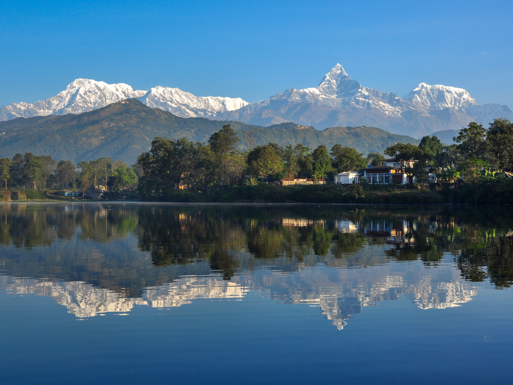
A real restaurant, laundry, a long shower, or simply sitting by Phewa Lake watching the mountains from below. You have walked all the way in from up there. That is worth a quiet evening.
Day 13: Drive back from Pokhara to Kathmandu
Bus back to Kathmandu. The road journey takes 7 to 8 hours, following the same Prithvi Highway you came in on. The drive feels different on the return. You are looking at the same hills with different eyes.
Back in Thamel in the evening. The city has been waiting. This is the night for a proper dinner, a cold beer, and a walk through the lanes. You finished the trek. The mountains will not be less remarkable tomorrow. Tonight belongs to Kathmandu.
Day 14: Departure
We will drop you at Tribhuvan International Airport approximately 3.5 hours before your scheduled departure.
Best time to visit
Two seasons work for this trek: Spring and Autumn. Monsoon, June through August, brings heavy daily rain, leeches through the lower gorge, high landslide risk in the sections that already carry it, and almost no mountain visibility. Winter above 3,000 m means snow on trail, closed teahouses above Chhomrong, and genuine avalanche risk through the gorge. Neither is the right window for most trekkers. The temperatures below are at 4,130 m at base camp. The lower sections of the trail are considerably warmer.
Spring (March to May)
Maximum temperature at ABC: 4°C (March) to 14°C (May)
Minimum temperature at ABC: -10°C (March) to 0°C (May)
Autumn (September to November)
Maximum temperature at ABC: 20°C (September) to 10°C (November)
Minimum temperature at ABC: 0°C (September) to -15°C (November)
Accommodation and Food
Teahouses run at every overnight stop on this itinerary. Rooms range from comfortable twin-share with attached bathrooms on the lower trail to basic cold rooms with shared facilities above Chhomrong. At MBC, accommodation is simple, heating is minimal, and hot showers are either cold or nonexistent. Dal bhat, lentil soup with rice, vegetables, and pickle, is the most reliable meal at every elevation and usually comes with free refills. Menus above Chhomrong narrow and prices increase with altitude. Water must be treated or boiled without exception. Solar power at MBC is inconsistent. Carry a power bank.
Kit List
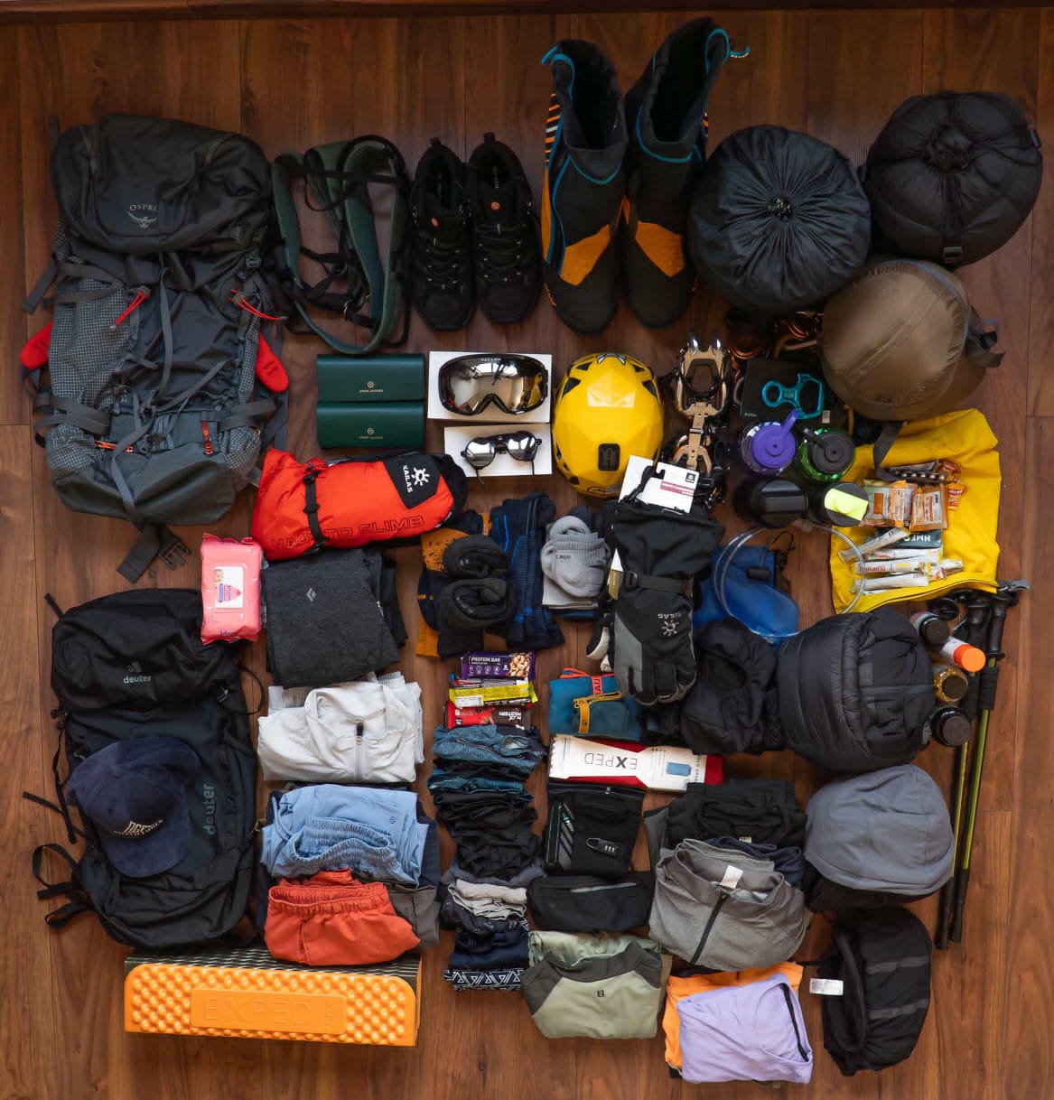
The difference between a comfortable ABC trek and a miserable one is often not fitness. It is what you are wearing on day seven at 3,700 m in the rain. Five items are non-negotiable. Everything else supports them.
Non-Negotiable
Trekking poles, both
Sleeping bag rated to -10°C
Waterproof jacket and trousers
Broken-in boots with ankle support
Water purification tablets or filter
Layers
Moisture-wicking base layer
Insulating mid-layer, down or fleece
Warm hat covering ears
Gloves: liner plus outer
Sun hat and UV-rated sunglasses
For the full list including what to and what to buy in Kathmandu, read our ABC Trek Packing List.
The Annapurna Sanctuary is a place that stays with you long after you’ve returned home and washed the dust off your boots. While the trail is physically demanding, the feeling of standing in that silent, glacial amphitheater is a reward that truly earns every step.
Whenever you’re ready to start, the mountains are waiting for you.
KEEP EXPLORING
Uncover similar insights
Ensuring equal inclusion for persons with disabilities in the sports and tourism